The United States’ New Weather Satellite Isn’t Quite as Broken as We Thought

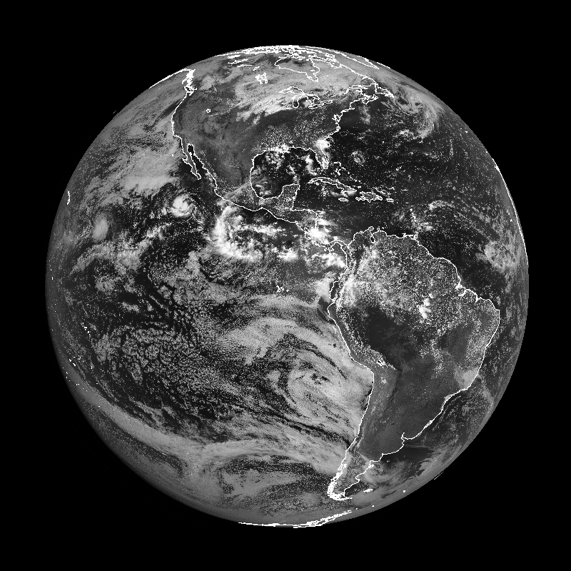
Are you ready for some preliminary, non-operational good news? Sure you are! It’s about time we had something positive. GOES-17, the shiny new satellite the United States launched into orbit a couple of months ago, isn’t quite as broken as we thought it was when they fired it up earlier this year. Not only has the latest weather satellite’s future been upgraded from “oh no, please no” to “working (for the most part),” but today we’re starting to get our first public images from the satellite.
GOES, short for Geostationary Operational Environmental Satellite, is the United States’ advanced network of weather satellites that keep a constant eye on storms across the Western Hemisphere. The family of satellites has seen numerous series since the first launch in 1975. GOES-17 is the second satellite in the fifth GOES series; the first, GOES-16, went into operation as GOES-East in late 2017. GOES-17 is slated to become GOES-West, covering the western half of the Western Hemisphere, when it’s put into operational use later this year.
GOES-17 launched from Cape Canaveral back on March 1 and quickly wiggled its way into a testing orbit in the following weeks. Once scientists started firing up the satellite’s instruments, they found that the cooling system for the Advanced Baseline Imager (ABI) isn’t working at full capacity.
The ABI is the instrument that gives us all of our visible, infrared, and water vapor imagery. The ABI analyzes radiation from the Earth at 16 different wavelengths (known as “bands”) to give us everything from visible imagery—showing us clouds as if we took a picture with a camera—to water vapor imagery that shows the location of moist and dry air at different levels of the atmosphere.
Visible imagery utilizes the shortest wavelengths, while infrared imagery—the colorful images that tell us the temperature of the cloudtops and allow us to see clouds at night—operates at the longest wavelengths.
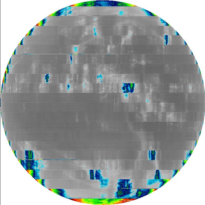 |
| An example of degraded infrared imagery from the GOES-17 satellite, August 14, 2018. | Source: NOAA/NASA |
When the ABI runs hotter than it’s designed to handle, the instrument starts giving off enough heat that the additional radiation effectively drowns out some of the infrared products that run on longer wavelengths. The above image from NOAA shows what the interference will look like when excess heat starts interfering with certain water vapor and infrared products. The image is unusable for anything but wall art.
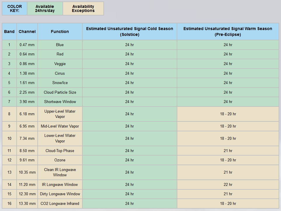
Not all hope is lost, though. Scientists working on the satellite have determined that they can change up the position the satellite so that the longer-wavelength products will only be unusable for just a few hours a day during certain parts of the year.
 |
| Source: NOAA/NASA |
All 16 channels should be available around the clock near the solstices, while the usability of longer-wave products like water vapor and most infrared imagery will be unavailable for a couple of hours at night around the vernal and autumnal equinox.
Why the equinoxes? GOES-17 follows a geostationary orbit above the equator; by matching its orbital speed to the rotation of the Earth, the satellite always stays over the same spot and always has the same view of the planet. This orbit exposes the satellite to the most intense solar radiation when the sun’s energy is focused on the equator around the vernal and autumnal equinox, and the least-direct radiation when the energy is focused on the Tropics of Cancer and Capricorn on the solstices.
The greatest heating will occur at night because of the satellite’s distance from the Earth. The front-facing ABI will experience direct sunlight while it’s nighttime in the Americas, while the instrument will be shielded from direct light when the satellite has its back to the sun during the Americas’ daytime.
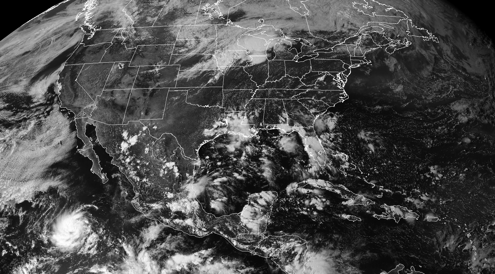 |
| GOES-17 red band visible imagery, 5:00 PM EDT August 28, 2018. Source: RAMMB/CIRA |
While it’s great that we’ll have full use of the new satellite between 75% and 85% of the time, that’s still going to amount to tens of thousands of hours of product downtime for meteorologists trying to track storms and features in great detail. NOAA says that they’re going to fill in the coverage gaps by using GOES-17 alongside the less-advanced (but fully-functioning) GOES-15, which currently serves as GOES-West.
All images and products from GOES-17 are considered preliminary and non-operational until NOAA says otherwise. (I have to put this in here or I might get an angry email from someone with a dot-gov email address.)
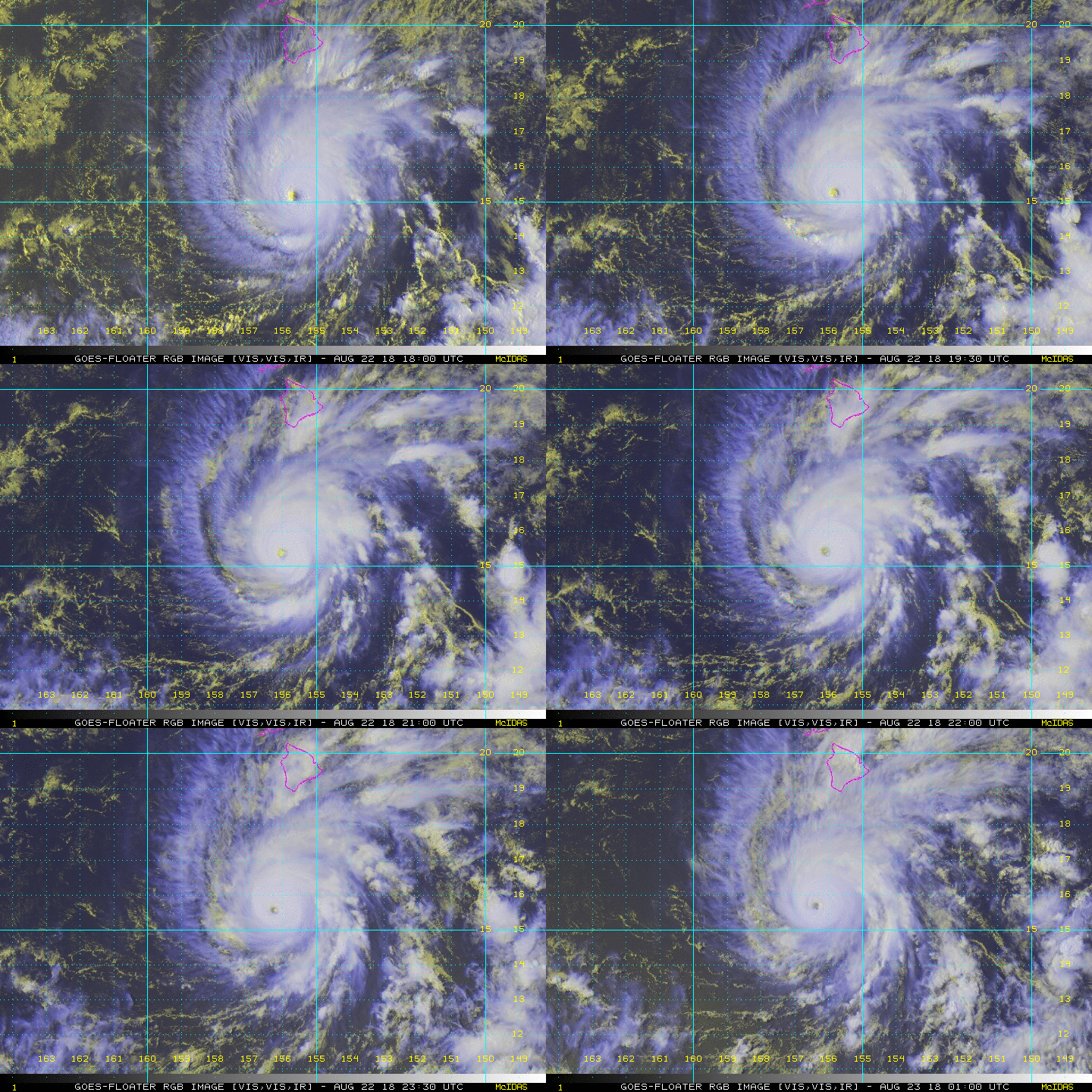
That being said, you can get some of those preliminary and non-operational images from the awesome SLIDER tool by RAMMB/CIRA, the source for the image at the top of this post. The full suite of products aren’t available yet, but the data we do have is pretty nice (and such a relief) to see.
Please consider subscribing to my Patreon. Reader-funded news is more important than ever and your support helps fund engaging, hype-free weather coverage.