Skip to content
DAMWeather DAMWeather DAMWeather

The weather can get scary. Reporting on it doesn't have to be.

DAMWeather DAMWeather DAMWeather

The weather can get scary. Reporting on it doesn't have to be.

  • About Me
  • All Bylines
    • Books, Bylines, and Press
    • The Skies Above (Book)
    • Extreme Weather (Book)
    • The Weather Network
    • The Vane
    • Forbes
    • Capital Weather Gang
    • Mental Floss
  • Maps
    • Hurricane Maps
    • Hurricane Names
    • Monthly Tornadoes
    • Tornado Tracks
    • F5/EF-5 Tornadoes
    • SPC High Risk Days
  • GIS Resources
  • Contact Me
    • Bluesky
    • Facebook
    • Instagram
  • wxdam.com
  • About Me
  • All Bylines
    • Books, Bylines, and Press
    • The Skies Above (Book)
    • Extreme Weather (Book)
    • The Weather Network
    • The Vane
    • Forbes
    • Capital Weather Gang
    • Mental Floss
  • Maps
    • Hurricane Maps
    • Hurricane Names
    • Monthly Tornadoes
    • Tornado Tracks
    • F5/EF-5 Tornadoes
    • SPC High Risk Days
  • GIS Resources
  • Contact Me
    • Bluesky
    • Facebook
    • Instagram
  • wxdam.com
Close

Search

Look At This Entire Trough

By Dennis Mersereau
December 20, 2018 3 Min Read

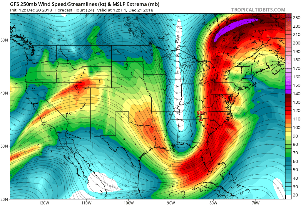
An ambitious butterfly could make it from Orlando to Buffalo in a couple of minutes if it flew high enough on Friday. An incredibly amplified trough entering the eastern United States will bring this week to the same dreary close we saw last week. In addition to lots of heavy rain and dangerous thunderstorms in Florida, the resulting surface low could bring some of the lowest air pressures ever recorded during the month of December in the Mid-Atlantic.
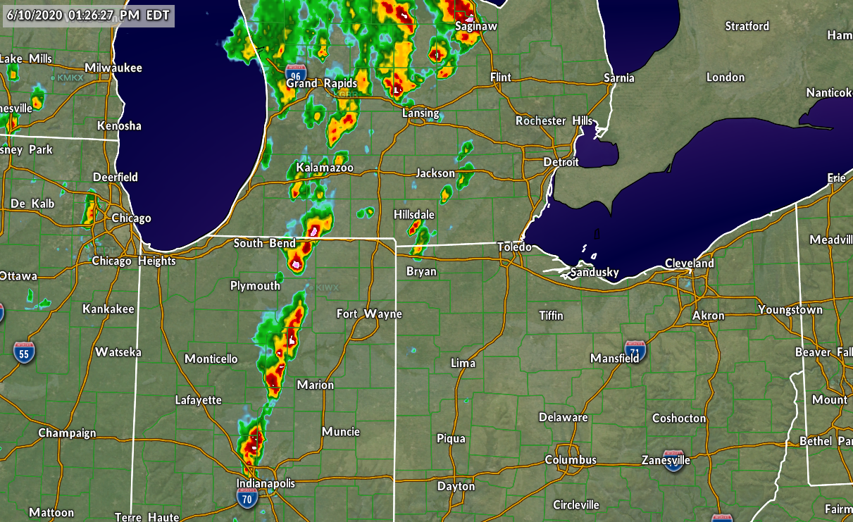
A line of severe thunderstorms was ongoing in Florida at the time of this post. It’s a classic wintertime severe weather setup for this part of the country. Warm, moist air ahead of an advancing cold front allowed a line of strong thunderstorms to sweep across the Florida Peninsula. Cooler, drier air will follow soon after the rain stops, bringing comfortable conditions as far south as Cuba and Mexico’s Yucatan Peninsula through the weekend.

A slog of steady, heavy rain will coat just about every square inch of the East Coast between now and Saturday. Most areas can expect an inch or two of rain with heavier totals likely in areas that experience thunderstorms. Some of the storms in the Carolinas could be severe on Thursday night, packing the risk for damaging winds and possibly an isolated tornado.

That trough is something else. I mean, look at this thing:
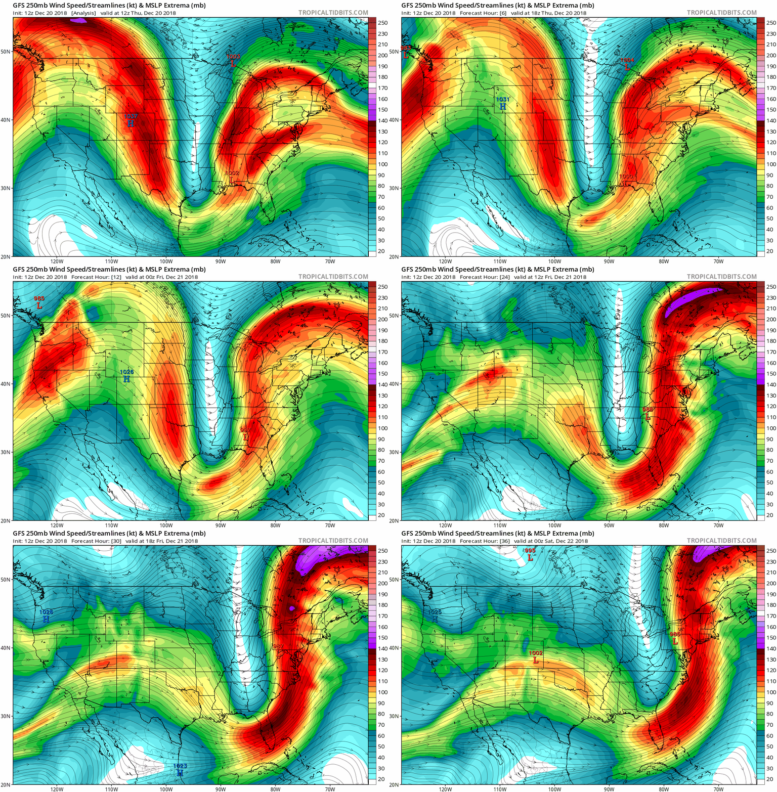
An animated model image of the jet stream. Source: Tropical Tidbits

A sharp trough like that is impressive enough on its own, but the combination of the amplified trough and strong winds of the jet stream within will strengthen the surface low moving over the Carolinas tonight and Friday. The latest forecast from the Weather Prediction Center shows the minimum surface pressure at the center of the low potentially reaching 987 mb on Friday as it moves over western North Carolina and Virginia.
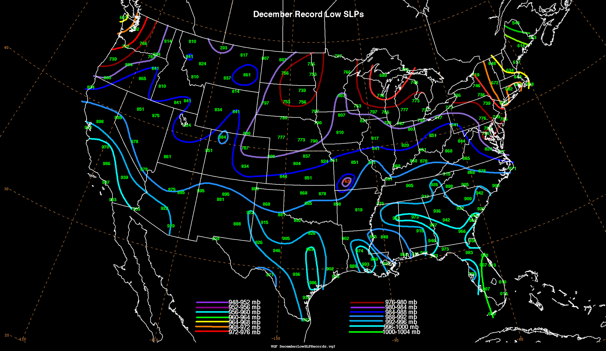
December record low air pressures (adjusted for sea level). Add a 9 to the front of every number for the value, which is rounded to the nearest tenth (“888” in Greensboro is 988.8 mb). Source: WPC

A surface pressure of 987 mb is extremely unusual for this part of the country during this time of the year. Surface pressure records compiled by David Roth at the WPC show the lowest air pressure recorded during the month of December in Greensboro, N.C., was 988.8 mb, and 986.5 mb up the road in Roanoke, VA. It’ll be a close one.

The lower air pressure itself won’t really have much of a direct effect other than kicking up a stiff breeze and possibly making your joints achier than usual. Other than that, it’s just a novelty.

[Top Image: Tropical Tidbits]


You can follow me on Twitter or send me an email.

Please consider subscribing to my Patreon. Reader-funded news is more important than ever and your support helps fund engaging, hype-free weather coverage.
 

Author

Dennis Mersereau

I have 15+ of experience providing hype-free weather information for folks across the United States and around the world. In addition to DAMWeather, I also contribute to The Weather Network as a digital writer and weather specialist.

Follow Me
Other Articles
Previous

A Rare Tornado Touched Down Near Seattle on Tuesday

Next

2018 Is Set To End With The Fewest Tornado-Related Fatalities On Record


Local ◈ UTC
Facebook | Bluesky
Instagram | Threads | Email
DAMWeather is now ad-free! Everyone benefits from engaging, hype-free weather coverage. Please consider supporting my efforts through Patreon:


Order The Skies Above today!

Bookshop.org || Barnes & Noble
Mountaineers Books || Amazon

My latest book, The Skies Above, is now available!

Did you know a puffy cloud can weigh millions of pounds? Or that every rainbow you see is unique to you?

Our atmosphere is full of spectacular sights that are always within your reach. Glistening layers of fog, gorgeous sunsets, and brilliant meteors flashing through the sky can light up even the calmest day.

The Skies Above, published by Mountaineers Books, is a celebration of what we overlook when we look up. I was thrilled to work with the editors and illustrators at Indelible Editions to share with you the quotidian beauty of our sky.

Order your copy now and learn about the wonders we take for granted every day.

I teamed up with the editors of Outdoor Life magazine to write The Extreme Weather Survival Manual, your guide to surviving and thriving in almost any weather condition. Whether you're an avid outdoorsperson or you enjoy watching the radar from the comfort of your home, you're sure to find helpful tips, advice, and new bits of knowledge in this fascinating book.

You can buy my book today through Amazon.
  • 2026 (34)
  • 2025 (49)
  • 2024 (59)
  • 2023 (43)
  • 2022 (57)
  • 2021 (71)
  • 2020 (83)
  • 2019 (88)
  • 2018 (92)
  • 2017 (1)
  • 2016 (4)
  • 2015 (10)

Copyright 2026 — DAMWeather. All rights reserved. Blogsy WordPress Theme