Tropical System In Gulf Likely To Strengthen; Greatest Threat Is Flooding From Heavy Rain


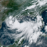
A tropical disturbance entering the Gulf of Mexico has a high chance of growing into a named storm by the end of the week. Some models have the system intensifying before it makes landfall on the northern Gulf Coast this weekend. Flash flooding from heavy rain is far and away the greatest threat with this system, no matter what it’s called at landfall.
Tuesday afternoon’s update from the National Hurricane Center gave the disturbance, dubbed “Invest 92L” for now, an 80 percent chance of developing into a tropical depression by Thursday morning. We’ve been watching this trough of low pressure mosey southward across the southeastern United States for a couple of days. The disturbance emerged in the northeastern Gulf of Mexico on Tuesday morning, opening the window for potential development over the next day or two.

Conditions over the Gulf of Mexico are capable of supporting a tropical system. Sea surface temperatures in the northern Gulf are in the mid- to upper-80s, which is plenty warm enough to support tropical development. Low wind shear will allow thunderstorms to develop without getting ripped apart, and ample moisture should stave off intrusions of dry air from suffocating the storm.
The major complication here is the structure of the disturbance itself. It’s pretty disorganized at the moment. Assuming the system develops, exactly where it takes root and how strong it gets will ultimately determine how far west it travels across the northern Gulf. A stronger storm may be able to tap into winds that could steer the storm farther west across the Gulf.
Water is the greatest threat with this system no matter what it does. The best case scenario right now is that this system remains disorganized and weak. The worst case scenario is that the system gets its act together in a hurry, posing a threat for wind damage and power outages in addition to lots of heavy rain.

Either scenario would bring heavy rain to the Gulf Coast. The latest forecast from the Weather Prediction Center shows more than five inches of rain falling across a wide swath of the southern United States, with a maximum near the coast where the system ultimately makes landfall. This swath of heavy rain will shift in location and intensity as forecasters get a better handle on exactly what will happen. Everyone along and inland of the Gulf Coast is at risk of seeing flooding rains through next weekend.
We’ve seen so many storms in recent years—from tropical storms to major hurricanes—leave behind horrendous flooding in their wake. Folks in Texas and North Carolina are intimately aware of the threat for flooding in a landfalling tropical system. Even so, it’s still a major battle to get folks in harm’s way to appreciate the threat of water over the threat of wind.
The threat of winds can’t be completely ignored, of course. Strong winds could cause damage if this system reaches shore as a tropical storm or hurricane. Tree damage, power outages, and some structural damage would be possible in that scenario. Those are significant hazards, made even worse by the potential for flooding from heavy rains.
Forecasters (and weather models!) will have a better idea of what’s going to happen over the next couple of days once—and if—the system develops and there’s actually something there to analyze. It’s a good idea to prepare for an extended period of heavy rain if you live in any of the southern states. Good questions to ask yourself right now include “do I have multiple routes to get around if roads are flooded out?” and “do I have food and supplies to get through a couple of days without power?”
The National Hurricane Center will begin issuing advisories on this system every 3-6 hours if/once it develops into a tropical depression. In the meantime, they issue tropical weather outlooks every six hours at 2:00 and 8:00 AM/PM Eastern Time.
Please consider subscribing to my Patreon. Your support helps me write engaging, hype-free weather coverage—no fretting over ad revenue, no chasing viral clicks. Just the weather.