Hurricane Dorian, Now A Category Four, Poses A Major Threat To Southeast Next Week


Hurricane Dorian rapidly strengthened into a category four storm on Friday evening, packing winds of 140 MPH by the 11:00 PM EDT advisory. We’ve known for a few days now that the storm would enter an extremely favorable environment for strengthening by the time it got to this point. The storm’s track is still highly uncertain right now, with the probability of the coast-hugging scenario I mentioned yesterday ticking upward.
 |
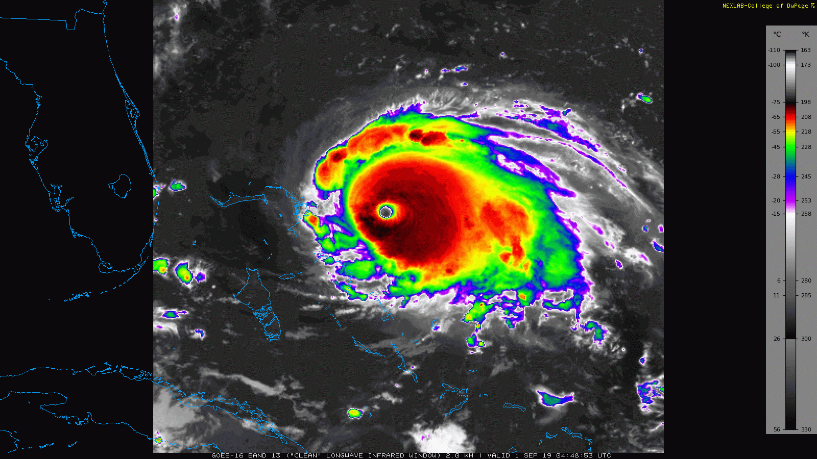
| Hurricane Dorian at 11:50 PM EDT on August 30, 2019. | College of DuPage |
It’s impressive to watch satellite loops of Dorian organize into a near-perfect hurricane through the day on Friday, and that organization is evident in advisory updates through the evening. Here’s how quickly the storm strengthened in just six hours this evening:
5:00 PM EDT — 115 MPH, 970 mb
8:00 PM EDT — 125 MPH, 950 mb
8:30 PM EDT — 130 MPH, 950 mb
11:00 PM EDT — 140 MPH, 948 mb
It could remain a major hurricane as it approaches Florida next week.
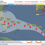
The National Hurricane Center‘s latest track forecast shows Dorian approaching Florida on Monday and Tuesday as a major hurricane. The official forecast follows model guidance showing an earlier turn near the coast, a scenario that would cause the storm to “hug” the coast in a very similar manner to Hurricane Matthew back in 2016. This path could expose coastal sections of Georgia, South Carolina, and North Carolina to hurricane conditions by the middle of next week.
There’s still quite a bit of uncertainty in that forecast. We’re still three to four days from the core of the storm approaching land. When it comes to an uncertain track like this, a shift of a few dozen miles either way can mean the difference between tragedy and a near miss most people will forget in a year.
A ridge of high pressure to the north of Dorian is responsible for the uncertainty. The ridge is acting like a buffer that keeps Dorian from simply racing north and out to sea. As soon as the ridge weakens or moves, though, Dorian is going to make that northward curve. Models disagree when the ridge will weaken enough for the hurricane to make that turn. Some say the ridge will stay stronger longer, while others weaken it much faster. That relatively small difference is the source of all the consternation.
Aircraft reconnaissance will fly through, above, and around the storm through next week to feed forecasters a constant feed of data to help them understand Dorian’s structure and the environment around it. Weather balloon launch sites across North America will release balloons four times a day—as opposed to twice a day—to collect upper-air data to aid in the forecast process. All of this extra data gets fed into weather models to give them a better starting view of the atmosphere, helping them to create more accurate guidance.
Potential Impacts
The forecast for the northwestern Bahamas is downright terrifying to
read. In addition to (and as a result of) the potential for category
four winds, some islands that experience the core of the storm could see
a 10- to 15-foot storm surge. This would likely inundate much of the
city of Freeport on Grand Bahama. Flash flooding is also likely due to
rainfall totals exceeding one foot along the path of the storm.
Unfortunately, it’s still too early to talk about specific impacts in the United States until forecasters are more certain about the track of the storm. Anyone along Florida’s east coast is at risk for a period of intense winds, significant storm surge, and widespread flash flooding from heavy rainfall if the storm follows its predicted track. Hurricane Dorian will be a slow-moving storm when it approaches Florida. This slowness would exacerbate the effects of strong winds, storm surge, and heavy rainfall.
A near-shore curve could bring high winds, storm surge flooding, and flooding from heavy rains to Georgia and the Carolinas. However, since these effects are more than five days out—geez, it feels like we’re going to deal with this storm forever—they’re not included in official forecasts.
A Note About Weather Models
I wrote a post about using weather models over at my Forbes blog. Be careful looking at weather models. Meteorologists and enthusiasts share them openly on Facebook and Twitter, and it’s easy to mistake these guidance products as official forecasts.
Using a weather model without proper training is like arguing with a
medical diagnosis by waving a printout from Google in your doctor’s
face. Contrary to popular wisecracking, meteorologists don’t just rip
their forecasts from the models. Weather models are guidance. It takes a
trained eye to analyze weather model output and use that information to
craft their forecast.
Always rely on the National Hurricane Center’s forecasts to make decisions.
A Note To Vacationers
A ruined vacation sucks. I know it. A
hurricane threatening land on Labor Day weekend isn’t exactly an
unexpected event. There’s literally a historic hurricane called the
“Labor Day Hurricane.” Any trip to the southeastern United States this
close to the peak of hurricane season comes with the inherent risk of
not happening due to the weather.
Every year, we hear about visitors who dig-in and insist that they’re not leaving because of a storm.
If
and when the authorities say to leave, that’s the end of your vacation.
Better luck next year. You are a guest in whatever town you’re
visiting. If you put yourself in harm’s way for the sake of getting your
money’s worth or the thrill of experiencing a hurricane, you are
selfishly taking from the people who actually live there and may not
have the money or means to evacuate. An emergency crew assisting you is
an emergency crew not assisting somebody who actually belongs there.
A Note to Meteorologists
Hi. Thanks for all your hard work. As I mention every couple of months when a big weather event happens, keep in mind that those of us tuned into the weather 24/7 follow no
fewer than 500 other weather folks on Twitter. You’re going to see the
same information about Dorian over and over and over again. Please don’t shame folks out of sharing the same basic forecasts and satellite images because you’re seeing it so often. Their
followers may only see that information cross their feed once or twice and there’s always a chance it could help a few of them. That’s all that matters.
Please consider subscribing to my Patreon. Your support helps me write engaging, hype-free weather coverage—no fretting over ad revenue, no chasing viral clicks. Just the weather.