Tropical Storm Conditions Close In On Gulf Coast As Cristobal Approaches Louisiana


Tropical storm warnings are up for the northern Gulf Coast as Tropical Storm Cristobal steadily makes its way toward landfall in Louisiana on Sunday night. Conditions will begin deteriorating across the region on Saturday night as the outer bands start to come ashore. Flooding rains, gusty winds, and tornadoes are possible along the storm’s track through early next week.
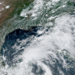
Tropical Storm Cristobal isn’t the most traditional looking storm this evening. All the heavy rain and thunderstorm activity is displaced far to the east of the center of the storm, leaving a center of circulation that’s almost completely exposed on satellite imagery. The National Hurricane Center‘s 5:00 PM discussion even points out that this system is more like a subtropical storm than a tropical storm. Regardless of its name or appearance, though, it’ll have the same effects when it comes ashore.

The latest forecast shows Cristobal making landfall in southeastern Louisiana sometime on Sunday evening, accelerating as it curves up the Mississippi River through early next week.
As I always put at the bottom of my maps, the NHC’s forecast only applies to the center of the storm, and the rain, wind, and storm surge can sometimes extend hundreds of miles from the center. That’s very much the case here with Tropical Storm Cristobal. The lopsided nature of this storm means that most of its impacts will occur to the east of the center.

Heavy rain is the greatest threat with this system. The Weather Prediction Center‘s rainfall forecast over the next couple of days shows a widespread area of 3-5″ of rain falling along the storm’s projected path, with a swath of heavy rain following the storm’s remnants as they race north toward the Great Lakes later this week. Flooding is possible in vulnerable areas, and training bands of thunderstorms could lead to the threat for flash flooding.
Make sure you’re prepared for power outages. Rain-soaked soil will make it harder for trees and power lines to hang on against strong winds for any length of time. It’s probably too late to do any stock-up shopping before conditions head downhill, but it never hurts to gather up supplies you may already have at home—batteries, flashlights, radios—so you don’t have to fumble around in the dark if the lights go out.
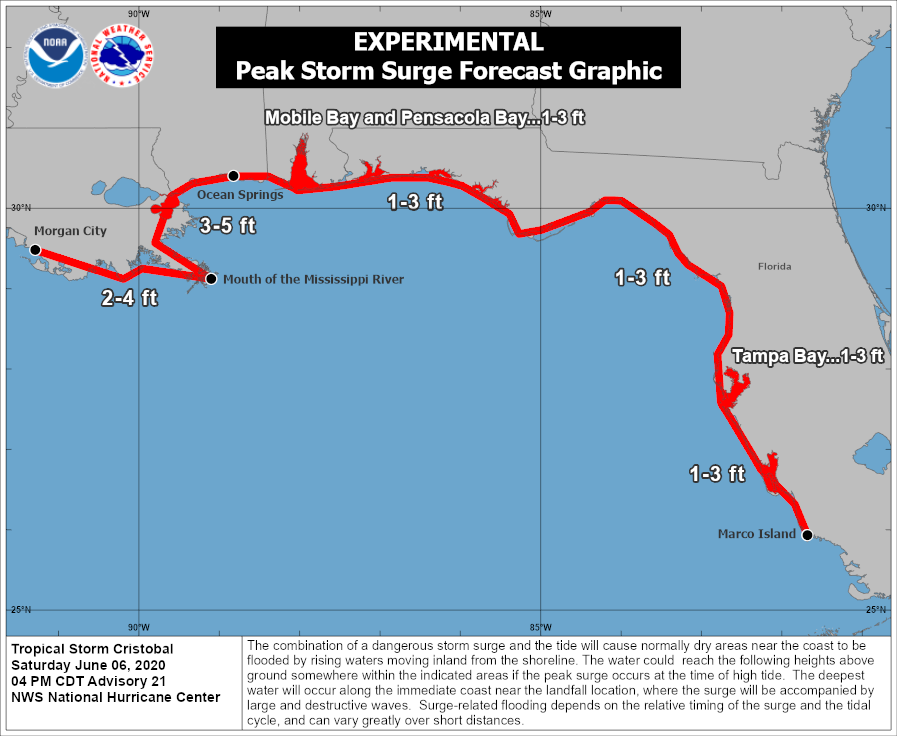
Cristobal’s strong winds could produce a storm surge along coastal areas in the path of the storm. The NHC began issuing nifty storm surge summary maps this year. Their latest forecast shows a maximum potential storm surge of 3-5 feet above ground level between the mouth of the Mississippi River in Louisiana and Ocean Springs, Mississippi, if the surge occurs at high tide. A storm surge is possible as far east as Marco Island, Florida.

Tornadoes are a threat with any landfalling tropical cyclone. Communities to the east of Cristobal’s center are under a risk for tornadoes as the system moves through the region. We’ve already seen several tornadoes across the Florida Peninsula on Saturday, including one that moved through the heart of Orlando. The tornado threat will shift to the northern Gulf Coast on Sunday as the storm approaches landfall.
[Satellite: NOAA | Surge Graphic: NHC]
You can follow me on Twitter or send me an email.
Please consider subscribing to my Patreon. Your support helps me write engaging, hype-free weather coverage—no fretting over ad revenue, no chasing viral clicks. Just the weather.