Here’s The Latest On Tropical Storm Fay As It Heads Toward The Northeast


Tropical storm warnings are up for coastal communities in New Jersey, New York, and Connecticut as Tropical Storm Fay moves toward the area on Friday. Heavy rain could lead to flooding concerns along the storm’s path, with heavy rain falling over many of the same areas that got drenched a few days ago.
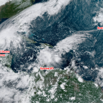
Tropical Storm Fay formed off the coast of North Carolina on Thursday afternoon from a long-watched disturbance that began as a group of thunderstorms over the Deep South late last week. The tropical storm is still disheveled and lopsided, but it’s getting its act together and it’ll look a little better as it heads up the coast over the next 36 hours.

Thursday evening’s advisory from the National Hurricane Center shows Fay hanging around off of Virginia Beach, steadily paralleling the coast until it makes landfall on Long Island overnight Friday into Saturday morning. The center of the storm doesn’t matter all that much at the moment—what matters is the gusty winds and flash flooding that will accompany the storm as it scrapes the coast and moves inland.
Rain
Heavy rain will follow the storm’s track until it dissipates in eastern Canada this weekend. The heaviest rain is likely in the Delmarva Peninsula and New Jersey, falling over the same areas that saw a tremendous amount of rain from stalled thunderstorms just a few days ago. It won’t take much persistent heavy rain to cause flooding issues in these areas.
This storm will cover plenty of densely populated metro areas that could easily experience urban and street flooding. Don’t drive across a flooded roadway or attempt to walk through standing water. It’s impossible to tell how deep the water is before it’s too late. It takes a surprisingly low amount of water to engulf or sweep away a vehicle or pedestrian.
Wind
Wind often takes a backseat to rain in landfalling systems, but it matters a great deal if your power goes out or a tree falls through your roof. Gusty winds will lead to pockets of power outages, especially where the soil is loose from recent rains. It’s a little late to head to the store at this point, but go around the house and collect flashlights and batteries so you can feel your way around if you go into Friday night without power.
Tornadoes
Tornadoes are always a threat with landfalling tropical systems. There’s enough spin in the atmosphere in a tropical cyclone that heavy showers and thunderstorms in the rain bands can produce quick tornadoes. Tornadoes are most likely to the right of the center of circulation; for Tropical Storm Fay, that’s the eastern side of the storm. The greatest tornado threat on Friday and Saturday will exist along and east of I-95 from New York City northward.
Tropical tornadoes tend to be smaller and weaker than you’d expect to see in Oklahoma, but even the smallest tornado is dangerous if it hits your home. Pay close attention to warnings and be prepared to act quickly, since these tornadoes form quickly and lead time is often just a couple of minutes.
You can follow me on Twitter or send me an email.
Please consider subscribing to my Patreon. Your support helps me write engaging, hype-free weather coverage—no fretting over ad revenue, no chasing viral clicks. Just the weather.