Tornado Threat Increases For I-95 Corridor Between D.C. And Philly On Wednesday


An enhanced risk for severe weather will exist around the Washington, Baltimore, and Philadelphia areas on Wednesday as the remnants of Hurricane Ida move through the region. There’s enough wind shear that the strongest thunderstorms that form in the region could produce tornadoes.

Forecasters at the Storm Prediction Center issued an enhanced risk for severe weather—a three on the five-category scale measuring the threat for severe thunderstorms—for the I-95 corridor stretching from northern Virginia to southern New Jersey, including parts of southeastern Pennsylvania, eastern Maryland, and Delaware.
Tornadoes will be the predominant risk. Severe thunderstorms in the risk areas could also produce damaging wind gusts.
The threat will be greatest during the afternoon and evening hours on Wednesday.
While the enhanced risk area will see the best environment for tornadoes, a risk for tornadoes on Wednesday will extend as far to the south as the Charleston, S.C., area, and as far to the north as Nantucket.
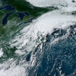
Tropical Depression Ida (and soon to be “Remnants of Ida”) spent Tuesday swirling over the Tennessee Valley. The system will continue heading toward the northeast over the next couple of days.
The system is undergoing extratropical transition, which means it’s losing its tropical characteristics and transitioning into an everyday type of low-pressure system that’s powered by upper-level winds and has surface fronts.
There’s still plenty of wind shear on the eastern side of the system, which is common for landfalling tropical cyclones. This wind shear allows thunderstorms to develop rotation that can produce tornadoes.
The remnants of hurricanes that hit the Gulf Coast are infamous for the tornado potential these systems can bring to the Mid-Atlantic. If tomorrow’s forecast pans out, Ida’s remnants will be no exception.
 |
| SOURCE: Tropical Tidbits |
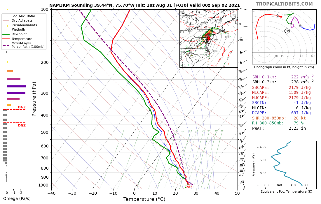
The graph above reveals why there’s an enhanced risk for tornadoes around the Mid-Atlantic on Wednesday.
This is a model simulation of the data we get from weather balloons, looking at temperature, moisture, and winds through a vertical slice of the atmosphere. This particular graphic is for the area around Wilmington, Delaware on Wednesday evening.
If you look at the hodograph on the top-right side of the image, you’ll see a long line that hooks clockwise as it spirals out on the graph.
That tells us that winds are picking up speed and veering clockwise with height—the type of shear that makes supercell thunderstorms possible.
Make sure you have a way to receive severe weather warnings the moment they’re issued. Check your cell phone’s emergency alerts feature and make sure they’re activated for tornadoes. Tropical-influenced tornadoes can happen quickly, and they can grow quite strong.

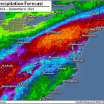
A threat for tornadoes isn’t the only concern we’ll have to deal with on Wednesday. The system’s ample tropical moisture will produce widespread heavy rainfall from the Appalachians to coastal New England over the next couple of days.
Rainfall totals of 3-5″ will be common, with locally higher amounts where training thunderstorms develop. This heavy rainfall will lead to a potential for flash flooding across a large stretch of the region.
 |
| SOURCE: WPC |
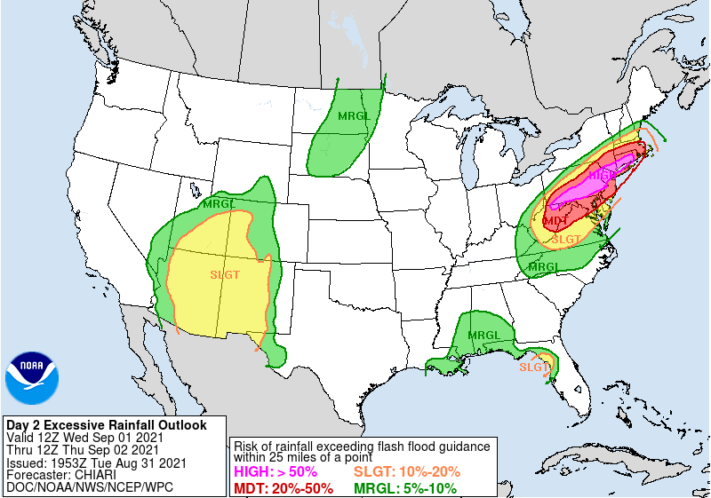
The Weather Prediction Center issued a high risk for excessive rainfall (read: flash flooding) on Wednesday across portions of Pennsylvania, New Jersey, New York, and Connecticut. A high risk for excessive rainfall from the WPC is relatively rare, and it’s indicative of high confidence in the potential for widespread flash flooding.
Stay alert for flash flood warnings in addition to tornado warnings. Never try to drive across a flooded roadway. Many people die every year when they drive into a flood and drown. It’s impossible to tell how deep the water is before it’s too late.
You can follow me on Twitter or send me an email.
Please consider subscribing to my Patreon. Your support helps me write engaging, hype-free weather coverage—no fretting over ad revenue, no chasing viral clicks. Just the weather.