A Quick-Hitting Storm Will Pack A Wallop With Destructive Winds, Severe Storms

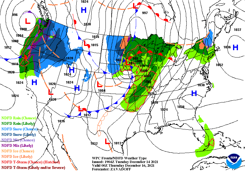
A quick-hitting Colorado low will sweep over the central United States through Thursday and make a mess of things in its wake. The system will have it all: rain, snow, high winds, an extreme fire danger, and a risk for severe thunderstorms over parts of Iowa and Minnesota.
Blink and you’ll miss it. This storm is going to haul tail toward Canada, forming over Colorado on Wednesday morning and zoom into northern Ontario by the same time on Thursday morning. It’s going to be quite the active 24 hours for a vast swath of the central United States, beginning with the threat for high winds and an extreme fire danger on the Plains.
Powerful Winds Likely on Wednesday
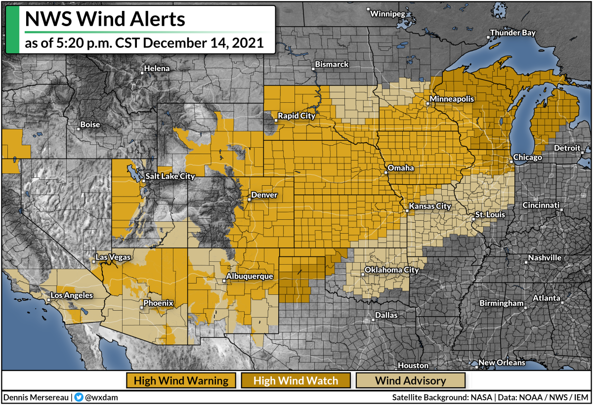
A dangerous situation is setting up along the path of the low from the Front Range straight through to the Great Lakes. Intense winds will easily mix down to the surface, bringing the threat for 60+ mph gusts that will topple trees, cause power outages, and toss around loose objects like Christmas decorations, patio furniture, trash cans, and grills.
The strongest winds will rake over the Front Range, where wind gusts could reach 100 mph in spots during the day on Wednesday. This is the graphic that NWS Denver made for the event, highlighting how dangerous conditions will be on Wednesday:
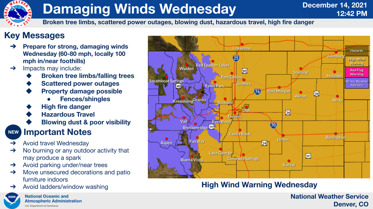
If the forecasts hold up, this will be a significant and memorable wind event for many folks in Colorado.
Strong winds will follow the path of the low as it races toward Canada. High wind watches and warnings are in place across the central Plains, a huge swath of the Midwest, and much of the Great Lakes in anticipation of damaging winds.
The criteria for wind advisories and high wind warnings varies from place to place, but it’s safe to say that all of these regions will experience dangerous winds for a time on Wednesday and Thursday.
If you live in an area expecting powerful winds, remain mindful of tall trees or large tree limbs that loom over your home. Most wind-related injuries occur when trees or tree limbs fall into houses. If you have a big limb hanging over your bedroom, for example, consider avoiding that room as much as possible during the strong winds.
Prepare tonight for power outages tomorrow. Make sure your devices are charged and you have juiced-up flashlights within easy reach. (It’s tough to feel around for flashlights batteries in the dark. Don’t ask me how I know.)
High Fire Danger Accompanies The Winds
Powerful winds, warm temperatures, dry air, and ongoing drought conditions will all work together to create a high fire danger from the northern Texas Panhandle through central Kansas on Wednesday.
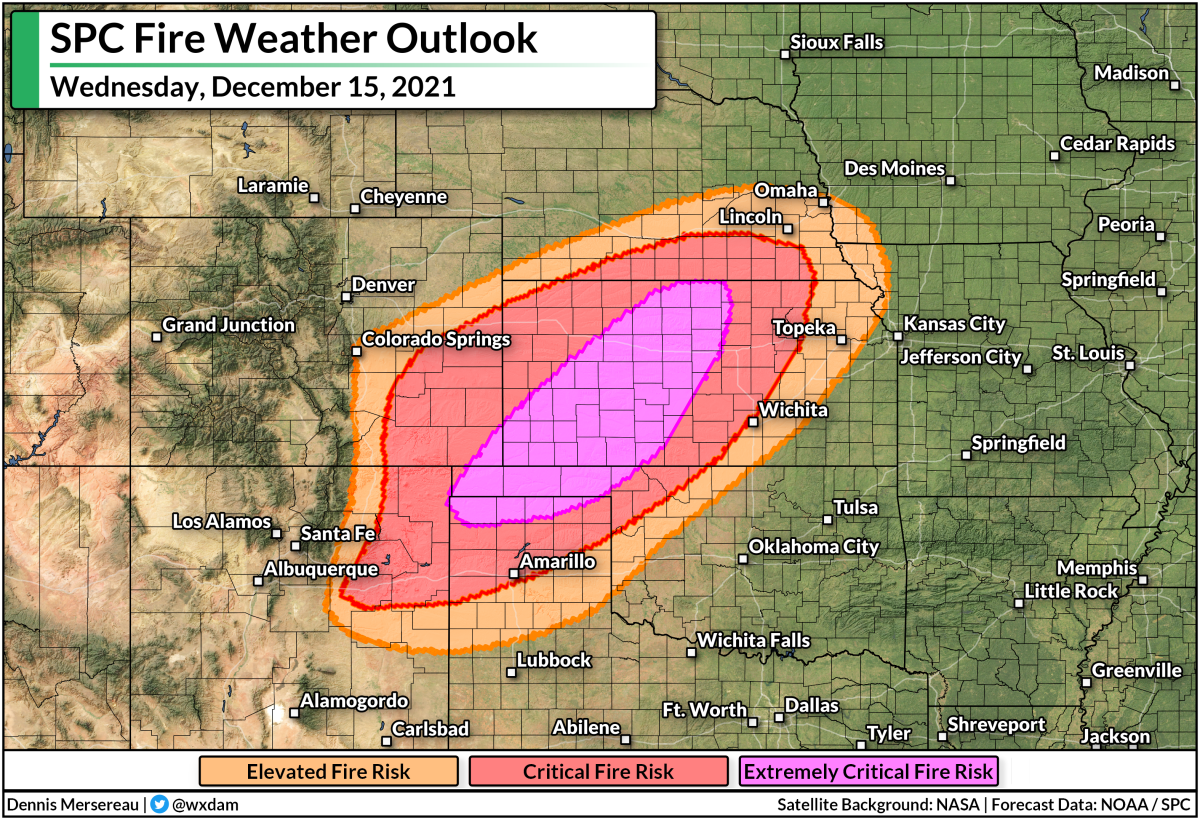
A high fire danger extends out to include communities from northeastern New Mexico to southern Nebraska. There aren’t too many people who live in the affected areas, and I doubt many of you live there (thanks for reading if you do!), but it’s the kind of day where any fire could quickly spiral out of control. One fire threatening one home is too many.
Severe Storms
The surge of moisture and warmer, unstable air on the south side of the low will set the stage for thunderstorms to develop over Iowa and Minnesota on Wednesday.
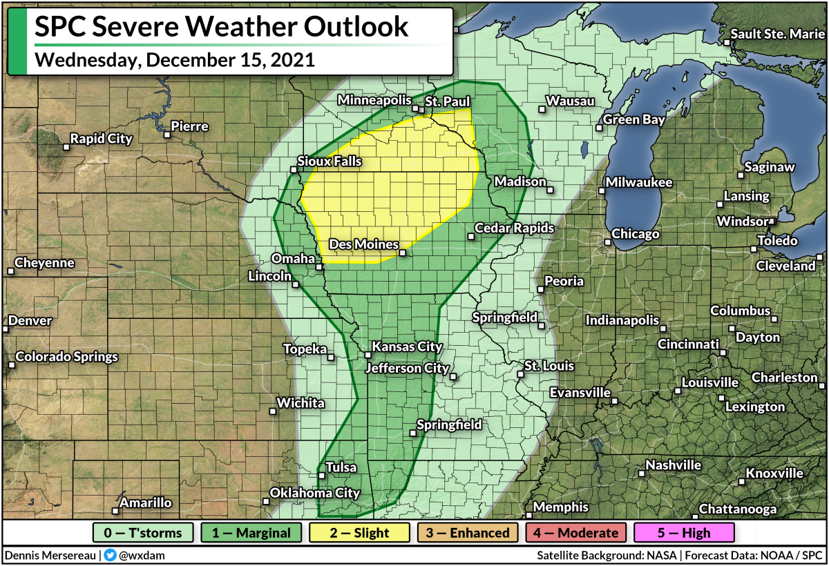
The Storm Prediction Center issued a slight risk for severe weather across much of Iowa and southern Minnesota. The strongest storms that form in and around this area could produce tornadoes, damaging winds, and large hail. It won’t take much of a downdraft to pull those intense winds down to the surface.
As always, make sure that you have a way to receive severe weather warnings the moment they’re issued. Take a moment to look at your phone and ensure that emergency alerts for tornado warnings are active, and that you have a way to hear warnings if you’re asleep when rough weather moves through.
It’s also worth noting that much of the area under that severe weather risk on Wednesday currently has several inches of snow on the ground. It’s not out of the realm of possibility that we could get a picture or two of a tornado traversing a snow-covered landscape. (It’s not unprecedented!)
[Top Map: Weather Prediction Center]
You can follow me on Twitter or send me an email.
Please consider subscribing to my Patreon. Your support helps me write engaging, hype-free weather coverage—no fretting over ad revenue, no chasing viral clicks. Just the weather.