Milton, a now-historic Category 5 hurricane, poses grave danger to Florida


Hurricane Milton explosively intensified into a scale-topping Category 5 storm during the day on Monday, strengthening at a rate only seen a handful of times since modern technology made real-time hurricane tracking possible.
Milton will threaten Florida as a major hurricane on Wednesday, posing a grave risk for destructive winds, a life-threatening storm surge, flooding rains, and the potential for tornadoes over much of the state.
Near-Historic Intensification
It’s hard to convey the severity and magnitude of what Hurricane Milton has managed to accomplish in such a short period of time.

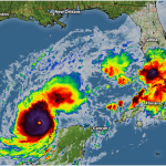
The storm’s winds intensified from 90 mph to 175 mph over the course of 12 hours between 1:00 a.m. CDT and 1:00 p.m. CDT on Monday. Hurricane Milton’s minimum central pressure plummeted from 975 mb to 911 mb over the same time period—a rate of explosive intensification rivaled only by a few storms in modern history, including Wilma back in 2005.
Milton is now one of the strongest hurricanes ever recorded in the Atlantic basin, which is no small feat given that we’re in October. Milton is the strongest storm we’ve ever seen in the Gulf of Mexico this late in the year, according to hurricane expert Philip Klotzbach.
Multiple factors contributed to the storm’s near-unprecedented strengthening session. Sea surface temperatures across the Gulf of Mexico are extremely warm, running 88°F or warmer throughout much of the region where Milton is currently tracking.

The storm has a very small core. Hurricane force winds only extend 30 miles from the center of the storm. Think of a figure skater pulling her arms in to spin faster—small hurricanes can efficiently translate their deep minimum air pressure into ferocious winds.
A subtropical jet stream north of Hurricane Milton is likely aiding the storm’s robust intensification. Hurricanes lift a massive amount of air into the upper atmosphere. That cooler air needs to vent out and away from the storm in order for it to thrive. These strong winds north of Milton are likely helping to exhaust some of that air away from the core of the hurricane.

While the storm is likely near its peak strength today, it’s worth noting that “weakening” is a relative term when it comes to a major hurricane aiming for land. This is likely to remain a very intense and dangerous hurricane as it approaches landfall in Florida over the next 48 hours.
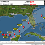
The latest forecast from the National Hurricane Center puts Milton’s intense core into the Tampa Bay area on Wednesday evening as a major hurricane with 125 mph winds. Small changes in the storm’s intensity and track are likely as the storm gets closer to land. A few miles to the north or the south will make all the difference for the storm surge that gets shoved into Tampa Bay.
Storm Surge and Destructive Winds
Widespread wind damage will accompany the hurricane ashore and spread across the Florida Peninsula. Communities near the point of landfall will likely experience a period of sustained winds in excess of 100 mph with higher gusts. Hurricane force winds are likely across Florida along the track of the storm.
Structural damage, downed trees, and long-lasting power outages are expected near the point of landfall, inland toward the Orlando metro area, and even toward Florida’s eastern seaboard.
A life-threatening storm surge is all but assured given Hurricane Milton’s current intensity and the fact that forecasters expect the storm to grow in size as it approaches Florida.
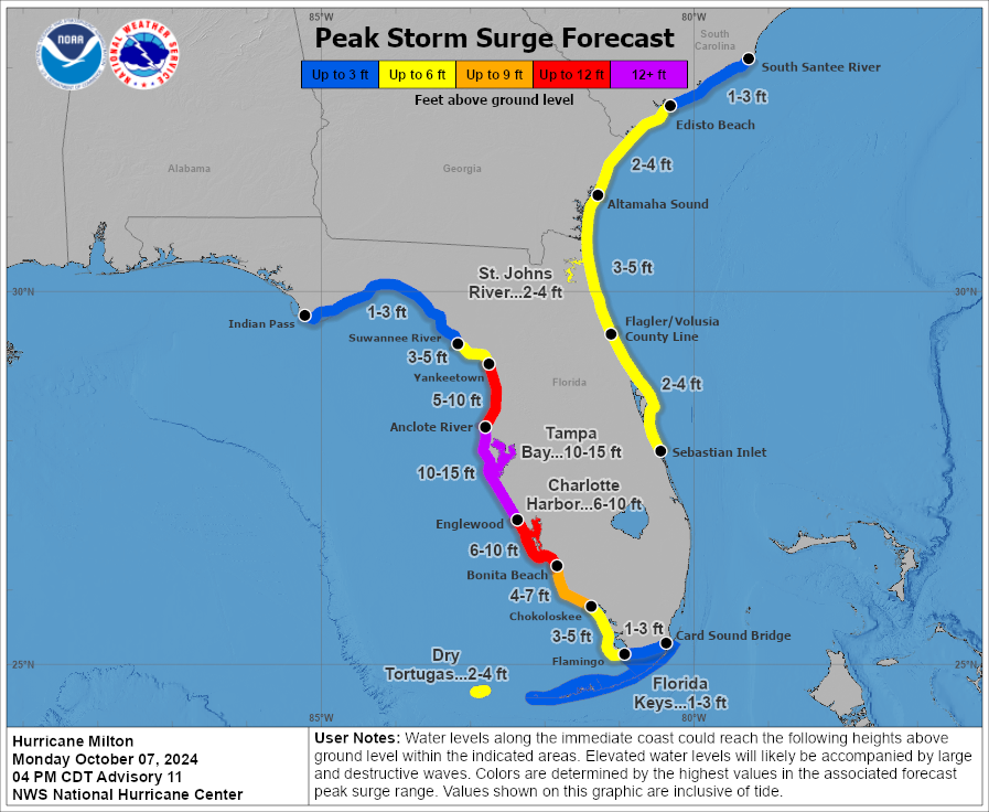
Florida’s western coast is extremely vulnerable to storm surge. Tampa Bay, Charlotte Harbor, and the Caloosahatchee River will amplify any surge that arrives in the region, posing a significant threat to neighborhoods within a few dozen feet of sea level.
The latest guidance from the National Hurricane Center calls for a potential storm surge of 10-15 feet above ground level across much of west-central Florida’s coast if the storm surge coincides with high tide. This includes Tampa and St. Petersburg. 6-10 feet of surge possible farther south toward Cape Coral, Fort Myers, and other seaside communities throughout the region.
Storm surge is seawater pushed inland by a hurricane’s strong and intense winds. This much surge is unsurvivable; it’s more than enough to completely submerge and likely wash away well-built structures.
This has the potential to be the worst storm surge ever observed in this region. We haven’t had a major hurricane hit Tampa Bay since 1921. For context, Hurricane Charley pushed an estimated 6-7 foot storm surge into Sanibel Island back in August 2004.
Flooding Rains

Heavy rain is ongoing across Florida as a surge of tropical moisture ahead of Milton interacts with a stationary front parked across the state. This setup has already produced several inches of rain across much of Florida since the beginning of the weekend.
Additional rainfall totals of 4-8 inches are expected through the end of the week as Milton hammers the state through Thursday. The heaviest amounts are likely along and to the north of Milton’s track.
Nearly half of all deaths in landfalling hurricanes are the result of flooding rains. Never try to drive across a flooded roadway. It’s impossible to tell how deep the water is until it’s too late, and the road may have washed away beneath the water.
Tornado Risk

Tornadoes are a risk in any landfalling tropical system. The risk for tornadoes will grow throughout southern and central Florida as Hurricane Milton’s rainbands begin sweeping over the state on Tuesday and when the storm makes landfall on Wednesday.
Stay alert for tornado warnings and have a plan to act quickly if a warning is issued for your area. Tropical tornadoes happen quickly and with reduced tornado warning lead time.