Robust winter storm possible across southern, eastern U.S. this weekend


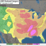
Forecasters are increasingly confident that a robust and potentially high-impact winter storm will spread across much of the southern and Mid-Atlantic states by the end of the week and into this weekend.
While it’s still too soon for specifics like exact precipitation types and amounts, all the lights on the dashboard are starting to blink about this storm’s disruptive potential.
Key Points
CONFIDENCE RISING: A widespread winter storm is likely by the end of the week into this weekend.
FRIGID AIR: Plenty of frigid air will spill over the eastern two-thirds of the U.S. soon.
PRECIPITATION: The whole spectrum of wintry precipitation is on the table.
AMOUNTS/TYPES UNCERTAIN: It’s still too soon for specifics.
PREPARATION IS KEY: Don’t wait until the last minute to prepare for power outages or hunkering down at home for at least a couple of days. You know how we are in the south…just the mention of snow in the forecast is enough to pack Walmart to the rafters.
The Setup

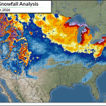
A lobe of the polar vortex will swoop south toward the Great Lakes by the end of the week, dragging bitterly cold Arctic air south with it. How cold are we talking? Saturday’s daytime highs throughout the Upper Midwest are currently forecast remain below zero.

This surge of frigid conditions will spill deep into the United States and kickstart a sustained period of below-seasonal temperatures east of the Rockies. We’re likely going to remember this bout of cold weather as the coldest of the season, and it’s probably going to last through the end of the month for many folks.
Cold air? Check.
Next is the precipitation. This sharp cold front will slice into warm air blowing over the southern United States and stall out as it reaches the region.
Southerly flow won’t stop just because the front arrived. Cold, dense air hugs the ground. Warm and humid winds from the south will flow up and over the cold air at the surface.
This is called overrunning, and it’s the mechanism through which we’ll see widespread precipitation develop from Texas to North Carolina beginning Friday in the west and continuing east into the weekend.
We’ll eventually see a low-pressure system develop along that stalled front, which will likely enhance precipitation in portions of the southeast and Mid-Atlantic before it moves out to sea.
Precipitation? Check.
Next up is the million-dollar question.

Warm air rising over cold air at the surface is a recipe for a mixture of snow, sleet, freezing rain, and plain ol’ rain.
This will be the perfect setup for all four types of precipitation. Some communities are going to get a memorable snowstorm. Others will see a highly disruptive ice storm.
The problem right now is that it’s just too soon to say exactly where those dividing lines will set up. Tiny changes in temperature can have a huge impact on what kind of precipitation reaches the surface. A slight shift in the timing of the front, the scope of the cold air, or the track of the eventual low-pressure system will all affect how much of what type of precipitation each town will see.
Stay up-to-date on your local forecast from trusted sources. Don’t rely on the simple weather app on your phone or computer. A few numbers and icons won’t tell you the whole story in a complicated setup like the one in the works.
Prepare for Disruptions
It’s a good idea to start preparing now for potential travel and power disruptions just in case this plays out as the models currently suggest.
- Ensure you have flashlights, actual flashlights!, and batteries enough to power them for several days of frequent use.
- Keep a stock of non-perishable food on hand that doesn’t require cooking. PB&J sandwiches, canned ravioli, packets of chicken and tuna, crackers, cereal or protein bars, goodies like that.
- Snow shovels, snow brushes, and ice scrapers are a must. We don’t want to see a quarter-sized peephole on the windshield. You can’t drive around with mound of snow on the roof big enough to sink the Titanic.
- Listen to trusted sources. Don’t run with every outlandish weather model image you see on Facebook or TikTok. People are going to try to scare you and get you going. It’s called “engagement bait” and it’s how they make money off fooling you. Keep tabs on your local National Weather Service office. Seek out a trustworthy meteorologist from the local news.
- Prepare for changes in the forecast. Have some mercy on forecasters as they get a handle on the complex dynamics at play. Again, tiny changes over short distances can dramatically affect the forecast. Forecasts get better as we get closer to the storm, so don’t be surprised if there are big shifts here and there.
Follow me on Facebook | Bluesky | Instagram
Get in touch! Send me an email.
Please consider subscribing to my Patreon. Your support helps me write engaging, hype-free weather coverage—no fretting over ad revenue, no chasing viral clicks. Just the weather.