
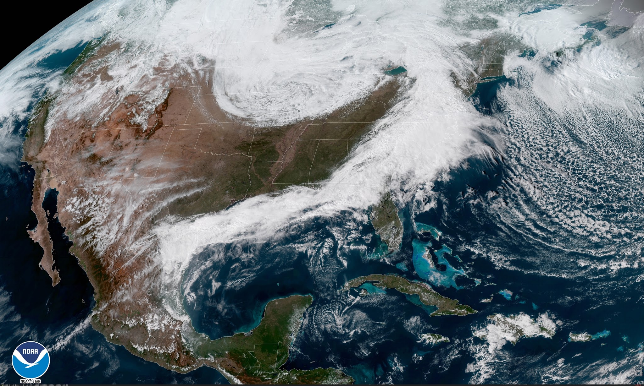
No two snowflakes or nor’easters are exactly alike. Parts of the Northeast will experience a classic winter snowstorm on Wednesday and Thursday as a strengthening system along the coast ingests just enough cold air to produce heavy snow from northeastern Maryland to coastal Maine. Some areas will see more than a foot of snow by Thursday.
While last week’s nor’easter did produce heavy snow across interior parts of the Northeast (including many areas expecting more heavy snow this week), the big story of last week’s nor’easter was its relentless winds. Dulles Airport recorded a peak wind gust of 71 MPH during the storm. Many locations in the Mid-Atlantic and Northeast saw wind gusts strong enough to knock out power to more than a million customers, trigger destructive coastal flooding, and the gusts even led to the demise of one of Interstate 95’s most memorable…landmarks.
- Heavy snow along and west of Interstate 95, with a sharp cutoff in totals.
- Flight/train cancellations and roads nearly impassable in the heaviest bands.
- Heavy rain at the coast possibly switching over to snow late in the storm.
- The weight of the snow and gusty winds will stress trees that took a beating last week, leading to the potential for more power outages and damage.
A complicated forecast
The most important thing to know about nor’easters is that the track is crucial in who sees what. A tiny nudge to the east or the west in a storm’s path could dramatically change a town’s snowy fortunes. Too close to land and the heavy snow stays inland and areas closer to the coast are a wintry mix or cold, dreary rain. Too far from shore and the snow stays along the immediate coast.

There’s going to be a sharp gradient in snowfall totals wherever the heaviest bands set up. Neighboring counties (even neighboring towns) could see double-digit differences in accumulation.
Now, that’s just the WPC’s 50th-percentile (most likely) forecast from early this morning. The situation gets much more interesting if you go a step lower and start reading forecasts from individual NWS offices, each of which has their own local experts that produce their own forecasts.

The official forecast from NWS New York (pictured above) shows the heavy snow falling closer to the coast, plastering New York City with more than half a foot of snow and its far northern suburbs coming in with more than a foot. That’s a pretty big difference from the most likely WPC forecast issued this morning.

It’s a similar situation up in Boston where the forecast is shifting by leaps and bounds depending on what town you’re driving through. The original forecast issued this morning called for up to 8″ of snow in Boston proper while towns like Taunton and Foxborough, separated by 14 miles, had a nine-inch spread in snow totals between them.
The latest forecast from NWS Boston shows the rain/snow line pushed farther inland, keeping Boston’s snow on the inconvenient side and putting the stress of wondering if you’ll get plastered or annoyed squarely on inland towns. An eastward jog in the storm’s track could bring the forecast for heavier snows closer to the coast again.
Why so much uncertainty?
The track of the storm is responsible for all of this uncertainty. The storm will be close enough to the coast that just a tiny intrusion of warm air at or above the surface could provide towns close to the shore with much lower snowfall totals than they would see if the storm scooted a bit farther off the coast and the atmosphere was uniformly subfreezing from top to bottom.
Here’s what the WPC had to say in their heavy snow discussion on Tuesday morning:
THE TRACK OF THE SURFACE LOW IS OF GREAT IMPORTANCE TO THE SNOW
IMPACTS AS TIGHT GRADIENTS IN SNOWFALL AMOUNTS LEAD TO SIGNIFICANT
SNOWFALL AMOUNT ADJUSTMENTS POSSIBLE IN THE PRECIP TYPE TRANSITION
ZONE IN EASTERN NJ/LONG ISLAND/SOUTHEAST CT/RI/BOSTON AREA.
And this is what NWS New York said in its forecast discussion at 12:54 PM on Tuesday:
Precipitation will be light to start, and this light intensity
may allow parts of the New York City metro area to start off as
rain, but as the precipitation becomes steadier and heavier,
cooling the column, a change over to all snow is expected late
tonight.
The latter discussion refers to a process known as evaporative cooling—liquid absorbs latent heat when it evaporates, which helps cool the air. You’ve probably heard the term in the context of air conditioners or even reading about how microbursts form, but evaporative cooling can help change rain over to snow in winter storms. You might see talk on social media about winter storm “producing its own cold air,” and this is the process they’re usually hoping will happen.
Prepare for the worst and hope for the best.
It can be frustrating to hear something like this when we live in an era where we can predict the weather with such accuracy and precision, but some things really do come down to waiting and watching. Local forecasters expect the heaviest snow to develop right over the big cities and unload off to the west, but the storm’s finicky track and unexpected intrusions of warm air above the surface can change things in a hurry.
The best thing to do right now is to expect the worst and hope for the best. It’s going to be a close one no matter which way the precipitation falls. It’s the wonder of geography and meteorology that some of the country’s biggest cities fall right where the rain/snow line usually sets up shop.
Watch out for power outages.
Just like last week, make sure you’re prepared to deal with power outages. Keep your phones and devices charged and keep a few actual flashlights (not just the feature on your cell phone) juiced up and ready to go just in case the lights go out.
[Satellite Image: NOAA | WPC Map: Author | NWS Maps: NWS New York / NWS Boston]