Dangerous heat wave underway across central, eastern U.S.
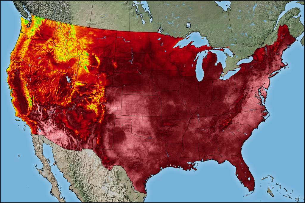
A high-impact heat wave is underway across the eastern two-thirds of the United States. Most communities away from the immediate coastlines will soar into the upper 90s to lower 100s for several days during this event.
Here’s what you need to know.
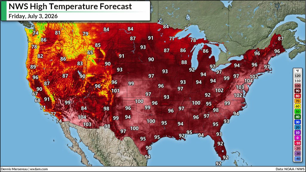
1) Dangerously high daytime temperatures are likely for several days across much of the country east of the Rockies. Readings will approach all-time heat records in some areas.
2) Expect little to no overnight relief as humidity prevents temperatures from cooling off significantly at night. Some urban areas, such as Washington, D.C., may not drop below 80°F for 48-60 consecutive hours.
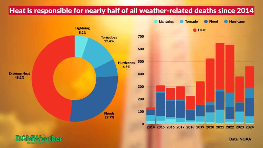
3) Excessive heat is the deadliest type of extreme weather because of those stifling overnight conditions. People without access to air conditioning rely on cooler nighttime temperatures to survive.
4) Heat ridges like this are a breeding ground for severe thunderstorms, often called “ring of fire” storms. The outer periphery of the center of high pressure serves as a focus for instability, moisture, and wind shear.
It’s common to see organized clusters of thunderstorms race around the northern half of these ridges, which often puts the Upper Midwest, Great Lakes, and Northeast states in line for potential severe weather.
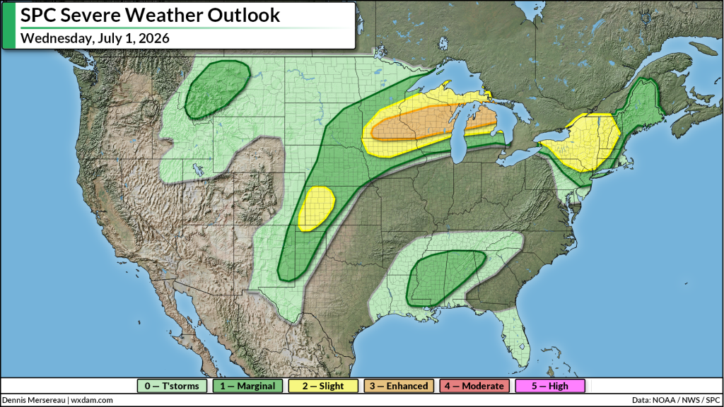
Wednesday will feature the greatest severe weather threat from Minnesota to Michigan, with a subsequent threat popping up each day into the weekend.
The predominant threat with any clusters/squall lines that form will be damaging wind gusts, some of which could be significant at 75+ mph.
Follow me on: Facebook | Bluesky | Instagram
Please consider subscribing to my Patreon. Your support helps me write engaging, hype-free weather coverage–no fretting over ad revenue, no chasing viral clicks. Just the weather.