Extreme heat set to build across western U.S. into mid-July

The good news is that the heat wave that broiled the eastern half of the United States to start July is finally waning.
The bad news is that another extended stretch of heat is building across much of the country heading into the middle of the month, and this round of above-seasonal temperatures looks even more widespread than the bout we just endured.
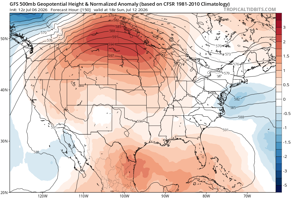
Later this week, we’ll see the development of a significant ridge of high pressure over the Rockies and Plains. This ridge’s influence will extend from coast to coast.
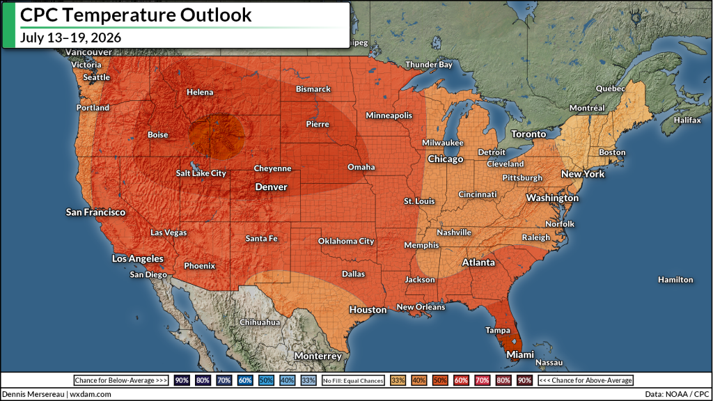
As a result, the Climate Prediction Center is calling for above-normal temperatures for every square inch of the continental U.S. between July 13 and July 19, with the greatest anomalies centered across the Rockies and much of the Intermountain West.
We’re at the peak of summer. A spell of extreme heat this time of year hits different. For example, Denver will have multiple opportunities to see daytime highs cross 100°F, easily threatening daytime record highs. It’s not completely out of the question that the city might have a shot at challenging its July record of 105°F set back on July 20, 2005.
On top of the heat itself, a hot and dry pattern is terrible news for the wildfire situation across the western states. We’re likely going to see a rapid uptick in fire ignitions and growth as a result of this setup coming down the pike.
The focus of this heat wave will not be the East Coast this time around. Even so, warmer-than-normal temperatures at the very peak of summer is still enough to cause health concerns for vulnerable populations.
Follow me on: Facebook | Bluesky | Instagram
Please consider subscribing to my Patreon. Your support helps me write engaging, hype-free weather coverage–no fretting over ad revenue, no chasing viral clicks. Just the weather.