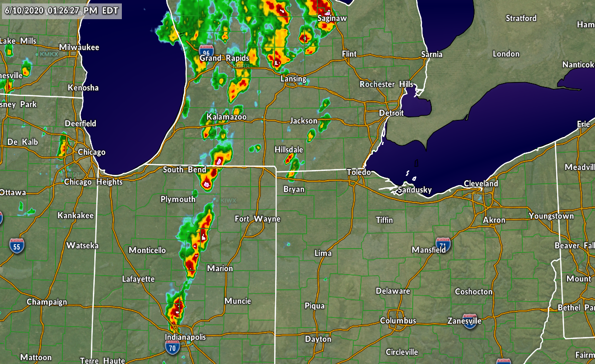
Strong Fall Storm Spawns Tornadoes, Snow, Floods, General Malaise
A large storm system that continues to crawl across the United States this afternoon—officially known as Winter Storm Skittlebip III by the dennismersereau dot com naming and brunch committee—will herald the end of our unusually warm fall, bringing in colder temperatures to bathe the tornado debris, flooded roads, and generally miserable people.
Before growing into the mid-latitude beast it is today, this storm system came ashore on the West Coast as a trough that produced heavy rain, snow, and some thunderstorms in California. One of those thunderstorms went on to produce an EF-1 tornado in Denair, California, which unfortunately occurred without warning as the tornado was not detected on weather radar.
Once the low got its act together on the eastern slopes of the Rocky Mountains, it let loose in one of the most formidable severe weather outbreaks we’ve seen in 2015, which is not surprising given how this year is going. November represents a second peak in severe weather season as atmospheric conditions in the late fall are similar to what you might see in the early spring, but that severe weather is typically found in the Midwest or Deep South. This outbreak, while not unusual overall, is unique in that it was the farthest west we’ve ever seen a tornado outbreak this late in the year.

The Storm Prediction Center logged 43 tornado reports on Monday, November 16, all of which occurred from southern Nebraska through western Texas. While multiple reports exist for the same tornadoes, it’s likely that the area saw more than a dozen twisters on Monday. The strongest tornadoes both occurred around Pampa, Texas, and both were rated an EF-3 on the Enhanced Fujita Scale.
One of the more interesting aspects of the storm was that some areas slammed by severe thunderstorms were under a blizzard warning at the same time; as the low got its act together and wound its way toward the east, cold air filtered in and the rain changed to a heavy, driving snow. Much of eastern Colorado and western Kansas/Nebraska saw blizzard conditions on Tuesday and Wednesday. Denver saw about four inches of snow by the end of the storm, while communities to the south and east saw totals well over a foot.
For the rest of us, though, the news is heavy rain, lots of wind, and an eventual cool down.
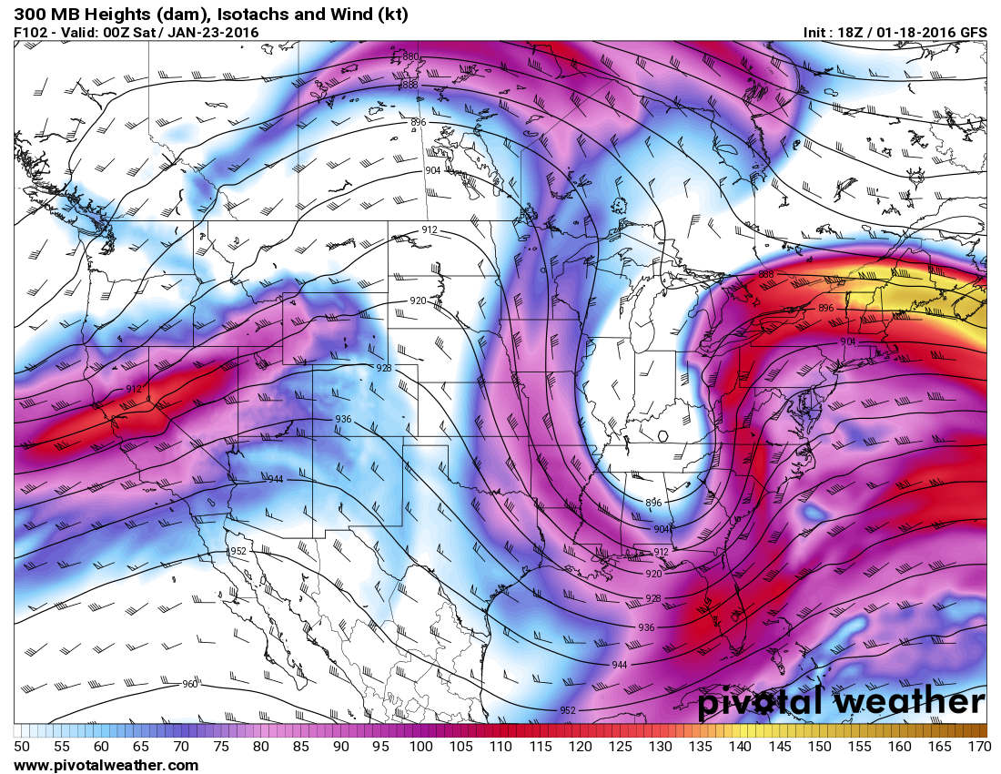
It’s going to take at least another day and a half to rid ourselves of this troublesome storm. The low pressure itself is moving very slowly toward the northeast—as of 1:00 PM EST, the low was right on the border between Minnesota and Ontario with a central minimum pressure of 979 millibars, which is pretty decent as far as lows go.
The cold front is the feature that’s causing all of the problems now, as it’s producing very heavy rainfall that’s moving as a snail’s pace. The front is crawling along because the jet stream (above) is practically parallel to it, so there’s not much force to hustle it along.
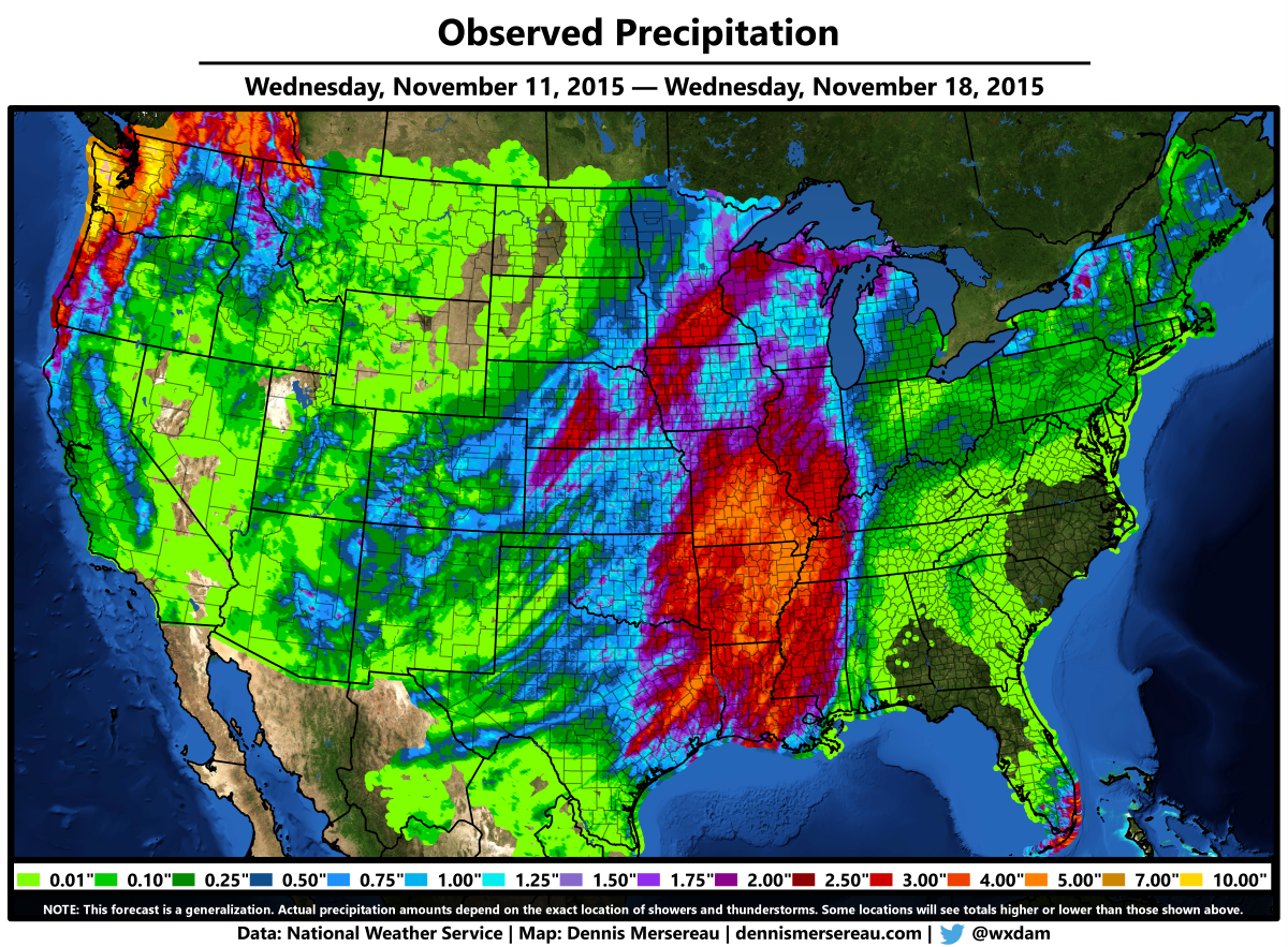
A widespread area of three or more inches of rain has fallen over the past day or so in the center of the country, causing some flooding issues for vulnerable areas, but nothing on the scale of what we saw in Texas and South Carolina earlier in the year. Those of us stuck east of the Appalachians will get in on the heavy rain overnight and into the morning hours on Thursday; a general area of one to two inches of rain is possible, with a little more in the gauges if someone gets caught under a persistent band.
Toward the end of the week and this weekend, though, and we’ll experience our first bone-chiller of the year. A burst of cold air from Canada will filter down behind a clipper system that promises to bring snow to the Plains and Upper Midwest, and this cold air will plunge temperatures ten or more degrees below average. The high in Chicago on Sunday might not climb above freezing for the first time since March 3, when the high was only 27°F. Places as far south as Montgomery, Alabama, could see highs struggle to climb out of the 40s on Saturday, and the chill envelops the eastern seaboard by Sunday and Monday.
Bring it on.
[Maps; Author | Model Image: Pivotal Weather]

