Winter Storm Skittlebip IV Promises Many Inches of White Doom to the Midwest
Many have asked what Skittlebip means. The legend of Skittlebip is that its legend is never fully formed. It is an ever-lasting and frequently evolving storm, a skittleblip on the continuum of time and space partially consumed by the media’s insatiable appetite for every storm to be worse than the last. Perhaps by Skittlebip XVII we will have a better understanding of its deeper metaphysical position on the hierarchy of doom, but for now. it is time to deal with The Fourth One in the Midwest.
And oh and what a sight it will be. A thick blanket of snow covering the Midwest after such a sustained period of unusual warmth. Just think of all those people who tease southerners for not knowing how to drive who will slide a little bit this weekend and then complain about it for the next six months.
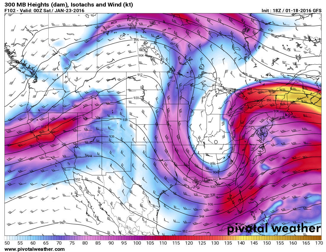
The atmosphere is starting to recover from the big storm that’s dominated weather news in the United States this week. For the most part, all that’s left is the arrival of the cold air that will slowly invade on Friday and this weekend. This afternoon’s run of the GFS model shows a jet stream that looks like a bathtub, with a curvaceous pattern that extends from one side of the country to the other. A surface low will develop under that trough in the Wyoming Rockies, looping down toward Kansas and Missouri on Saturday before quickly scooting off toward eastern Canada.
This system will ingest just enough moisture and encounter just cold enough air to provide some pretty decent snow totals to the Plains and Upper Midwest. As usual, the cutoff between heavy snows, light accumulations, and a wintry mix should be fairly sharp, so the exact track of the storm is key to who sees how much of what.
Flakes will start falling on Friday in the Plains and start spreading over Iowa by Friday afternoon. Friday night and Saturday morning will see the heaviest accumulations, with the system pushing over the Great Lakes and snow tapering off on Saturday night in Michigan.
Here’s what the National Weather Service thinks in terms of snowfall totals as of 22z, which is 5:00 PM EST:
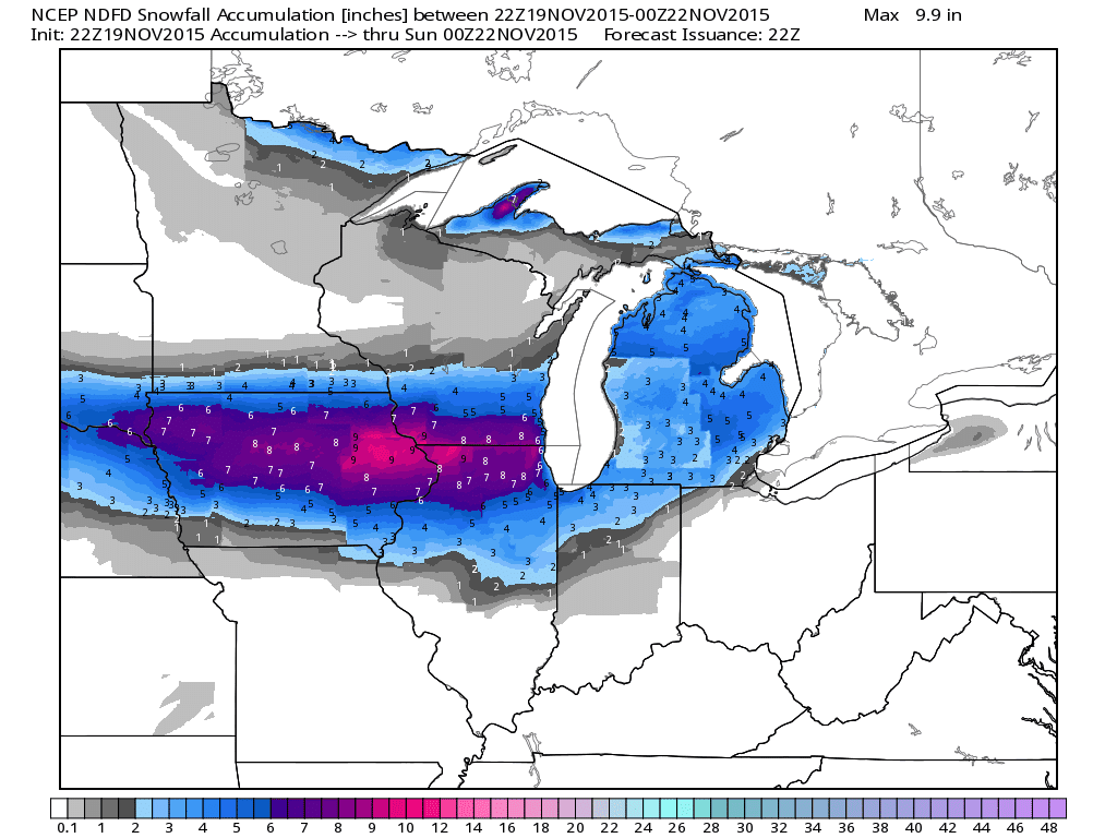
Quite a few people will see more than six inches of snow if this plays out, and some areas could push ten inches if a good band sets up and doesn’t move much. Some models and organizations are predicting higher totals, with their forecasts calling for a foot or more of snow.
Not bad for November! Some of these snow totals could break records for the month and for early-season snows, but it’s nowhere near unprecedented. Take, for instance, Des Moines, Iowa, where the earliest six-inch snowfall occurred on October 26, 1997 (6.8″). The city also saw 11.8″ of snow on November 10, 1968, which is probably more than they’ll see this time around. A little farther north, the earliest five-inch snowfall up in Madison, Wisconsin, occurred on November 9, 1985. If they manage to crack 7.6″, it’ll be the second-largest snowfall so early in the year; that amount of snow fell in Madison on November 27, 1995.
This kind of snow isn’t too uncommon, nor is it an omen of a treacherous winter to come. Thanksgiving is a week from today. It gets cold and starts snowing in November. Skittlebip IV rages forth.
[Simulated Radar: GREarth | Jet Stream Model Image: Pivotal Weather | NWS Forecast Map: WeatherBELL]

