Blizzard 2016: Prepare for Zero to Thirty Inches of Snow or Ice or Rain

The breadbakers and cows of America are proud to present the blockbuster feature of Winter 2015-16, an event to rival all model-simulated events, one that will result in the highest number of breathless street interviews since the release of the iPhone. We have rounded the corner and there is no turning back. The snow machine is turned up to eleven. This, my friends, is Blizzard 2016. Cue the dramatic music.
‘Blizzard’
The term “blizzard” has a very specific definition. A blizzard occurs when 35+ MPH winds create blowing snow that limits visibility to one-quarter of a mile or less for at least three consecutive hours. In other words, a blizzard is essentially a whiteout. There’s a chance that someone somewhere could see blizzard conditions, but it’s hard to achieve and not yet a guarantee. In lieu of using my beloved “Skittlebip” names (or, heaven forbid, using Winter Storm Chirple or Tupp or whatever they’re calling this one), I’ve decided to use the delightfully retro and dramatic “Blizzard 2016.”
The Setup
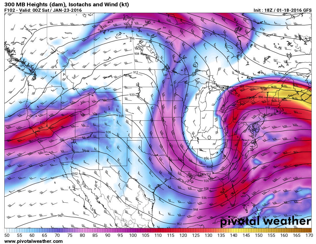
And here’s the same step from the same run of the same model showing the surface low sitting off North Carolina. Ahhhh:

Likely Impacts
WHO: This storm will occur in two phases; the first dropping some snow and ice as it swings across the Midwest and Mid-South. The system will probably drop a decent blanket of snow (generally less than six inches) on top of some ice accretion from freezing rain. The main area expecting wintry precipitation is from the AR/MO border eastward through Kentucky and West Virginia. This is different from the other winter storm that’s expected to affect the area on Tuesday night and Wednesday. (It’s active out there!)
The second phase will be the nor’easter, likely affecting folks from the southern Appalachian Mountains northeast through the Mid-Atlantic and possibly into the Northeast. The likely swath of decent snow/ice from the nor’easter will occur from western North Carolina east to Raleigh and north through most of Virginia and the D.C. area. Once you get farther north than D.C., the impact of the storm is far more uncertain. You could see lots of snow or almost nothing. It’s just too early to tell.
In other words, everyone from Asheville to Boston is in play. That’s maddeningly unspecific, but we’re three to four days from the event. Specifics will get clearer on Wednesday and Thursday. We are predicting the future, after all.
WHEN: The snow and ice from the low moving east across the country will fall on the Midwest and Mid-South on Thursday into Friday, with the nor’easter beginning on Thursday night and lasting through Sunday from south to north. The storm will probably move slowly once it approaches the coast, so an extended period of heavy precipitation is possible in places like North Carolina, Virginia, the D.C. area, and the Delmarva Peninsula.
SNOW: Significant snowfall is possible from western North Carolina through the Mid-Atlantic, possibly extending into the Northeast if the track is farther north. I’d say there’s a better than 50% chance that a large area sees a foot or more of snow, and many people within that swath see two or more feet of snow. It’ll be a big storm, and depending on where that giant thump takes place, it could be historic.
The exact track of the storm is key for snowfall, as its movement will determine where the deformation zone sets up shop—the “comma head” in the storm that hosts the heaviest bands of precipitation that sit and dump many inches of snow an hour. Its track will also determine where the rain/ice/snow line sets up. Someone will get a lot of cold rain. Someone will probably see a significant ice accretion from sleet and freezing rain before switching over to rain or snow. Someone will see two or more feet of snow. The distance between these three weather conditions will not be great—maybe a few dozen miles.
TRAVEL: Expect airport closures and flight cancellations anywhere heavy wintry precipitation falls. Several hubs will be affected. The hardest-hit areas will see cancellations last for days. Train service will cease for a large area until the tracks are cleared. Public transit will shut down completely or operate on a severely limited schedule. Roads will be impassable during the worst of the storm, and crews will likely struggle to keep up with plowing. Side streets will remain snow covered until crews can clear main arteries. If you have to go out driving, make sure you have supplies in your car to keep warm, communicate, dig yourself out, and feed/hydrate yourself for a day or more.
Make alternate plans for travel if you have a pretty good feeling that your flight/train/trip won’t happen as you hoped it would.
POWER OUTAGES: Heavy snow, ice, and wind are a recipe for widespread power outages. Make sure you have food, water, first aid supplies, batteries, and sources of warmth (candles and blankets, especially) to last a couple of days. Keep some cash on hand, too, so you can buy things if necessary. Plastic doesn’t work if the power’s out.
PETS: Don’t leave your pets outside. Bring them inside. Read them a book. Pet them.
COASTAL FLOODING: The strength/duration of the storm combined with a full moon will lead to coastal flooding and beach erosion, all of which will be worse at high tide. Coastal communities are (well, should be) well prepared for this type of an event, but be mindful of the potential for impassable roads and a storm surge if you’re on the coast during this storm.
STRUCTURAL DAMAGE: Snow and ice are heavy. Large accumulations can strain damaged roofs to the point of cracking or completely giving in. Look out for signs of stress or damage to your home, and avoid box stores (especially older ones) if you can. If you’re a store after the storm and hear loud metallic creaking above you, it’s probably a good idea to tell someone and then leave.
SCHOOLS: This is a kid’s nightmare, unfolding on a Friday and Saturday like this. For shame. Snow on a weekend probably limit the amount of school closings come next week. Areas that experience the heaviest snow will probably still have at least a snow day or two next week.
Worst Case Scenario
The first is the most obvious, one in which Washington D.C., Baltimore, and Philadelphia crack into their top ten all-time snowstorms. Many suburbs would see two or more feet of snow, with some lucky spots approaching three feet. Even though the storm would go down on Friday and Saturday, schools would close on Monday and Tuesday, if not longer. Airports would be closed during the storm itself, with residual cancellations in the thousands for days after the storm. Power would go out for many as wet snow and strong winds stress trees and power lines to their breaking point.
The other worst case scenario is one that Tuesday’s 12z run of the European model showed, slamming southern/central Virginia and North Carolina with more snow than they’ve ever seen from any single storm in recorded history. This latter scenario, which would be a complete disaster for the area, is far more unlikely than the former.
Back to Reality
- We know the storm will more than likely happen. We’re not too sure exactly where the storm will go. If you live in Washington D.C., for instance, and the storm goes a bit farther north than many of the models are showing, then you’ll have an extended period of rain or ice before changing over to snow. This would severely limit snow accumulations and create a whole new set of problems.
If you live along the rest of the I-95 corridor between there and New York City, what will happen is even more up in the air, because if the storm treks farther south than predicted, you might get very little to no snow. On the other hand, if it goes farther north, you could get slammed with the full might of a top-ten snowstorm.
Track is everything.
- In addition to track, an unexpected intrusion of warm air a few thousand feet above the surface could also wreak havoc on a forecast, leading to much more ice or plain ol’ rain than forecasters initially expected. This is more likely on the southern periphery of the storm, in places like the Delmarva Peninsula, southeastern Virginia, and North Carolina.
- A big storm like the one models are showing has a bigger opportunity to ingest dry air, which leads to a snow lover’s dreaded “dry slot.” If dry air seeps into the storm, it could significantly cut down on snowfall totals in the areas cut off from the rest of the precipitation.
- Any sleet or freezing rain/rain that mixes in will compact snow that’s already on the ground, leading to the potential for solidification after a cold night. Snow that freezes into a sort of glacial ice is extremely hard to remove once it freezes, so sidewalks, parking lots, and streets that aren’t cleared immediately may not be cleared for a while.
Cool Down
[Top Image via The Simpsons/YouTube | Weather Models via Pivotal Weather]

