The West Coast’s Most Advanced Weather Satellite Is Set to Launch This Week

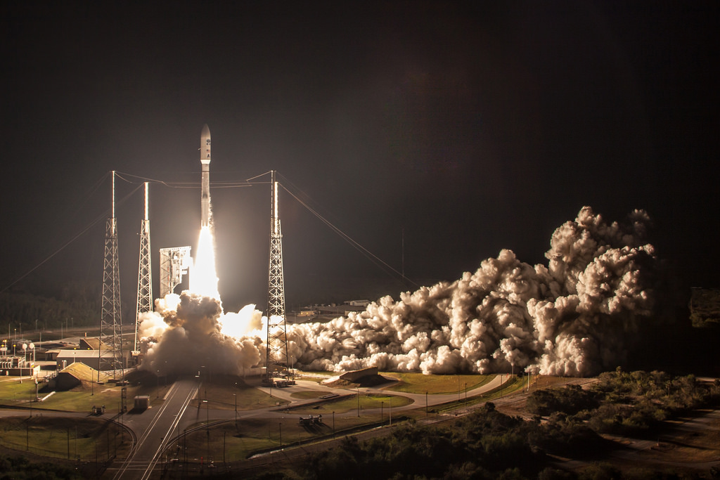
March will come in with the roar of rocket engines for weather geeks
and space buffs around the world when the United States launches its newest weather satellite into orbit. GOES-S will
lift off from Cape Canaveral, Florida, just after 5:00 PM Eastern on Thursday,
March 1, 2018, barring any technical or environmental delays like thunderstorms or annoying boaters. The enhanced resolution, faster updates, and virtual playground of useful products created by the new
satellite will boost our efforts in weather forecasting and
environmental monitoring.
and space buffs around the world when the United States launches its newest weather satellite into orbit. GOES-S will
lift off from Cape Canaveral, Florida, just after 5:00 PM Eastern on Thursday,
March 1, 2018, barring any technical or environmental delays like thunderstorms or annoying boaters. The enhanced resolution, faster updates, and virtual playground of useful products created by the new
satellite will boost our efforts in weather forecasting and
environmental monitoring.
NOAA’s
network of operational weather satellites covering the Western
Hemisphere are part of the Geostationary Operational Environmental
Satellite (GOES) series. The GOES-S satellite launching on Thursday will
be the seventeenth working satellite in the series that began in 1975 with a
satellite that provided scientists one image every 20 minutes.
network of operational weather satellites covering the Western
Hemisphere are part of the Geostationary Operational Environmental
Satellite (GOES) series. The GOES-S satellite launching on Thursday will
be the seventeenth working satellite in the series that began in 1975 with a
satellite that provided scientists one image every 20 minutes.
The first in the current family of GOES satellites, GOES-16, launched into orbit in November 2016 and became fully operational as GOES-East in December 2017. GOES-S
will be renamed GOES-17 once it reaches orbit and it will be designated GOES-West following a successful testing period later this year.
will be renamed GOES-17 once it reaches orbit and it will be designated GOES-West following a successful testing period later this year.
The new satellite will provide us with
views of western North and South Americas and much of the eastern half
of the Pacific Ocean. GOES-West and its twin GOES-East will have a combined view that stretches from tropical waves chugging off the African coast to
enormous low-pressure systems swirling off of New Zealand, and a prime view of
every cloud that forms between the southern tip of Chile to the far
reaches of the Alaskan wilderness.
views of western North and South Americas and much of the eastern half
of the Pacific Ocean. GOES-West and its twin GOES-East will have a combined view that stretches from tropical waves chugging off the African coast to
enormous low-pressure systems swirling off of New Zealand, and a prime view of
every cloud that forms between the southern tip of Chile to the far
reaches of the Alaskan wilderness.
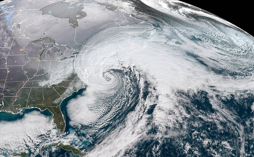
The products created by the new
generation of weather satellites are a breathtaking display of advanced
technology and engineering. The improved resolution is often compared to trading in your old
television for a 55″ behemoth that has more pixels than you can count. You can watch individual ripples flow through the tops of thunderstorms on the Plains. The resolution is so fine that you can pinpoint individual cumulus clouds hanging over your house.
generation of weather satellites are a breathtaking display of advanced
technology and engineering. The improved resolution is often compared to trading in your old
television for a 55″ behemoth that has more pixels than you can count. You can watch individual ripples flow through the tops of thunderstorms on the Plains. The resolution is so fine that you can pinpoint individual cumulus clouds hanging over your house.
One of the most impressive updates is the speed at which we get new images. The previous GOES family provided us updated images of the United States every 15 minutes and a full-disk image of the Western Hemisphere every three hours. The new satellites reduce that speed to a five-minute view of the U.S. and a snapshot of the entire hemisphere every 15 minutes. The satellite can scan mesoscale sectors—zoomed-in views of areas like storms or wildfires—every 30 to 60 seconds.
The enhanced speed and resolution makes such a difference that long animated loops of last year’s hurricanes look like they were shot in slow motion. The above animation from NOAA Satellites shows a side-by-side comparison of Hurricane Irma’s eye as seen by GOES-16 (left) and the ten-year-old GOES-13 (right).
Improved resolution and speed are only the beginning. The new family of satellites give meteorologists 16 bands (different wavelengths) through which to view the atmosphere, allowing them to differentiate high-level clouds from low-level clouds, spot snow on the ground with ease, keep track of contrails and fog, and even look for hotspots indicative of wildfires.
One of the coolest features is the Global Lightning Mapper, a sensor that tracks and maps lightning flashes in real time. This helps meteorologists track thunderstorms in areas without radar and even lets them monitor intensification in the eyewall of tropical cyclones. The satellite can monitor solar activity and warn scientists of dangerous solar flares that could damage equipment and put astronauts’ health at risk.
GOES-17 will replace GOES-15 as the western sector’s operational satellite. GOES-15 was launched in 2010 and will be retired to a storage orbit once GOES-17 is operational.
You can see real-time images from GOES-16 over at the College of DuPage’s analysis site and RAMMB/CIRA’s excellent satellite viewer.
[Images: NASA/Flickr | NOAA/CIRA/RAMMB]
Please consider subscribing to my writing on Patreon. Reader-funded journalism is more important than ever and your support helps fund engaging, hype-free weather coverage.