We Should Move The Start of the Atlantic Hurricane Season to May

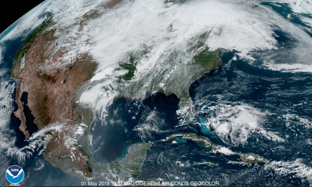
There’s a low chance that a disturbance over The Bahamas could develop into a tropical system off the southeast coast over the next couple of days. That can seem jarring to read at the beginning of May, but pre-season storms really aren’t that uncommon anymore. We should seriously consider moving the start of Atlantic hurricane season up a few weeks from June 1 to compensate for the basin’s tendency to pop out the occasional storm in May.
(Update: In 2021, the NHC moved the unofficial start of the Atlantic hurricane season to May 15, with the option to move the official start of the season based on a recommendation from the World Meteorological Organization.)
A trough over The Bahamas has brought soggy weather to the islands over the last couple of days. The disturbance was hard to miss on satellite imagery on Tuesday and Wednesday. Tthe dense overcast and curving cirrus clouds led me to make a bad joke on Twitter that the blob of clouds looked like every forgettable named storm we saw during the sleepy 2013, 2014, and 2015 hurricane seasons. (I had no idea the National Hurricane Center would issue an outlook for the disturbance soon after.)
 |
| NHC |
Wednesday morning’s special forecast from the NHC gave the disturbance a 20 percent chance of developing into a tropical system as it moves west toward Florida and curves back out to sea through the weekend. Models don’t really do anything with the system, but it’s organized enough—and the environment marginally okay enough (to use a technical term)—that a tiny bit of development can’t be completely ruled out.
This isn’t all that odd compared to what we’ve seen in May for much of the last decade.
 |
| NHC |
Whether it’s snowing in September or we’re watching a tropical storm in May, use of the phrase “Mother Nature doesn’t follow a calendar” is popular among weather folks when it’s time to brush off an annoying comment about a weather event happening outside of its prime season. The most annoying thing about that phrase is that it’s true, and we really box ourselves into a corner when we say that a certain weather event happens between the dates of X and Y.
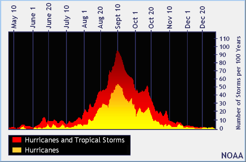
It all has to do with climatology. If you chart out all tropical systems in the Atlantic Ocean, you’ll see activity start to rise in June and wane in November, hence the traditional June 1—November 30 dates that everyone learns in elementary school. That doesn’t mean that tropical cyclones in the Atlantic are confined to that period of the year—however, that’s how many people take it. Just like we still fight to shake off the idea that there’s a set “tornado season” and you’re safe from twisters on Christmas (you’re not!), it can feel weird to entertain the idea of any named storms off the coast before June 1.

Six of the last ten hurricane seasons started during the month of May. Tropical Storm Alberto made landfall on the Florida Panhandle last year with 65 MPH winds. The storm continued—as a tropical system, mind you!—all the way to the Ohio Valley before finally petering out. The year before that saw Arlene out in the north-central Atlantic. We had a freak hurricane develop in January 2016 out near the Azores Islands, followed by Tropical Storm Bonnie’s flooding rains in the Carolinas and Georgia at the end of May 2016.
That’s a hefty list of pre-season storms. There are some factors like better technology and greater knowledge that likely contribute to the increase in pre-season storms in recent years, but the sheer number of May storms leaves the idea of moving the start of the Atlantic hurricane season from June 1 to May 15—coinciding with the eastern Pacific’s hurricane season—something that’s worth serious consideration.
Please consider subscribing to my Patreon. Reader-funded news is more important than ever and your support helps fund engaging, hype-free weather coverage.