Skip to content
DAMWeather DAMWeather DAMWeather

The weather can get scary. Reporting on it doesn't have to be.

DAMWeather DAMWeather DAMWeather

The weather can get scary. Reporting on it doesn't have to be.

  • About Me
  • All Bylines
    • Books, Bylines, and Press
    • The Skies Above (Book)
    • Extreme Weather (Book)
    • The Weather Network
    • The Vane
    • Forbes
    • Capital Weather Gang
    • Mental Floss
  • Maps
    • Hurricane Maps
    • Hurricane Names
    • Monthly Tornadoes
    • Tornado Tracks
    • F5/EF-5 Tornadoes
    • SPC High Risk Days
  • GIS Resources
  • Contact Me
    • Bluesky
    • Facebook
    • Instagram
  • wxdam.com
  • About Me
  • All Bylines
    • Books, Bylines, and Press
    • The Skies Above (Book)
    • Extreme Weather (Book)
    • The Weather Network
    • The Vane
    • Forbes
    • Capital Weather Gang
    • Mental Floss
  • Maps
    • Hurricane Maps
    • Hurricane Names
    • Monthly Tornadoes
    • Tornado Tracks
    • F5/EF-5 Tornadoes
    • SPC High Risk Days
  • GIS Resources
  • Contact Me
    • Bluesky
    • Facebook
    • Instagram
  • wxdam.com
Close

Search

Hurricane Dorian Quickly Organizing In The Southwestern Atlantic Ocean

By Dennis Mersereau
August 29, 2019 3 Min Read

Dorian strengthened into a hurricane over the U.S. Virgin Islands on
Wednesday afternoon, passing into the southwestern Atlantic Ocean where
it will spend the next four days in a prime environment for strengthening.
The National Hurricane Center expects the storm to make landfall in
Florida on Sunday, but the storm’s specific track—and what happens
beyond landfall—is still an open question.

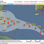
The 11:00 PM EDT advisory from the National Hurricane Center shows
Dorian making landfall on Florida’s east coast as a major hurricane on
Sunday or Monday. The cone of uncertainty stretches from the Everglades
to the central Georgia coast, though, so don’t get too hung up on exact
landfall locations this far in advance. Everyone in Florida and along
the southeastern and Gulf coasts should carefully follow the storm’s progress.

Hurricane Dorian ramped up in a hurry on Wednesday. The storm was a disheveled mess on Tuesday, struggling to maintain itself in the eastern Caribbean Sea and constantly reforming its center of circulation to the northeast. At the time, it wasn’t entirely clear if the storm would survive its encounter with the Greater Antilles, given its disorganized state and the mountainous terrain of Puerto Rico.

Those northeasterly jogs kept the bulk of the storm east of Puerto Rico, bringing hurricane conditions to the U.S. Virgin Islands and keeping the center of circulation mostly over water. This allowed Dorian to organize its structure and strengthen into a hurricane on Wednesday afternoon.

Tropical Tidbits

Dorian is now moving away from the Greater Antilles and into the open waters of the southwestern Atlantic Ocean. At 11:00 PM EDT, aircraft investigating the storm found maximum winds around 85 MPH with a central minimum pressure of 986 mb. The storm is struggling a bit due to intrusions of dry air. You can see the structure of the storm really well on the radar out of San Juan:

Gibson Ridge

The hurricane is lopsided at the moment, with a core and heavy bands off to the east. This band shows up as that “blob” on the satellite imagery above, which could be the result of easterly winds causing convergence on the east side of the system. Fluctuations in organization and intensity are common in storms, especially as they start to get their act together, but the overall environment is favorable for Dorian to use the next four or five days to grow into a major hurricane as it heads toward Florida.

The NHC issues official forecasts every six hours—at 11:00 and 5:00 AM/PM—with intermediate strength and position updates every three hours in between. If you live in the southeastern United States, even if you’re dozens of miles inland, make sure you have enough food, water, and batteries to get through several days without power. Make plans to go somewhere if you have to evacuate from storm surge or inland flooding due to heavy rain.

I’ll have a longer and more detailed post here at DAMWeather during the day on Thursday.


You can follow me on Twitter or send me an email.

Please consider subscribing to my Patreon. Your support helps me write engaging, hype-free weather coverage—no fretting over ad revenue, no chasing viral clicks. Just the weather.
 

Author

Dennis Mersereau

I have 15+ of experience providing hype-free weather information for folks across the United States and around the world. In addition to DAMWeather, I also contribute to The Weather Network as a digital writer and weather specialist.

Follow Me
Other Articles
Previous

The Tropical Atlantic Grows Active Again After An Unusually Long Midsummer Silence

Next

Hurricane Dorian Poised To Threaten Florida As A Major Hurricane Early Next Week


Local ◈ UTC
Facebook | Bluesky
Instagram | Threads | Email
DAMWeather is now ad-free! Everyone benefits from engaging, hype-free weather coverage. Please consider supporting my efforts through Patreon:


Order The Skies Above today!

Bookshop.org || Barnes & Noble
Mountaineers Books || Amazon

My latest book, The Skies Above, is now available!

Did you know a puffy cloud can weigh millions of pounds? Or that every rainbow you see is unique to you?

Our atmosphere is full of spectacular sights that are always within your reach. Glistening layers of fog, gorgeous sunsets, and brilliant meteors flashing through the sky can light up even the calmest day.

The Skies Above, published by Mountaineers Books, is a celebration of what we overlook when we look up. I was thrilled to work with the editors and illustrators at Indelible Editions to share with you the quotidian beauty of our sky.

Order your copy now and learn about the wonders we take for granted every day.

I teamed up with the editors of Outdoor Life magazine to write The Extreme Weather Survival Manual, your guide to surviving and thriving in almost any weather condition. Whether you're an avid outdoorsperson or you enjoy watching the radar from the comfort of your home, you're sure to find helpful tips, advice, and new bits of knowledge in this fascinating book.

You can buy my book today through Amazon.
  • 2026 (34)
  • 2025 (49)
  • 2024 (59)
  • 2023 (43)
  • 2022 (57)
  • 2021 (71)
  • 2020 (83)
  • 2019 (88)
  • 2018 (92)
  • 2017 (1)
  • 2016 (4)
  • 2015 (10)

Copyright 2026 — DAMWeather. All rights reserved. Blogsy WordPress Theme