A Major Winter Storm Could Bring Blizzard To Northern Plains, Significant Snow To Northeast


A major winter storm will move across the northern United States through early next week, producing a solid blanket of snow from the northern Plains to the Northeast. The heaviest snow will fall on the Dakotas and across the Upper Midwest, where a huge swath of land could see more than 12″ of snow by the time the storm is over. Disruptive snowfall totals are also likely across a large portion of the interior Northeast early next week.
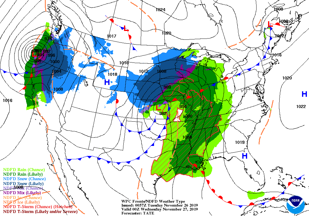
The developing storm will come from the same trough that generated the record-breaking low-pressure system in California and Oregon earlier this week. The storm broke the all-time record low air pressure reading for the state of California, with a pressure of 973.4 mb recorded in Crescent City on Tuesday night.
Northern Plains and Upper Midwest

Heavy snow will continue to spread across the north-central United States on Friday night, ending from west to east by Sunday night as the storm scoots east across the Great Lakes.
The National Weather Service predicts more than a foot of snow for a decent chunk of real estate, including the cities of Pierre, Fargo, Grand Forks, and Duluth. Duluth could wind up “winning” the snowfall contest as a result of snowfall enhanced by lake effect snow off of Lake Superior. The city could see a foot-and-a-half of snow by the end of the storm.
Strong, gusty winds associated with the developing winter storm could lead to blizzard conditions in parts of Wyoming, Nebraska, and South Dakota, including Rapid City. A blizzard warning is also in effect in and around Duluth as a result of strong winds blowing off of Lake Superior. A blizzard occurs when sustained winds of 35 MPH and blowing snow reduce visibility to one-quarter of a mile for three consecutive hours. Not only is travel almost impossible during blizzard conditions, but a whiteout can easily disorient someone even on a short trip from the front door to the mailbox.
Northeast

December will begin with the first major snowstorm of the season across much of the interior Northeast as a winter storm threatens to produce more than a foot of snow at higher elevations. This could be a long-duration winter storm, with precipitation beginning on Sunday evening and lasting through the first half of Tuesday in some areas. This is a winter-hardened part of the country, but more than half a foot of snow is difficult to deal with if road crews can’t keep up with snowfall rates.
Heavy snowfall totals will come perilously close to the major cities along the I-95 corridor. The gradient between a lot and a little could be especially apparent in Boston, where the current forecast calls for minor accumulations along the coast, but more than 6″ of snow just west of the city. A small nudge either way in the storm’s track could have a big impact on who sees decent snowfall totals.
It’s worth noting that the snowfall forecast above only runs through 7:00 PM EST on Monday, December 2. It’s possible that accumulating snow may continue after that cutoff in some areas, so those additional accumulations aren’t covered by the National Weather Service’s forecast above.
Freezing Rain

It’s not all going to be picturesque snow and fluffy drifts. Warmer air on the southern end of the system could allow precipitation to fall as freezing rain for a time, potentially leading to a crust of ice up to one-tenth of an inch thick on exposed surfaces. The greatest threat for freezing rain exists in central and western Pennsylvania, southwestern New York, southern Ontario, and parts of northeast Pennsylvania and northern Michigan.
Even the tiniest coating of ice can make travel by vehicle or foot almost impossible. A crust of ice beneath snow will make a snow-covered street deceptively slick, and freezing rain on top of snow can dramatically increase the weight of the snow and make shoveling a much more intensive task.
Please consider subscribing to my Patreon. Your support helps me write engaging, hype-free weather coverage—no fretting over ad revenue, no chasing viral clicks. Just the weather.