An Inch Of Ice From Freezing Rain (!) Is Possible In Parts New York And Quebec This Weekend

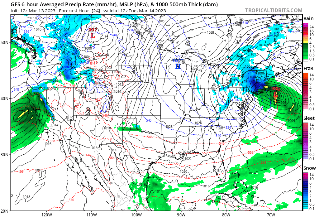
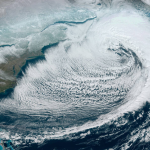
A significant ice storm appears likely across the U.S./Canadian border this weekend as a winter storm moves across the region. Conditions appear favorable for a prolonged period of freezing rain near the border from Michigan to Maine, with some areas potentially seeing as much as 1.00″ of ice accretion on exposed surfaces. If the highest totals come to fruition, it will cause significant tree damage and widespread, long-lasting power outages.
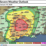
The threat for wintry precipitation lies on the northern side of the dynamic low-pressure system that’s causing all the severe weather in the southern United States right now. It’s cold enough for some areas to see all snow—it’s pouring snow in most of Iowa!—but warm air in the lower levels of the atmosphere will make a mess of things in many of the areas expecting wintry precipitation.
Significant Icing Possible
Forecasters expect a prolonged freezing rain event to unfold from Michigan to Maine—including our friends in Ontario and Quebec—as the system moves through the area on Saturday and Sunday. The National Weather Service issued ice storm warnings for eastern Michigan and portions of northern New York ahead of the system, while freezing rain advisories are in effect for parts of southern Ontario and Quebec, including the Montreal metro area.
Precipitation will start as rain early on Saturday, slowly transitioning to freezing rain from west to east on Saturday night as warm air takes over aloft and cold air entrenches at the surface. The storm will likely end with snow on Sunday.
Environment Canada warns of the potential for 15-30 mm of ice accretion from freezing rain in and around Montreal, which translates to about 0.60″ to 1.20″ of ice. That’s a major ice storm anywhere, let alone a heavily populated metropolitan area.
 |
| NWS |
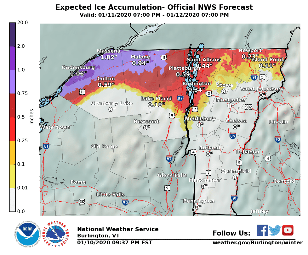
The National Weather Service in Burlington, Vermont, calls for similar ice accretion totals in northern parts of New York and Vermont. The official NWS forecast on Friday night called for 1.00″ of ice from freezing rain around Ogdensburg and Massena in New York, with around 0.50″ of ice in northwestern Vermont.
It only takes about 0.25″ of ice to begin doing damage to trees and power lines. Anything greater than that and the damage increases by a great deal. Significant and widespread damage to trees and power lines is likely once ice accretions exceed 0.50″. Areas that see a full inch of ice could see power outages that last for a week or longer and roads made impassable by parts of (or entire) downed trees.
It’s also going to be windy in many of the areas expecting freezing rain. Wind will only create additional stress on trees and power lines already struggling under the weight of ice. The additional weight of accumulating snow on the back-end of the system would complicate matters even further.
How Freezing Rain Forms
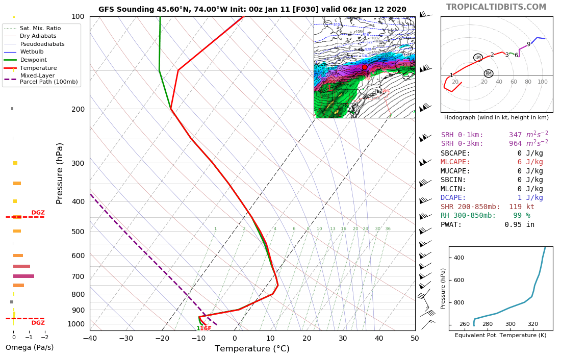
Freezing rain forms when a layer of subfreezing air hugging the surface is capped by a thick layer of warm air above it. Snowflakes melt as they fall into the layer of warm air. The melted snowflake—now a raindrop—falls into the subfreezing air at the surface, supercooling the liquid and allowing it to freeze on contact when it touches an exposed surface.
 |
| Tropical Tidbits |
Data collected by weather balloons (or, in this case, simulated by weather models) do a fantastic job showing the temperature profile behind the formation of freezing rain. Take a look at the above sounding from Friday night’s run of the GFS model near Montreal, Quebec, showing the atmosphere there just after midnight on Sunday.
The red line traces the temperature of air over Montreal from the surface to the top of the atmosphere. This particular model run shows a surface temperature of -9°C (about 16°F), while temperatures are firmly above freezing between 700 mb and 850 mb, or between about 5,000-10,000 feet above ground level. That’s a freezing rain profile if there ever was one.
Freezing rain is finicky. It takes slow and steady freezing rain for ice to build into a thick crust. If it rains too heavily, the water won’t be able to freeze on contact, simply running off and freezing into puddles on the ground instead. The worst ice storms are the ones that see hours and days of persistent freezing rain and drizzle. This won’t be historic, but it has the potential to be memorable for folks in the hardest-hit areas. 1.00″ of ice accretion from freezing rain is enough to fell thousands of trees and damage a power grid for a week or longer. That’s no small inconvenience.
[Top Image: Tropical Tidbits]
Please consider subscribing to my Patreon. Your support helps me write engaging, hype-free weather coverage—no fretting over ad revenue, no chasing viral clicks. Just the weather.