The West’s Intense Heat Wave Will Slowly Subside This Week

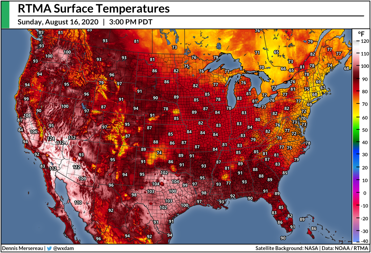
It’s been a pretty doggone hot summer across the United States, but nobody’s felt it quite so bad as the western half of the country. Often ignored in national weather coverage until they’re quite literally on fire, parts of the west—especially the desert Southwest—have suffered through one of their hottest summers in recent memory. This week’s heat was exceptionally unbearable; temperatures almost hit 100°F in Seattle on the same day that Death Valley saw one of its hottest readings on record. The heat will slowly wane this week in most areas.
Here’s what’s happened over just the last couple of days:
➤ Death Valley recorded a high temperature of 130°F on August 16, which is one of the hottest natural temperatures ever reliably recorded anywhere. They came close again on Monday. The weather station at the park’s visitor’s center reached 127°F on August 17, with a low temperature of only 104°F that morning.
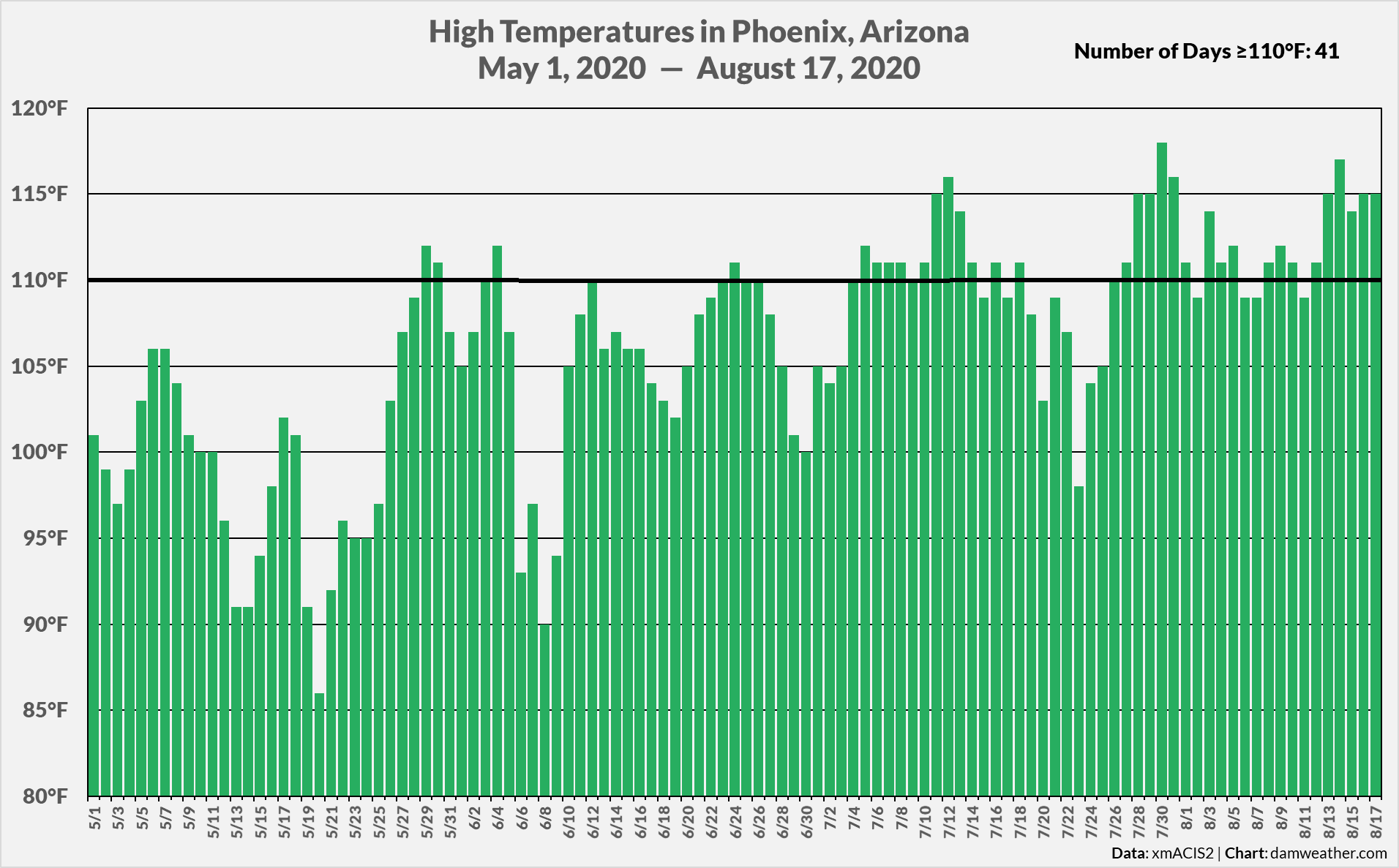
➤ Phoenix, Arizona, set a record—by a huge margin!—for the most 110°F+ high temperatures on record. The city’s recorded 41 days with a high temperature of 110°F or hotter as of August 17, and it looks like that streak will continue through at least Thursday. Phoenix’s previous record for the most supercentenarian high temperatures was 33 in 2011. With the exception of just one day, Phoenix has seen a high temperature in the triple digits every day since the beginning of July.
➤ Seattle, Washington, reached 98°F on August 16, which is about as hot as it gets in a city known for its temperate marine climate. Only a handful of days have seen a hotter high temperature since records began at Sea-Tac Airport back in 1945.
 |
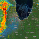
| Severe thunderstorms moving into the Bay Area before daybreak on August 16, 2020. |
➤ The heat and humidity allowed a cluster of thunderstorms to roll in off the Pacific Ocean, bringing storms to communities that don’t see thunder and lightning that often. The storms prompted the first severe thunderstorm warning for San Francisco proper since December 18, 2005.
➤ Widespread wildfires ignited across the western United States as a result of hot temperatures, gusty winds, and lightning strikes. Among the wildfires burning on Tuesday afternoon, including more than 8,000 acres in Sonoma County the 43,000-acre Dome Fire burning in California’s Mojave National Reserve, the uncontained Indian Creek fire near Juntura in eastern Oregon, and multiple lightning-induced fire complexes in central California, including more than 8,000 acres in Sonoma County and another complex of 20 separate fires across 25,000 acres east of the Bay Area.
➤ The Loyalton Fire in rural Lassen County, California, earned the first tornado warning ever issued for a fire whirl. A fire whirl is similar to a dust devil and they can grow as intense as low-end tornadoes. The circulation was so strong and stretched so high into the atmosphere that weather radar detected tornadic rotation in the smoke and clouds above the fire. A similar situation unfolded during the Carr Fire near Redding, California, in 2018. NWS meteorologists who surveyed the damage after the Carr Fire found damage consistent with winds produced by an EF-3 tornado.
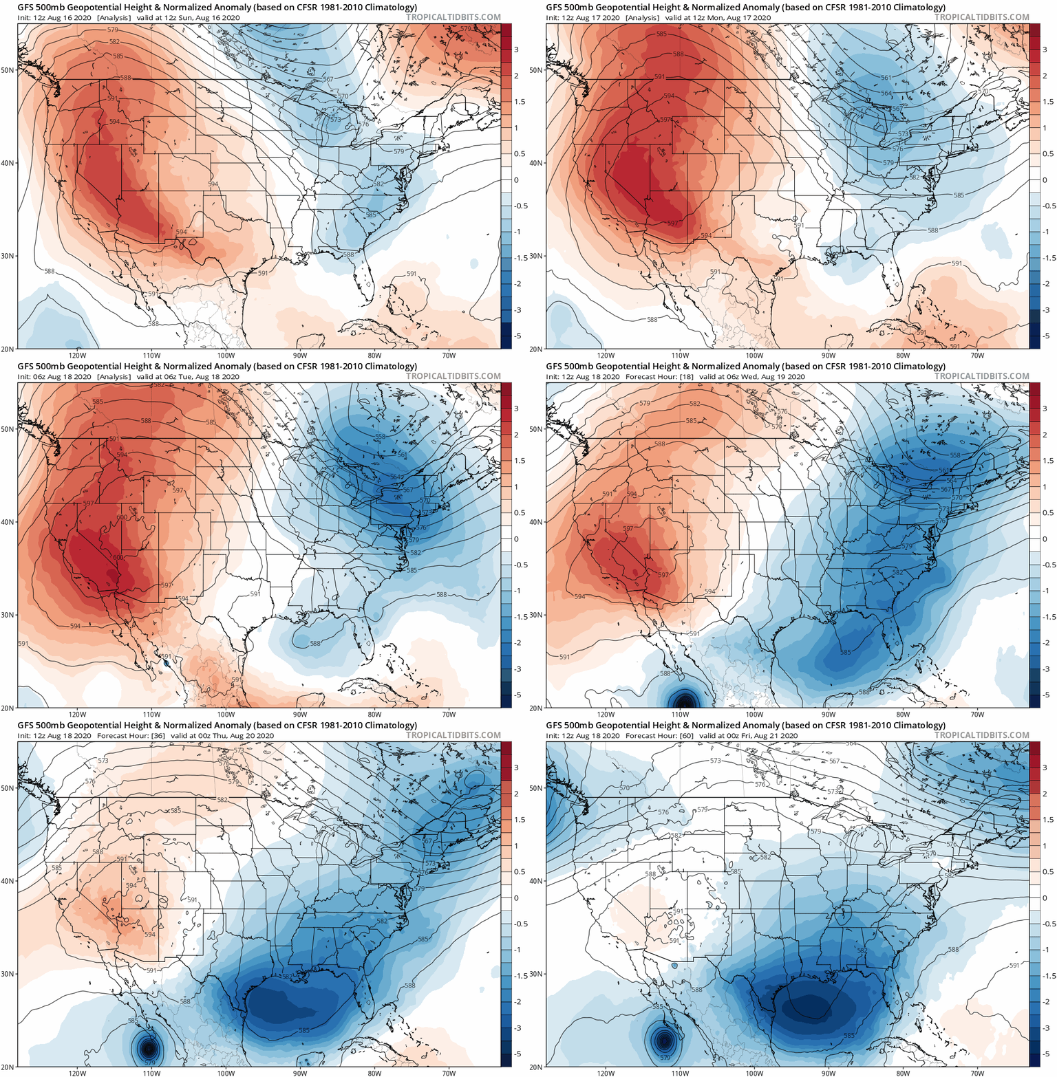
Why’s all this happening? It’s not much of a mystery if you look at the upper-level patterns:
 |
| Source: Tropical Tidbits |
The heat wave resulted from a huge ridge of high pressure parked over the western United States. Upper-level ridges foster sinking air, and sinking air heats up as it descends toward the surface, roasting most of the region under the hot August sun. The animation above shows the ridge between last Sunday and this Friday.
Here an animation showing the National Weather Service‘s high temperature forecasts between Tuesday, August 18, and Sunday, August 23:

Temperatures will moderate in the Pacific Northwest as the aforementioned upper-level ridge begins to break down, allowing the heat to retreat back to the Southwest where it’s been parked since April.
You can follow me on Twitter or send me an email.
Please consider subscribing to my Patreon. Your support helps me write engaging, hype-free weather coverage—no fretting over ad revenue, no chasing viral clicks. Just the weather.