Yet Another Tropical Storm Could Hit The Gulf Coast This Week


Tropical Storm Zeta could make landfall on the northern Gulf Coast by the middle of this week, becoming the unprecedented 11th named storm to make landfall in the United States in a single hurricane season. The storm could be at or near hurricane strength by the time it makes landfall, further damaging a region that’s seen more than its share of storms this season.
Zeta formed from a vigorous tropical wave in the western Caribbean. Models did a good job sniffing out the general pattern that was conducive to this tropical storm’s development. This is exactly where you’d expect to see tropical development in October and November—the waters here are still warm and the atmosphere is able to bounce back from cold fronts pushing off North America.
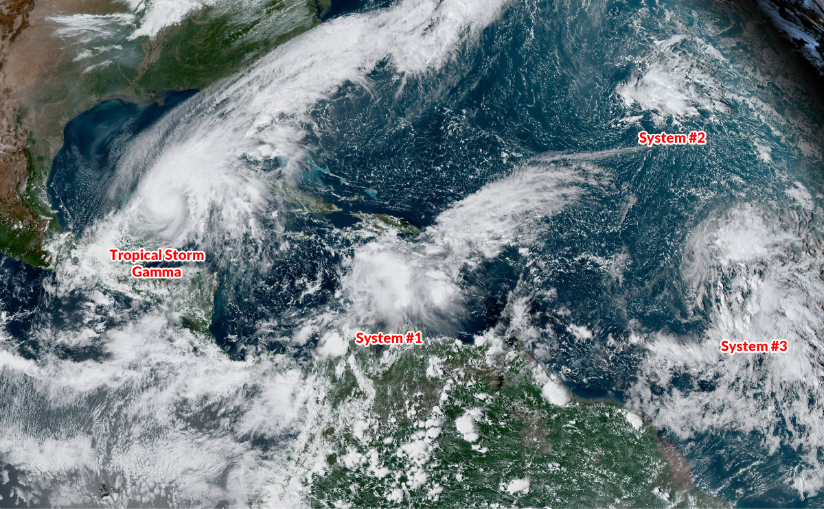 |
| Source: NOAA |
The latest advisory from the National Hurricane Center shows Zeta gradually gathering strength as it approaches the Yucatan Peninsula. Forecasters expect the system to reach hurricane strength before it makes landfall near Cancun on Monday evening. Once the storm crosses the Yucatan, it should emerge into the Gulf of Mexico and steadily make its way toward the northern Gulf Coast.
Don’t focus too much on exactly where the forecast shows the center of the storm making landfall. While the precise track of the storm will determine who sees the worst conditions, the effects of wind, heavy rain, and storm surge can extend far away from the center of the storm. Based on the current forecast, Zeta could make landfall in Louisiana, Mississippi, or Alabama during the day on Wednesday.
The NHC’s forecast discussion on Sunday afternoon notes “significant uncertainty” in the storm’s intensity forecast as it approaches U.S. landfall this week.
It’s late in the season and there’s only so much fuel for a tropical cyclone to tap into as it moves out of the Caribbean. Recent cold fronts and residual cool water churned up by Hurricane Delta a few weeks ago leave Zeta entering a Gulf of Mexico that isn’t favorable for the explosive intensification we saw several times during the heat of the summer.
Once Tropical Storm Zeta moves inland, the system’s remnants will bring heavy rain (and the potential for tornadoes) to the southeast and Mid-Atlantic before a cold front swoops down and brings cooler, drier conditions for the weekend.
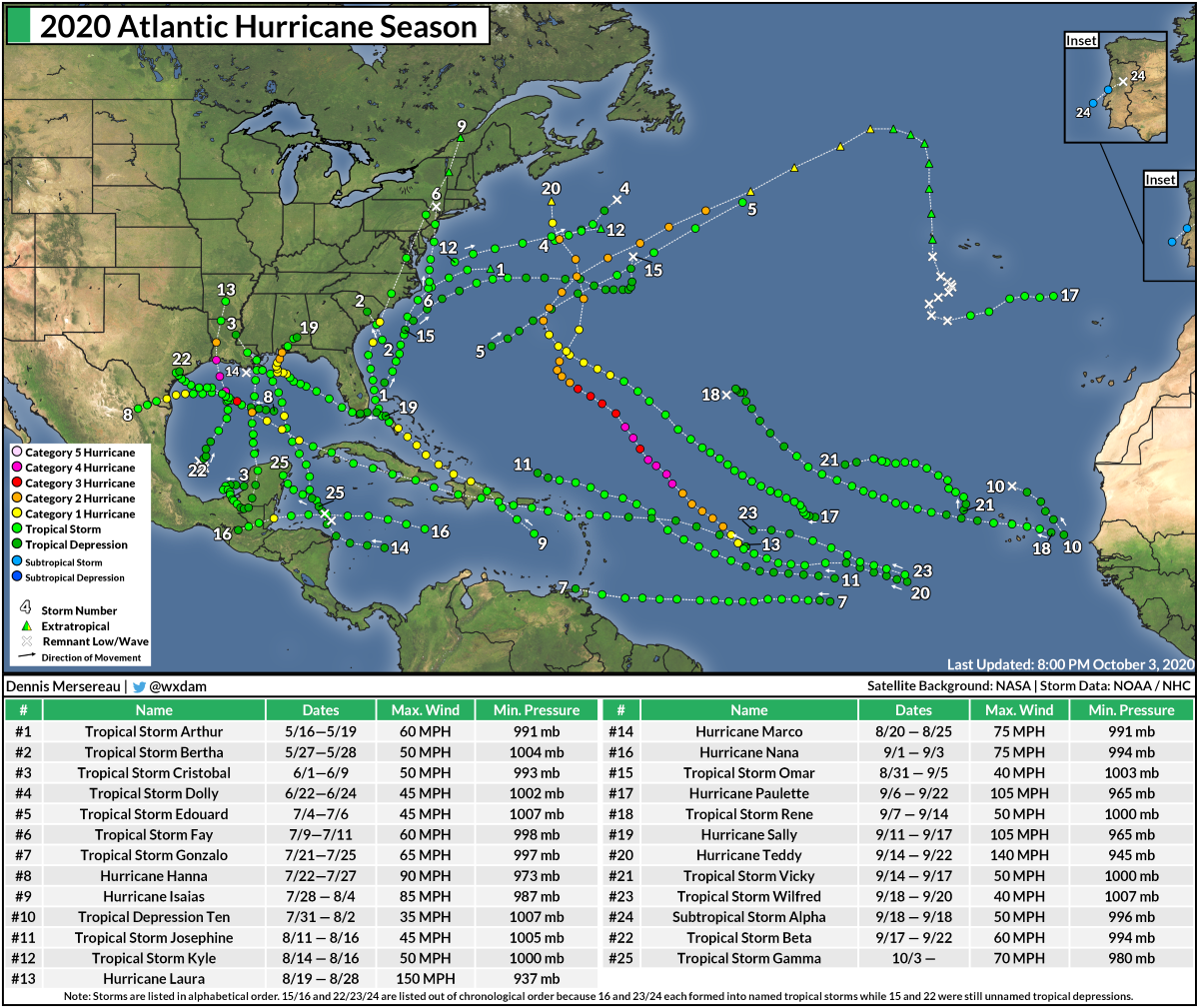
Zeta is the sixth letter of the Greek alphabet. This is the 27th named storm of the 2020 Atlantic hurricane season. We’re one storm away from tying the all-time record of 28 storms that developed during the 2005 hurricane season.
There’s still the potential that we could see additional storms after Zeta. The next name on the list is Eta, followed by Theta and Iota.
The letter Zeta is as deep into the Greek alphabet as we got in 2005. The “missing” 28th storm was an unnamed subtropical storm that developed on October 4, 2005. Forecasters missed that system at the time, catching it after the fact during the post-season analysis and adding it to the year’s total.
If the NHC had caught and issued advisories on the unnamed storm contemporaneously, every storm that formed after Hurricane Stan would’ve been pushed back one letter, and we would’ve reached the letter Eta. (Hurricane Wilma was that close to being Hurricane Alpha!)

If Zeta makes landfall as predicted, it’ll be the 11th named storm to hit the United States this year. Previously, the most named storms to make landfall in the United States was 9 storms during the 1916 hurricane season. Hurricane Sally tied as the 9th storm, and Hurricane Delta broke the record as the 10th.
You can follow me on Twitter or send me an email.
Please consider subscribing to my Patreon. Your support helps me write engaging, hype-free weather coverage—no fretting over ad revenue, no chasing viral clicks. Just the weather.