California Braces For Strong Adjectives As Rain, Snow, Wind Overspread State


A barrage of descriptive words will wash over California over the next couple of days as strong winds, heavy rain, and huge snows promise to do a number on the state’s drought. While rain and snow are a good thing, too much all at once can cause serious issues. Mammoth snowfall totals in the mountains will make travel impossible and lead to a high risk for avalanches, while heavy rain at lower elevations could trigger flash flooding and mudslides.
The Setup
A growing trough in the jet stream will continue to sharpen as it approaches the West Coast overnight into Wednesday. This trough, along with a cold front extending off a low-pressure system moving into the Pacific Northwest, will direct an atmospheric river right at California.
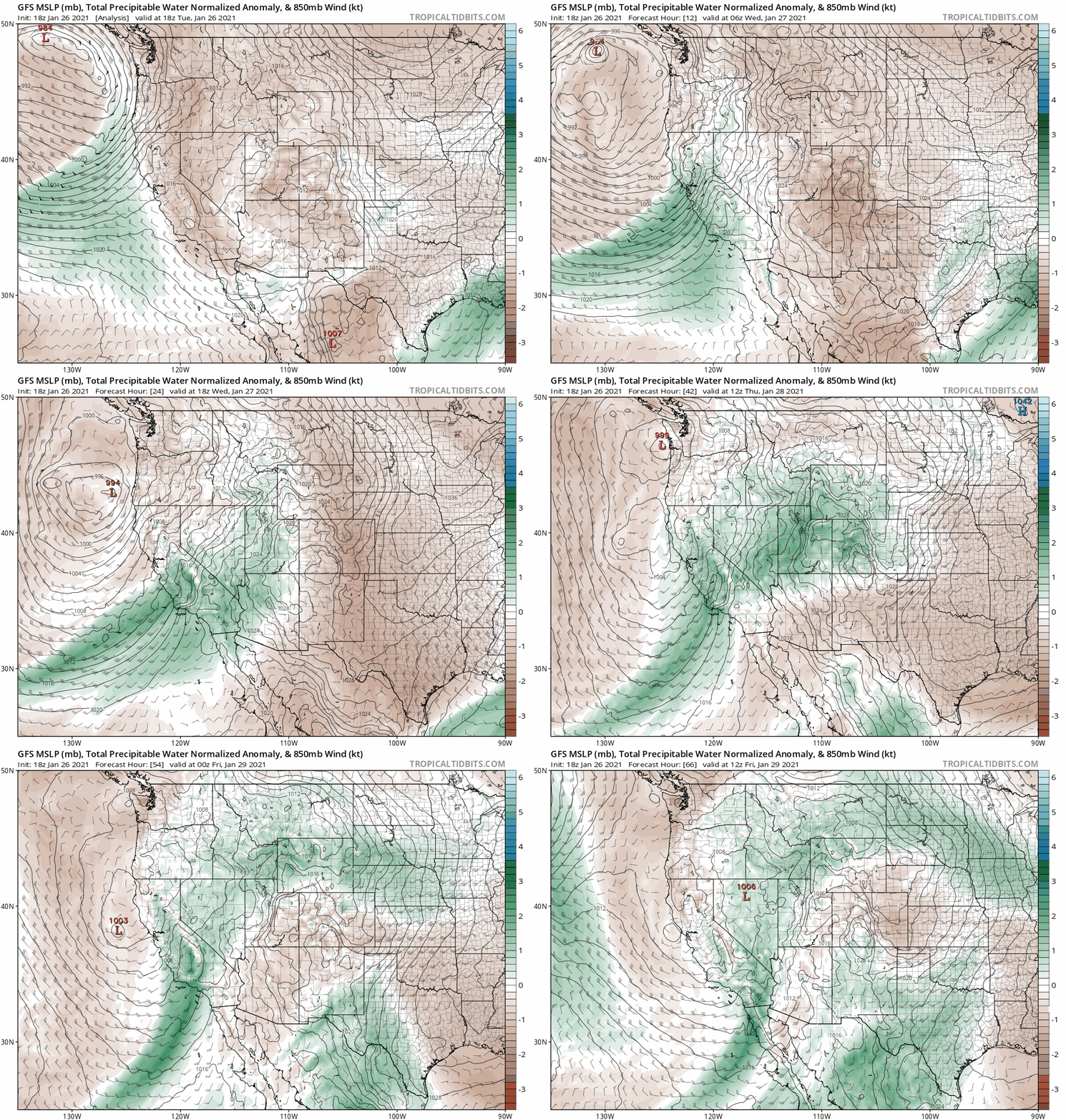 |
| Source: Tropical Tidbits |
Despite its name, an atmospheric river isn’t something made up to sound good on a chyron. The term describes a narrow band of enhanced moisture in the atmosphere that flows from tropical latitudes to the middle latitudes. In this case, the atmospheric river will drag tropical moisture from the central Pacific and focus it over much of California over the next couple of days.
The amount of moisture in the atmosphere plays a huge role in how much rain or snow can fall over a certain area. Rain showers, snow bands, and thunderstorms can tap into an atmospheric river like a reservoir and condense that rich moisture into a tremendous amount of precipitation.
The result will be impressive.
Snowfall
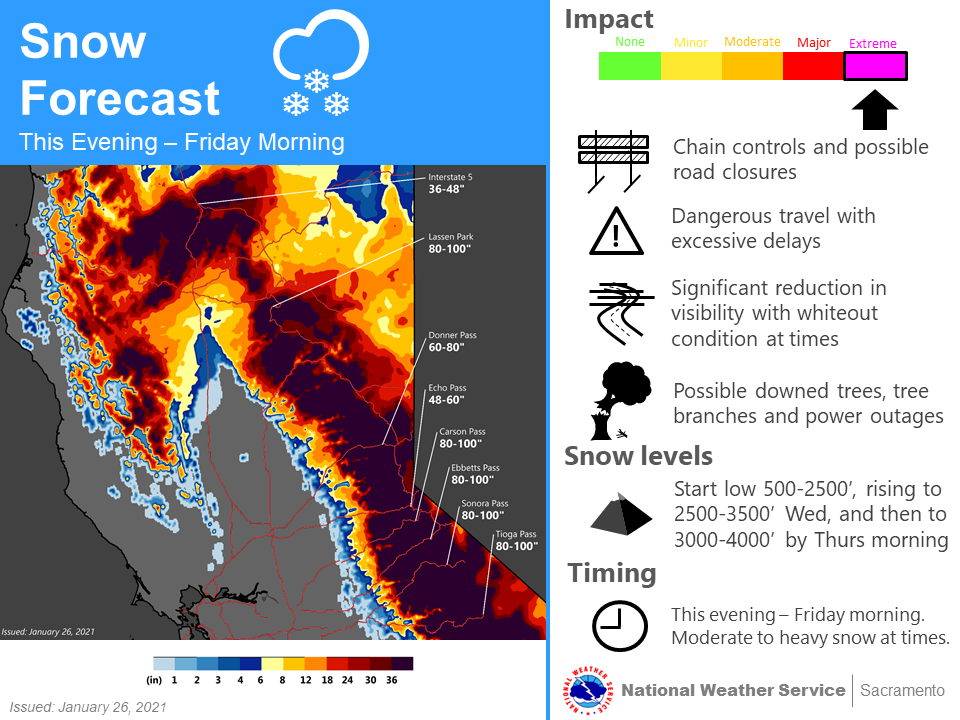 |
| Source: NWS Sacramento |
The National Weather Service’s snowfall forecast for the highest peaks in the Sierra calls for 80 to 100 inches of snow by the end of the storm, with locally higher snowfall totals possible. Some areas could see more than 10 feet of snow by the time things calm down.
That much snow all at once will make travel all but impossible across roads that traverse the mountains, and it’ll lead to a high risk for avalanches as much of the fresh snowpack will be unstable. It’s not all bad, though. Mountain snowpack is a significant source of freshwater for many communities around California. This kind of snow will go a long way toward reinforcing some of that water supply after the region’s slipped deeper into drought over the last year.
Rainfall

Lower elevations will experience rain—and plenty of it. Widespread rainfall totals of 3 to 6 inches are likely from western Washington straight down the coast through southern California. Higher elevations below the freezing line could see double-digit rainfall totals by the end of the storm. An inch or two of rain is possible all the way down in Los Angeles through this weekend.
This much rain falling this quickly will lead to a risk for flash flooding. The greatest risk for flash flooding will exist from about Monterey to San Luis Obispo, but a risk for excessive rainfall will exist from the Bay Area east to about Sacramento, and down the coast through Santa Barbara.
Never try to drive across a flooded roadway. It only takes a couple of inches of fast-moving water to lift a vehicle and carry it downstream. It’s impossible to judge how deep the water is until you’re already in it. Sometimes, floodwaters can wash away the road and obscure the fact that there isn’t a road there anymore until it’s too late.
The risk for flash flooding and mudslides is greater around the region’s many burn scars. Wildfires destroy the soil over which they burn, making the soil virtually impermeable. Since the water can’t penetrate into the ground, it oversaturates the topsoil and triggers a mudslide. Debris flows, flash floods that carry ash, rocks, and burned vegetation, can destroy roads and buildings downstream from the loaded floodwaters.
Gusty Winds
If it’s a storm in California, it’s going to be windy. High winds are possible across much of the state through Wednesday. Wind gusts as high as 60 MPH in some areas could easily knock down trees and power lines, especially where heavy rain loosens the soil and makes it harder for trees and poles to stand up to the stress of the wind.
[Satellite Image: NOAA]
You can follow me on Twitter or send me an email.
Please consider subscribing to my Patreon. Your support helps me write engaging, hype-free weather coverage—no fretting over ad revenue, no chasing viral clicks. Just the weather.