Flooding Rains Likely In Texas; Watching Five Different Tropical Disturbances In The Atlantic


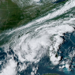
A tropical disturbance in the Gulf of Mexico has a high chance of developing into a tropical depression over the next couple of days as it moseys near the coasts of Mexico and Texas.
Regardless of its development, the system will bring drenching rains to coastal Texas, with totals possibly climbing into the double digits for some by the end of the week.
We’re also watching four other systems out in the Atlantic, each with varying chances for development heading into next week.
Gulf System + Texas Flooding

The National Hurricane Center (NHC) gives the Gulf disturbance a 90% chance of developing into a tropical depression by Monday, which is a decent display of confidence from the agency’s expert forecasters.
The disturbance could become Tropical Storm Nicholas before it reaches land, but that’s a big if, and it could have some significant impacts across the region whether or not it organizes and earns a name.
A surge of tropical moisture will sweep over the Texas coast over the next couple of days, providing a deep reserve of moisture for thunderstorms to tap into and produce torrential downpours across the region.

The Weather Prediction Center is calling for widespread rainfall totals of 4-8″ across the Gulf Coast from southern Texas through central Louisiana. Higher totals are possible around Houston, Galveston, Beaumont, and Lake Charles, where someone could wind up with double-digit totals by this time next week.
Right now, it looks like the heaviest rain could fall between Sunday night to Wednesday night.
These rainfall totals are likely to change subject to the development and path of the system. A stronger system would produce heavier rains along its path.
But either way, this has the potential to bring flooding rains to a region not particularly well-equipped to handle them. As always, the best advice is to remember that it’s impossible to tell how deep the water is before it’s too late. It’s never worth risking your life or the lives of your rescuers to try to drive through floodwaters.
Four Other Atlantic Disturbances

Friday was the climatological peak of the hurricane season. Storms don’t follow our puny calendars, of course, but this is about the time of the year when favorable atmospheric conditions coincide with sea surface temperatures warmed by the sultry heat of a long summer.
Even so, it’s still jarring to see the NHC’s tropical weather outlook map lit up like a Christmas tree. Aside from the impending tropical depression in the southwestern Gulf of Mexico, we have to watch four other systems out in the Atlantic.
Let’s go from most interesting to least interesting…
30% Near The Bahamas
A disturbance could develop east of The Bahamas in a couple of days. If this system develops, it’ll be worth watching for tropical development because of its proximity to the East Coast. An upper-level ridge is expected to develop over the region this week. Ridges tend to act like guardrails that, for lack of a better term, can trap tropical systems beneath them.
It’s nothing to worry about just yet, but file it away in the back of your mind. Spend the next few days thinking about what supplies you’d need to get through a power outage just in case something spins up and heads your way.
50% and 40% Near Africa
The two areas highlighted near the Cabo Verde Islands are typical tropical waves that roll off the western coast of Africa during the height of the summer. They’re a looong way out, and we’ll have plenty of time to watch what happens with these two disturbances.
20% Near Iberia
We seem to get at least one of these loners every year. A low-pressure system meandering in the northeastern Atlantic Ocean has a low chance of transitioning into a tropical or subtropical system this week. They usually don’t cause too much harm aside from bringing foul weather to The Azores and the Iberian Peninsula.
You can follow me on Twitter or send me an email.
Please consider subscribing to my Patreon. Your support helps me write engaging, hype-free weather coverage—no fretting over ad revenue, no chasing viral clicks. Just the weather.