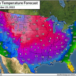
100+°F Temperature Gradient Likely As Extreme Pre-Christmas Cold Snap Hits U.S.

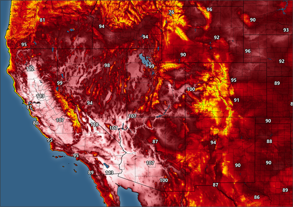
You know it’s going to be a heck of a cold front when there’s a 99-degree temperature difference between Glasgow, Montana, and Miami, Florida, in the middle of the day.
A brutal blast of Arctic air will pour south out of Canada this week and plunge almost all of the eastern two-thirds of the United States into an extended cold snap.
That Glasgow-Miami difference isn’t even the worst of it. It’s likely that we’ll see a >100°F spread between the warmest high temperature and the coldest high temperature in the U.S. at some point on Thursday or Friday.
Temperatures won’t climb much above the single digits, let alone the freezing mark, over a vast swath of the country for a couple of days this week.
The P***r V****x
This pre-Christmas cold spell comes courtesy of a splintered piece of the polar vortex—that terrifying, mythical wintertime creature that lurks in the “favorites” list of every broadcast news computer’s scary graphics folder.
The polar vortex is an ever-present belt of winds that wraps around the North Pole, growing to its peak strength every winter. This circulation keeps winter’s coldest air confined to the Arctic when it’s strong and well-behaved.
 |
| SOURCE: Tropical Tidbits |
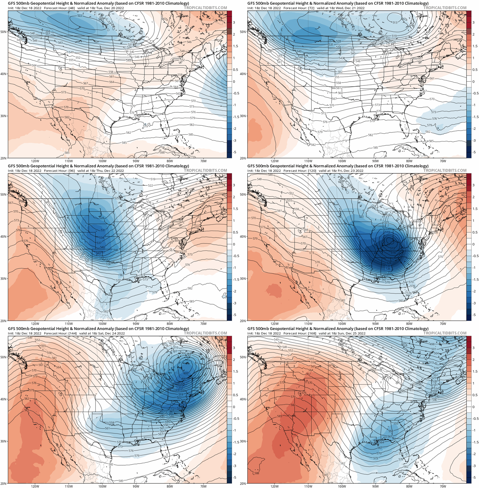
However, the circulation becomes unstable from time to time, allowing troughs or upper-level lows to swoop down to lower latitudes. These “pieces” of the polar vortex bring bitterly cold air south with them.
Our looming surge of Arctic air will come courtesy of an upper-level low that was once a part of the polar vortex’s broader circulation over far northern Canada.
Not only will this low pull frigid air as far south as Florida and southern Texas, but this setup will generate a low-pressure system at the surface.
This developing late-week storm will bring a major bout of wind and wintry precipitation just in time to mess up everyone’s holiday travel plans across the Midwest, Great Lakes, and Northeast.
The Cold
Subzero temperatures were firmly locked in place across the northern Plains on Sunday night, and temperatures will remain in negative territory for a full week from the northern Rockies to the Upper Midwest.
Wind chill values will drop well below -40°F during the worst of the cold across this region. That’s dangerous cold even for the hardiest Plains resident who boasts about their fortitude. Actual air temperatures below -30°F, and wind chill values below -40°F, can lead to frostbite and hypothermia in a matter of minutes. It’s serious stuff.
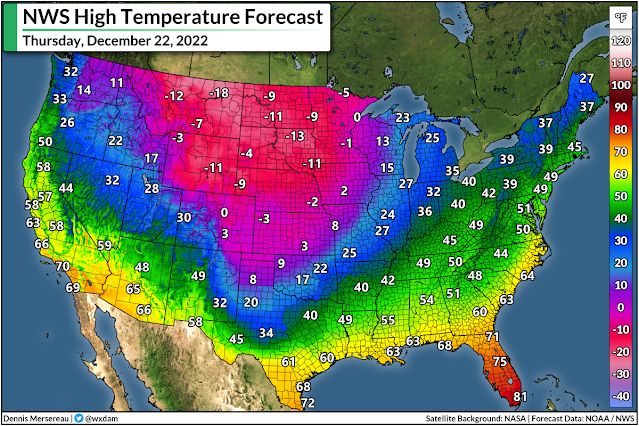
This unpleasantly cold air will steadily march southward over the next couple of days, forcing daytime highs to remain well below the freezing mark—even into the single digits or below zero—as we head through the middle of the week.
Thursday will see the most extreme temperature gradient across the country as our big storm system begins to develop across the Midwest.
Miami will bask in a high of 81°F on Thursday afternoon, while Glasgow, Montana, will only hit a balmy -18°F.
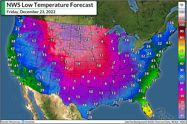
Overnight lows into Friday morning will be downright rude, with -30s widespread in the Dakotas, subzero readings into Oklahoma, and single digits as far south as northern Mississippi and Texas’ Big Bend region.
It’ll finally take until the night before Christmas for the cold front to reach the Atlantic coast, and all through the country it’ll be…really darn cold.

Temperatures will dip into the 40s down in the Everglades, and lows on Christmas morning will even get into the lower 20s across the northern Gulf Coast. (22°F is frigid for Mobile, Alabama, y’all.)
Conditions will gradually improve and warm toward some semblance of normal during that vaporwave week between Christmas and New Year’s when existence is a simulation and nobody actually gets anything done except for eating cookies and reading best-of-2022 listicles.
The Storm
Ohhh, the storm.
You’ve probably heard about it on Facebook or Mastodon or the failing tweeting bird app in the past week:
“It’s a blizzard. It’ll be a behemoth. It’ll rival your grandparents’ best childhood memories.”
It’s going to be a doozy for somebody, for sure. If you live along the East Coast, though…it’s probably not gonna be you.
 |
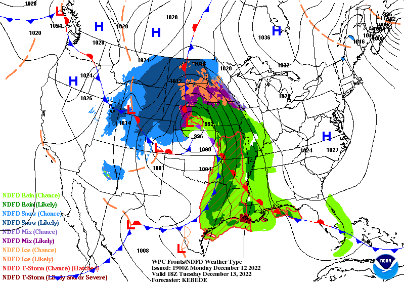
| SOURCE: NWS/WPC |
Models this weekend came into a bit of agreement that this low will track along or west of the Appalachian Mountains, which is great news for snow lovers in the Midwest and Great Lakes, and a nightmare scenario for the same group of folks along the I-95 corridor.
It’s still too early to call out specifics like snow totals, ice accretions, or even which cities are going to get walloped the hardest. (It’s at least four days away. For real. C’mon.) But the signals are all there that this is likely going to be a high-impact event for lots of major cities, including Chicago, Detroit, and Toronto.
Forecasters are already starting to use phrases like “blizzard conditions” for some areas, so this storm—regardless of its precise track—will have significant impacts on cross-country travelers heading out by road, rail, or plane.
Keep in mind that foul weather at air traffic hubs will have downstream ripple effects that affect flights that won’t ever touch a snowy runway. (Every plane comes from somewhere else, after all.)
We’ll have a better idea of what that storm will look like as we make our way through the week. Models will jump back and forth with its location a bit. Remember that only a few dozen miles to the east or to the west can have huge implications for the impacts of a winter storm.
The best thing to do now is to make flexible travel plans (a polite way of putting it) and try keep a jolly demeanor about whatever blows our way. We’ll remember this ordeal fondly come July when we’re breaking all-time heat records again.
[Top image created using WSV3.]
You can follow me on Facebook, Mastodon, and Twitter. You can also send me an email.
Please consider subscribing to my Patreon. Your support helps me write engaging, hype-free weather coverage—no fretting over ad revenue, no chasing viral clicks. Just the weather.