Skip to content
DAMWeather DAMWeather DAMWeather

The weather can get scary. Reporting on it doesn't have to be.

DAMWeather DAMWeather DAMWeather

The weather can get scary. Reporting on it doesn't have to be.

  • About Me
  • All Bylines
    • Books, Bylines, and Press
    • The Skies Above (Book)
    • Extreme Weather (Book)
    • The Weather Network
    • The Vane
    • Forbes
    • Capital Weather Gang
    • Mental Floss
  • Maps
    • Hurricane Maps
    • Hurricane Names
    • Monthly Tornadoes
    • Tornado Tracks
    • F5/EF-5 Tornadoes
    • SPC High Risk Days
  • GIS Resources
  • Contact Me
    • Bluesky
    • Facebook
    • Instagram
  • wxdam.com
  • About Me
  • All Bylines
    • Books, Bylines, and Press
    • The Skies Above (Book)
    • Extreme Weather (Book)
    • The Weather Network
    • The Vane
    • Forbes
    • Capital Weather Gang
    • Mental Floss
  • Maps
    • Hurricane Maps
    • Hurricane Names
    • Monthly Tornadoes
    • Tornado Tracks
    • F5/EF-5 Tornadoes
    • SPC High Risk Days
  • GIS Resources
  • Contact Me
    • Bluesky
    • Facebook
    • Instagram
  • wxdam.com
Close

Search

East Coast in for a pressure washing as a powerful storm arrives Sunday

By Dennis Mersereau
December 9, 2023 3 Min Read

A feisty low-pressure system is gearing up to bring plenty of disruptive weather to the East Coast over the next couple of days. Widespread heavy rain could lead to flooding along the I-95 megalopolis while the storm produces snow near the Great Lakes and severe storms across the southeast.
Sunday/Monday’s storm is part of a dynamic pattern that’s gradually making its way across the eastern half of the country. A cold front extending off a low-pressure system moving through the Great Lakes is responsible for most of the active weather we’re seeing on Saturday. A new storm will develop along this front on Sunday, becoming the dominant system that’ll bring all the headaches to end the weekend.

Sharp wind shear through the atmosphere combined with a cold front running into a pool of warm, moist air is a recipe for severe thunderstorms. An expansive severe risk covers a chunk of the southern U.S. on Saturday, mainly focused on the lower Mississippi Valley east into Alabama and Tennessee.
Any severe thunderstorms that bubble up on Saturday could produce damaging winds, hail, and a few tornadoes. We already saw a couple of tornadoes touch down in north-central Tennessee early Saturday afternoon.

We’ll see that storm threat shift east on Sunday as the cold front heads toward the Atlantic coast. Severe thunderstorms are possible from the D.C./Baltimore region down the I-95/I-85 corridor toward southeastern Alabama and the northern half of Florida. The main risk with Sunday’s storms would be damaging wind gusts, but a few tornadoes are possible, especially in parts of eastern Virginia and North Carolina.
Farther north, this developing storm’s main threats will be drenching rains, heavy snow, and blustery conditions.
Flood watches span the I-95 corridor from D.C. to Portland as forecasters anticipate several inches of rain falling through the day Sunday. Lots of rain falling in short order can overwhelm waterways and drainage systems, leading to pooling and possible street flooding.

It’s not going to be a gentle downpour, either. Widespread wind gusts of 20-30+ mph will accompany the storm as it chugs through interior New England on Sunday. Much stronger winds are likely for coastal communities across the northeast, where a period of 50-60+ mph wind gusts will be possible into Monday.
Winds this strong combined with wet soils could lead to fallen trees and power lines. Make sure your holiday decorations are tied down or brought inside, as well. Those things will take flight in a hurry once the gusty winds start, and it could be dangerous if they blow into the road.
Cold air flooding in behind the system will allow for widespread snow across the Northeast interior and down the spine of the Appalachians. The heaviest totals are likely near the Canadian border, where higher elevations in New York and Vermont could see more than a foot of fresh snow by Monday.
If you have plans to travel late Sunday or early Monday, it’s worth keeping in mind that some models are struggling a bit with the potential changeover from rain to snow across parts of Pennsylvania, the Mid-Atlantic, and even down into the North Carolina Piedmont.
Plan ahead for the potential for a burst of snow during the last few hours of precipitation overnight Sunday into Monday, with possible accumulation if temperatures are cold enough.
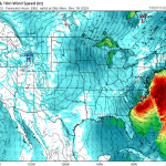
[Top model image generated using WSV3]


Follow me on Facebook | Bluesky |
Threads | Instagram | Twitter

Get in touch! Send me an email.

Please consider subscribing to my Patreon. Your support helps me write engaging, hype-free weather coverage—no fretting over ad revenue, no chasing viral clicks. Just the weather.


Author

Dennis Mersereau

I have 15+ of experience providing hype-free weather information for folks across the United States and around the world. In addition to DAMWeather, I also contribute to The Weather Network as a digital writer and weather specialist.

Follow Me
Other Articles
Previous

Cold air damming brought Greensboro a wild one-hour temperature tango

Next

Weekend deja vu as second powerful East Coast storm hits Sunday and Monday


Local ◈ UTC
Facebook | Bluesky
Instagram | Threads | Email
DAMWeather is now ad-free! Everyone benefits from engaging, hype-free weather coverage. Please consider supporting my efforts through Patreon:


Order The Skies Above today!

Bookshop.org || Barnes & Noble
Mountaineers Books || Amazon

My latest book, The Skies Above, is now available!

Did you know a puffy cloud can weigh millions of pounds? Or that every rainbow you see is unique to you?

Our atmosphere is full of spectacular sights that are always within your reach. Glistening layers of fog, gorgeous sunsets, and brilliant meteors flashing through the sky can light up even the calmest day.

The Skies Above, published by Mountaineers Books, is a celebration of what we overlook when we look up. I was thrilled to work with the editors and illustrators at Indelible Editions to share with you the quotidian beauty of our sky.

Order your copy now and learn about the wonders we take for granted every day.

I teamed up with the editors of Outdoor Life magazine to write The Extreme Weather Survival Manual, your guide to surviving and thriving in almost any weather condition. Whether you're an avid outdoorsperson or you enjoy watching the radar from the comfort of your home, you're sure to find helpful tips, advice, and new bits of knowledge in this fascinating book.

You can buy my book today through Amazon.
  • 2026 (34)
  • 2025 (49)
  • 2024 (59)
  • 2023 (43)
  • 2022 (57)
  • 2021 (71)
  • 2020 (83)
  • 2019 (88)
  • 2018 (92)
  • 2017 (1)
  • 2016 (4)
  • 2015 (10)

Copyright 2026 — DAMWeather. All rights reserved. Blogsy WordPress Theme