Gulf tropical depression forms; N.C. flooding possible this week

We’re on the lookout for two distinct weather events across the Southeast this week as a more active pattern (finally) moves into the area. Drought relief is likely for areas that desperately need rain–but too much rain falling all at once will lead to a flood threat for some areas.
Tropical Depression Two forms
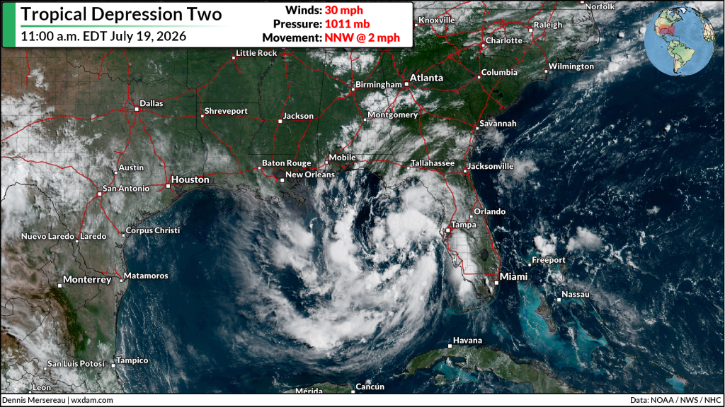
We’ve got our second tropical depression of the season in the eastern Gulf of Mexico.
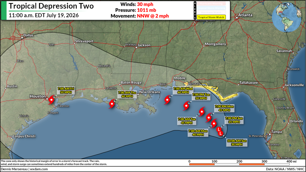
The National Hurricane Center initiated advisories on Tropical Depression Two at 11:00 a.m. Eastern on Sunday.
TD 2, which is expected to become Tropical Storm Bertha by Monday, is a relatively weak system and it’s pretty disheveled right now. The center of low pressure has just enough thunderstorm activity near its core to qualify as a tropical system.
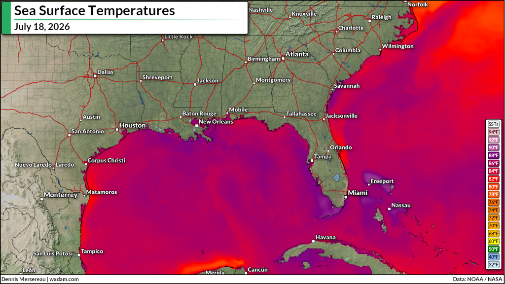
Sea surface temperatures across the Gulf are like a bathtub right now. Given the very warm waters and favorable environmental conditions, forecasters expect this system to gradually organize and intensify as it drifts north-northwest toward land.
All indications point toward this being a fairly lopsided system during its lifespan, with the bulk of the rain and wind on the southern and eastern quadrants of the storm. As a result, impacts to land are expected to be limited for now. A tropical storm watch is in effect for much of the Florida Panhandle, including all of the popular beaches in the region.
Heavy rains across North Carolina
We can see that lopsidedness in the Weather Prediction Center’s seven-day rainfall forecast for the region:
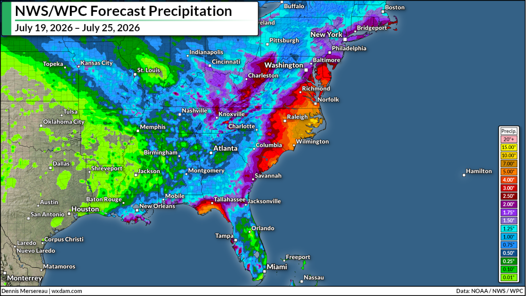
There’s certainly not as much rain as you’d expect along the northern Gulf Coast for a slow-moving tropical storm.
What does stand out, however, is the big slug of heavy rain predicted along the East Coast between South Carolina and Delaware.
A steady stream of tropical moisture associated with TD 2 will stream north through the coming week. This moisture will run against several fronts expected to move toward the Atlantic seaboard over the next five to six days, resulting in repeated rounds of heavy rain centered on the Carolinas and coastal Mid-Atlantic.
Eastern North Carolina will likely fall beneath the bullseye for the heavy rainfall, with 5-7+ inches of rain in the forecast throughout the region. Some areas could see double-digit rainfall totals by next weekend. This much heavy rain all at once will certainly lead to flooding concerns in vulnerable areas.
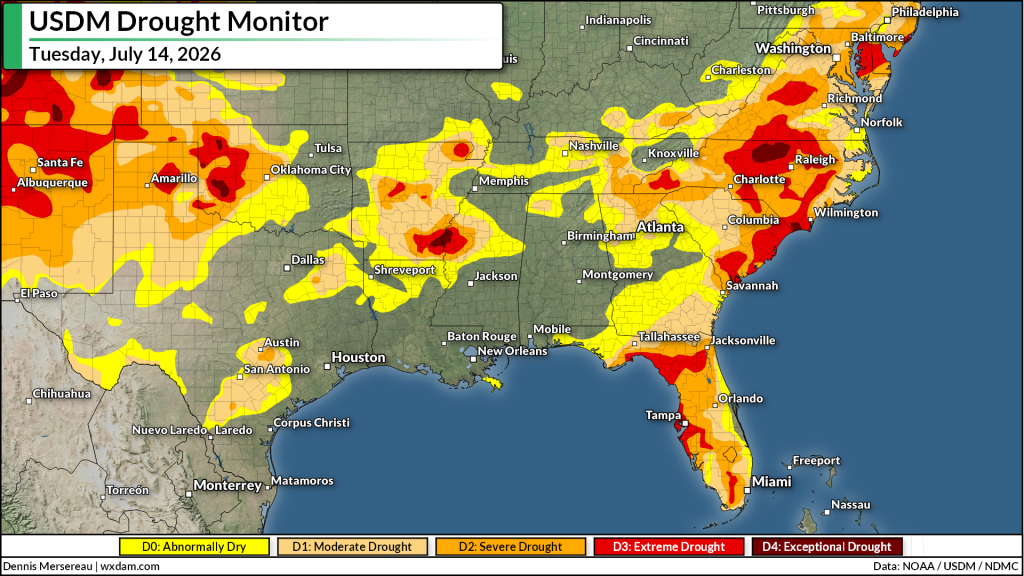
We’re enduring a pretty severe drought across the region, as well, which will enhance the flood risk in some areas as the dry ground will make it difficult for sudden bursts of heavy rainfall to absorb instead of running off.
Follow me on: Facebook | Bluesky | Instagram
Please consider subscribing to my Patreon. Your support helps me write engaging, hype-free weather coverage–no fretting over ad revenue, no chasing viral clicks. Just the weather.