Hurricane Genevieve becomes eastern Pacific’s 28th Category 5 hurricane

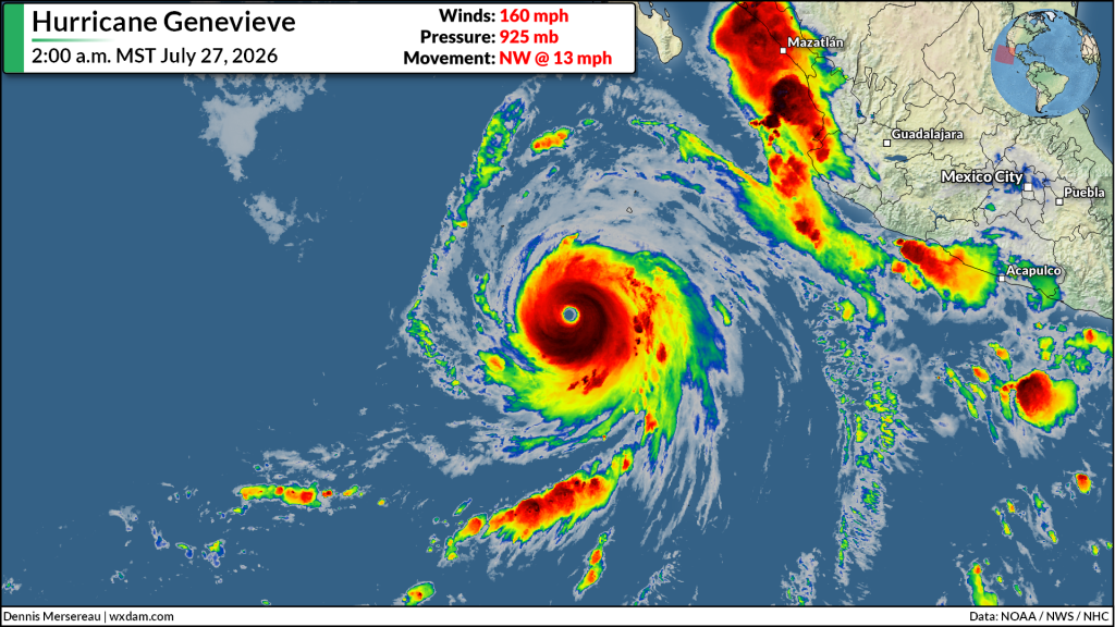
Hurricane Genevieve rapidly intensified into a Category 5 storm during the overnight hours Sunday into Monday, making it the 28th scale-topping storm observed in the eastern half of the Pacific basin since reliable records began in 1949.
Low wind shear, ample moisture, and very warm sea surface temperatures helped propel the system from a 70 mph tropical storm to a 140 mph hurricane in just 24 hours between Saturday and Sunday.
Genevieve continued to strengthen through the overnight hours, likely peaking early Monday morning with maximum sustained winds of 160 mph and a minimum central pressure of 925 mb.
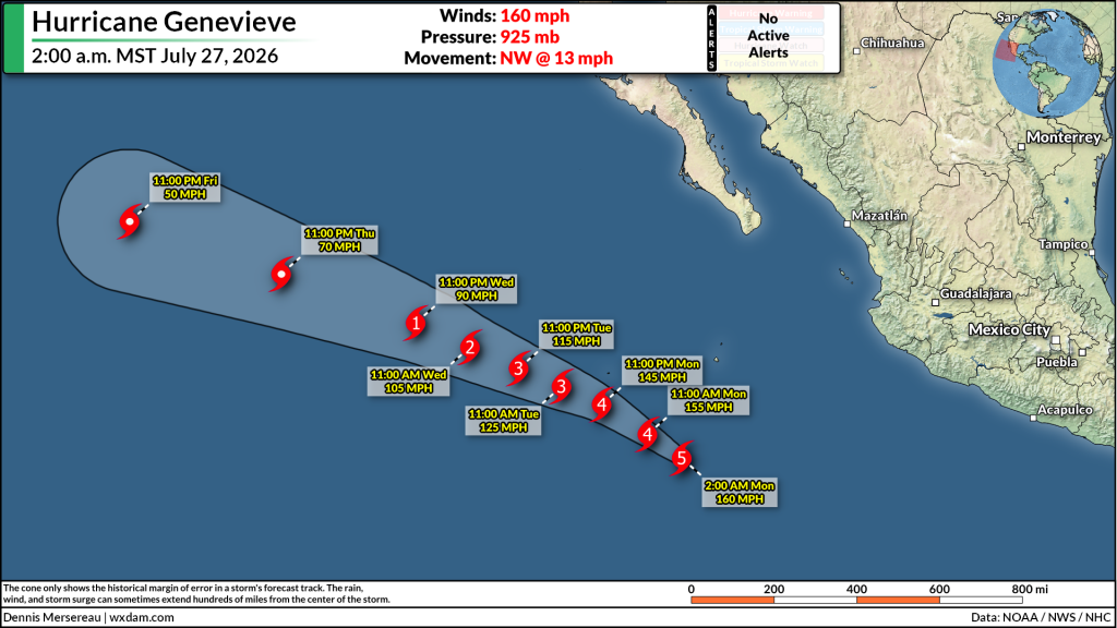
Thankfully, like most storms in the eastern Pacific, forecasters expect Genevieve to remain over open waters and pose no direct threat to land. Some rough surf and rip currents are possible at beaches along Mexico’s west coast, which may pose a danger to visitors in the region.
This is the 28th Category 5 hurricane to form in the central or eastern Pacific since reliable records began in 1949. Before Genevieve, the region’s most recent scale-topper was Hurricane Kristy in October 2024.
Despite their relative rarity, Category 5 hurricanes in the eastern Pacific have a history of causing widespread damage in Mexico. Hurricane Otis directly struck Acapulco in late October 2023, killing more than 50 people and causing many billions of dollars in damage.
Forecasters expect an above-average hurricane season across the eastern Pacific basin, largely driven by a growing and potentially historic El Niño event. This same pattern is contributing to an exceptionally quiet Atlantic hurricane season, which is so far underperforming even the most conservative outlooks so far this summer.
Follow me on: Facebook | Bluesky | Instagram
Please consider subscribing to my Patreon. Your support helps me write engaging, hype-free weather coverage–no fretting over ad revenue, no chasing viral clicks. Just the weather.