Polo set to rapidly intensify into a Category 5 hurricane, Fay dissipating


Monday’s tropical activity in the Atlantic and Pacific basins shows the stark contrast that can develop during a very strong El Niño right at the peak of hurricane season.
Soon-to-be Hurricane Polo is rapidly intensifying off the western shores of Mexico to start the week. Meanwhile, the Atlantic’s Tropical Storm Fay is quickly falling apart in the face of unfavorable conditions.
Fay nearly breaks the hurricane drought
A disturbance in the northeastern Atlantic took advantage of a brief window of minimal wind shear in order to quickly get its act together on Sunday and Sunday night. Tropical Storm Fay very nearly grew into the season’s first hurricane, packing maximum sustained winds of 70 mph at 11:00 p.m. on Sunday.
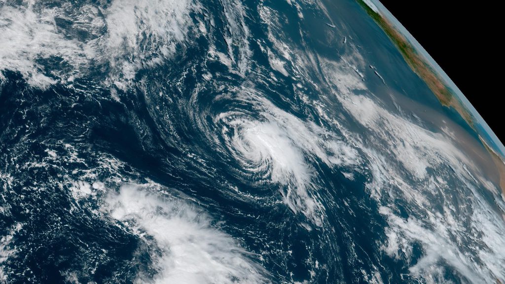
This reprieve proved short-lived, though, and Fay is now quickly weakening and losing organization as it struggles to withstand increased wind shear and dry air wrapping into the center of the system. The National Hurricane Center (NHC) expects Fay to dissipate by Wednesday.
Now, the historic wait for the season’s first hurricane ticks on for at least another five to seven days.
Polo rapidly intensifying off Mexico’s west coast
All the ingredients are aligned in the eastern Pacific Ocean for a powerful hurricane to graze the shores of Mexico later this week.
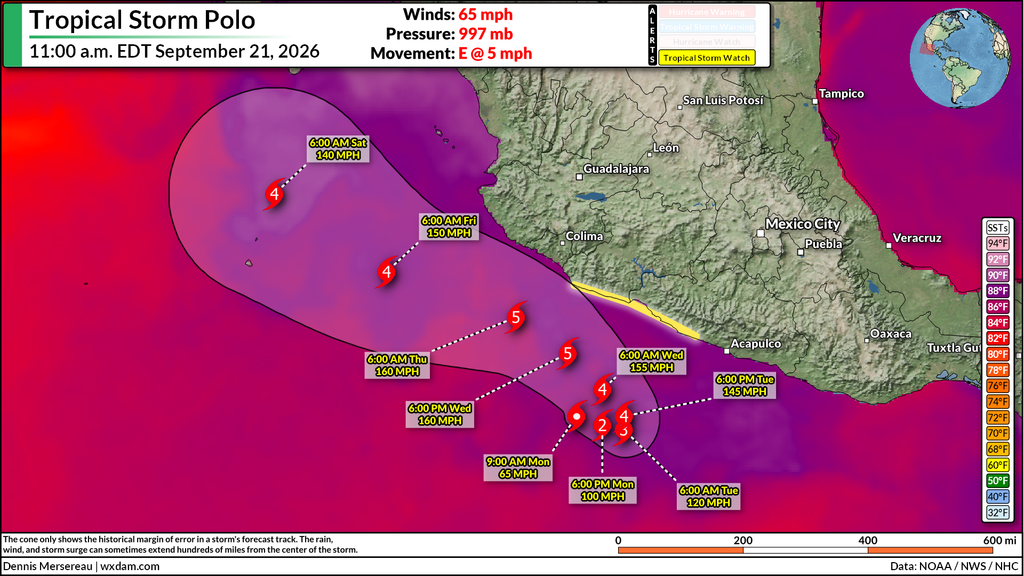
Tropical Storm Polo is rapidly organizing amid very warm waters, minimal wind shear, and ample moisture throughout the atmosphere.
The NHC’s forecast explicitly calls for the storm to reach Category 5 intensity later this week, becoming the world’s seventh scale-topping system so far this year. The only two potential impediments to the system’s continued strengthening over the next few days will be its own internal structure and its proximity to land.
If this system does reach Category 5 intensity as predicted, it’ll be the seventh such storm around the world so far this year following Horacio (Feb), Sinlaku (Apr), Dolphin (Jul), Bavi (Jul), Genevieve (Jul), and Lowell (Sep). Polo would be the third scale-topping hurricane in the eastern Pacific alone, a testament to how favorable conditions are here during very strong El Niño events.
Looking ahead, some model guidance suggests that remnant moisture from Polo may find its way over southern California and the desert Southwest around this time next week. The risk is heavily dependent on where the storm ultimately tracks, but it’s worth mentioning the potential now.
Follow me on: Facebook | Bluesky | Instagram
Please consider subscribing to my Patreon. Your support helps me write engaging, hype-free weather coverage–no fretting over ad revenue, no chasing viral clicks. Just the weather.