Sluggish Atlantic hurricane season shows a twitch of life

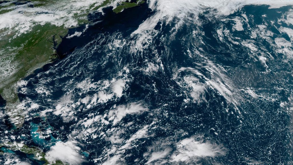
Our exceptionally quiet Atlantic hurricane season continues snoozing through the peak of the season this month as a powerful El Niño dominates conditions across the basin.
Forecasters with the National Hurricane Center (NHC) have only one area flagged for possible development over the next week, and models aren’t terribly hyped up about the potential.
A historic hurricane-less season so far
We’ve only see five named storms this year and none of them have achieved hurricane strength. This is the Atlantic’s longest wait for the season’s first hurricane since the satellite era began in 1966. The previous record was 8:00 a.m. EDT on Sept. 11, a remarkably late date tied in both 2013 and 2002.
Those two previous record-setters were still more active than this year. 2002 and 2013 saw 12 and 14 named storms, respectively, and the bulk of the season’s activity had already occurred by this point in the year.
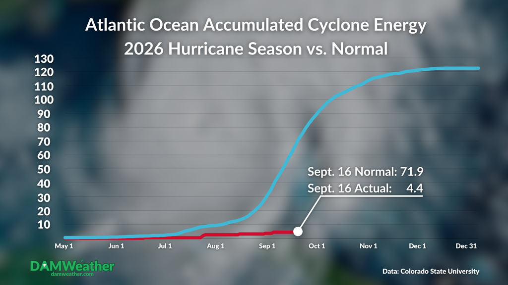
We often look at Accumulated Cyclone Energy (ACE) to judge a season beyond the simple number of storms it produces. ACE takes into account the longevity and strength of a storm over its lifetime. A typical Atlantic hurricane season generates an ACE value of 71.9 by Sept. 16, and a total seasonal ACE of 122.5. This season’s total value sits at 4.4 right now. That’s it.
Forecasters watching east of Bermuda

A small area of disturbed weather a few hundred miles east of Bermuda has a window of opportunity to develop into a tropical system by this weekend as it drifts through the region.
Models aren’t terribly enthused with it; in fact, the only model really trying to develop it is Google DeepMind (GDMI), the AI-powered model that’s outshined traditional computer guidance over the past few years. Some of the GDMI runs are trying to turn this into the season’s first hurricane, though it’ll have a long and uphill road to get to that point.
The next name on the list is Fay.
Regardless of the basin’s ongoing snoozefest, we are in the peak of hurricane season and folks along and near the coasts shouldn’t let their guards down for another couple of months. We’re just a few weeks from the time of year when storms tend to form closer to land, which may provide less lead time ahead of their arrival if they track toward land.
Follow me on: Facebook | Bluesky | Instagram
Please consider subscribing to my Patreon. Your support helps me write engaging, hype-free weather coverage–no fretting over ad revenue, no chasing viral clicks. Just the weather.