Rare, significant severe storm risk in the Southwest on Wednesday

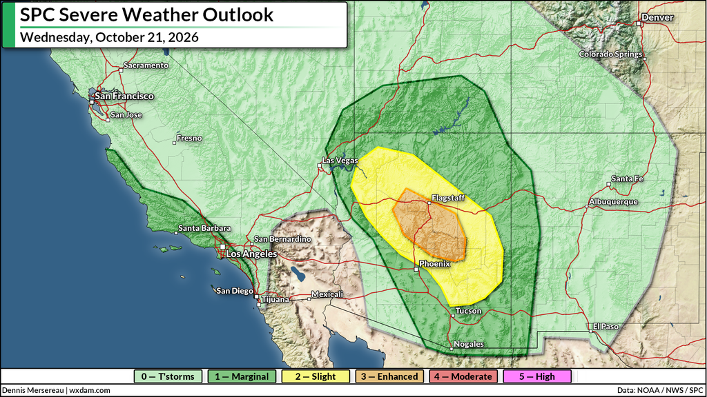
An unusually potent risk for severe weather will develop over parts of the U.S. Southwest on Wednesday as an active pattern sweeps into the region.
The Storm Prediction Center (SPC) has issued an enhanced risk (3/5) for severe weather across portions of central Arizona. This is the highest risk for severe weather for both Flagstaff and Prescott that I can find in the Iowa Environmental Mesonet’s records, which date back to 1987.
Instability and moisture will stream over the southwestern U.S. through the day Wednesday, alongside lift and strong wind shear provided by a potent upper-level trough just off the California coast. Together, these factors will spark and fuel scattered thunderstorms from southern California to New Mexico beginning around midday Wednesday.
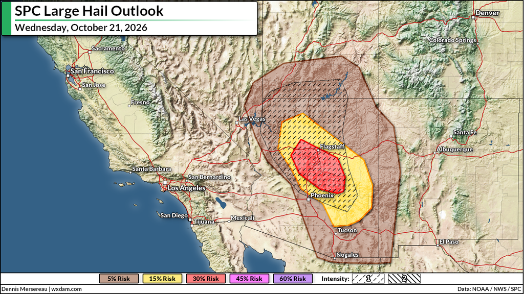
Forecasters are especially concerned about the risk for supercell thunderstorms across central Arizona, which will be capable of producing significant hail the size of golf balls or larger. This is a particular hazard from the northern Phoenix metro area north through southern Utah. Severe storms here may continue after dark.
On top of the hail risk, damaging wind gusts and isolated tornadoes are also possible. The strongest storms could easily produce rainfall rates of 1-2″+ per hour, leading to a risk for localized flash flooding.
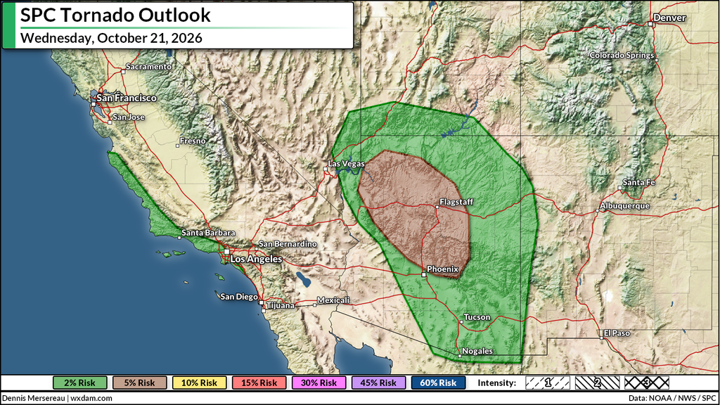
The SPC also highlighted a marginal (1/5) risk for severe weather along the California coastline from Monterey south toward Laguna Beach, including much of the Los Angeles metro area.
Upper-level dynamics are favorable enough that some of the storms pushing ashore on Wednesday could produce damaging wind gusts or a brief tornado. Remember to take any warnings here seriously–even a weak, short-lived tornado can be very dangerous.
The risk for severe weather will move a bit east heading into Thursday, with storms capable of producing isolated instances of large hail, damaging winds, and one or two tornadoes across eastern Arizona, western New Mexico, and a large swath of Utah.
Follow me on: Facebook | Bluesky | Instagram
Please consider subscribing to my Patreon. Your support helps me write engaging, hype-free weather coverage–no fretting over ad revenue, no chasing viral clicks. Just the weather.