Hurricane Isaias aiming for the Gulf Coast

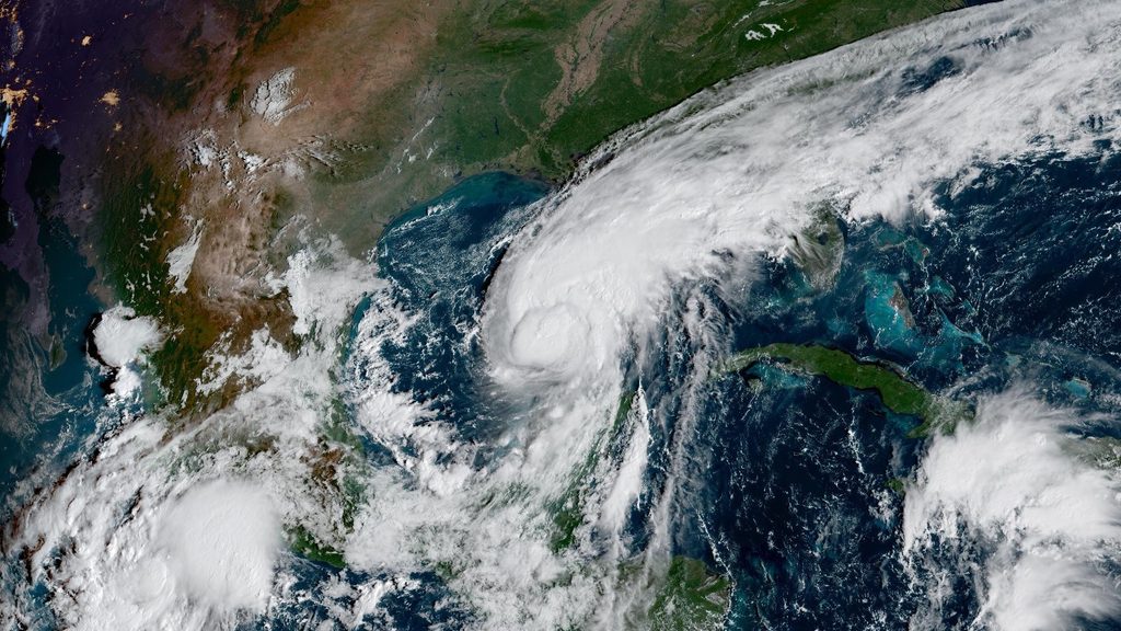
Isaias quickly grew into the season’s first hurricane late Wednesday night as it moves over the steamy waters of the Gulf of Mexico.
Folks along the northern Gulf Coast are running out of time to prepare for the storm’s high winds, storm surge, and flooding rains.
The National Hurricane Center expects the system to grow close to major hurricane strength over the next day as it moves north through the Gulf. Increasing wind shear should start to weaken the system before it make landfall, though the extent of weakening is still up in the air at the moment. Despite this potential trend, its hazardous storm surge and flooding rains will be baked in at that point.
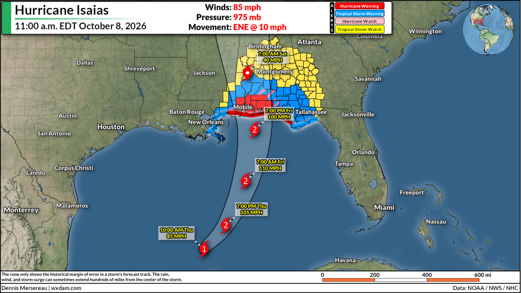
Forecasters expect the storm to make landfall between Mobile and Pensacola late Friday night into early Saturday morning. This would bring the strongest winds and most impactful storm surge into the western Florida Panhandle around Pensacola.
A peak storm surge of 5-7 feet is possible from Gulfport, Mississippi, east toward Indian Pass, Florida. This includes Mobile Bay.
High winds will knock down trees and power lines throughout the region. Tropical storm and hurricane warnings extend well into the southern half of Alabama as the core of the storm moves inland. Expect potentially long-lasting power outages in the hardest-hit areas.
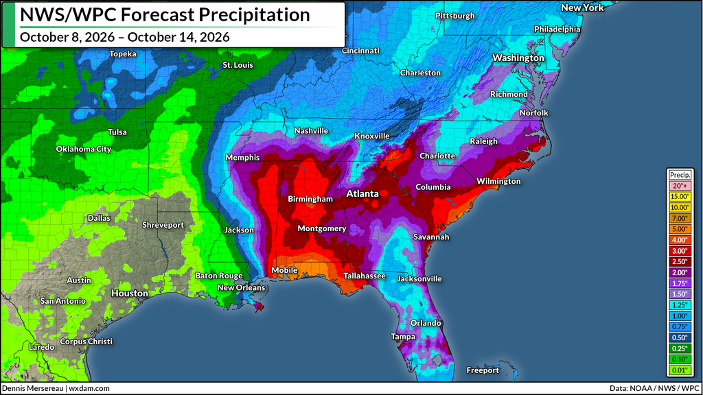
Flooding rains will also follow the storm inland, spreading across the entire Southeast through the weekend. Widespread rainfall totals of 2-5 inches are expected. Locally higher totals are possible, especially in Florida and Alabama. Remember, it’s impossible to tell how deep the water is until it’s too late. Half a foot of moving water is enough to lift a vehicle off the road.
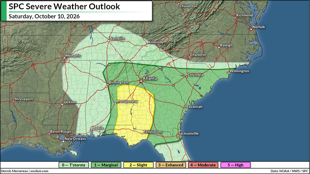
A risk for tornadoes will also develop through the weekend. The east side of landfalling tropical systems is fertile ground for tornadoes. These tropical tornadoes can spin up quickly and strike with reduced warning lead time.
The National Hurricane Center issues full forecast updates every six hours, at 5:00 and 11:00 a.m./p.m., with intermediate updates every three hours in between for as long as watches and warnings are in effect for land.
Follow me on: Facebook | Bluesky | Instagram
Please consider subscribing to my Patreon. Your support helps me write engaging, hype-free weather coverage–no fretting over ad revenue, no chasing viral clicks. Just the weather.