

The bark is sometimes worse than the bite in nor’easters. The nor’easter set to form off the East Coast tonight will not be one of those storms. If you don’t know the storm is coming, you’ll hear it soon enough. This storm will crank out some strong winds across the Ohio Valley, Mid-Atlantic, and the Northeast, with gusts possibly reaching 70 mph in spots between Thursday night and Saturday afternoon.
Wind advisories are in effect from central Alabama to the coast of Maine and high wind warnings are in effect from western North Carolina through Massachusetts. Winds could gust higher than 60 MPH in the warning areas, with a particular focus on the Appalachian Mountains, the Washington/Baltimore metro areas, and the New England coast.
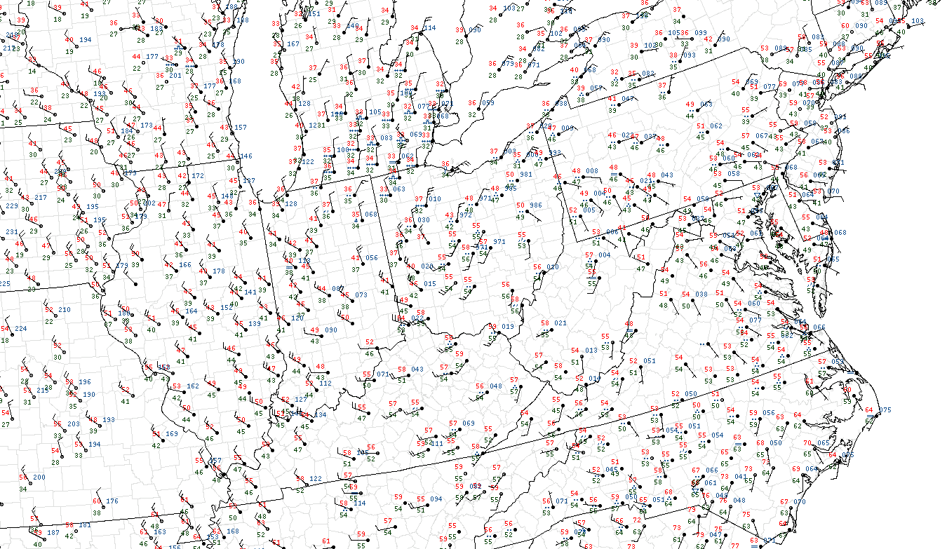 |
| Surface analysis at 3:00 PM EST March 1, 2018. |
The storm’s forecast strength alone is impressive enough, but a strong
high-pressure system will build over the Midwest at the same time as the
nor’easter strengthens. This combination of a strong low and a strong
high in relatively close quarters will result in a tight pressure
gradient that causes winds to crank up for a period on Friday and Saturday.
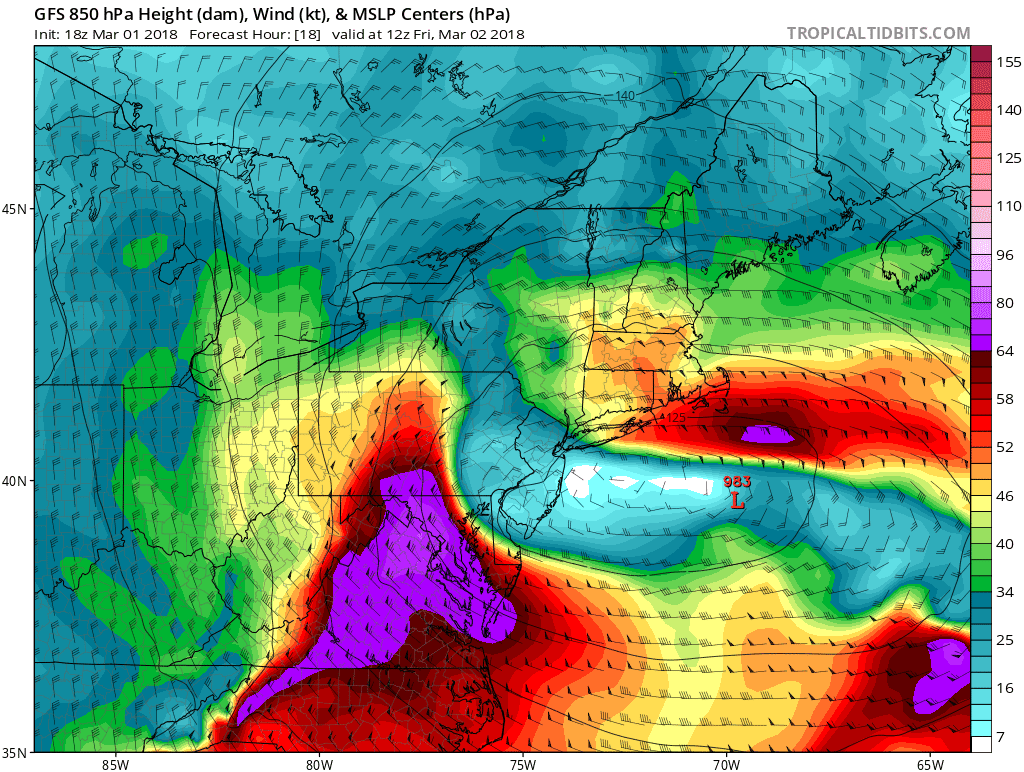
The above chart shows what the GFS model thinks winds (in kts) will look like a few thousand feet above the ground around 7:00 AM Eastern on Friday morning. The wind is going to be ripping just above the surface over the Mid-Atlantic, and it won’t take much to translate that energy down to the ground.
The core of the intense winds will shift its focus to New England on Friday evening and Saturday.

Wind damage is likely from this storm. Downed trees will cause damage to power lines, buildings, and vehicles. Debris will make some roads impassable for a time during the storm. Recent (and ongoing) rainfall has softened the soil and will make trees more susceptible to falling over. Widespread power outages are likely in areas expecting the highest winds.
A large number of flights will be cancelled—causing a ripple effect of cancellations and delays nationwide—as winds will exceed maximum levels that allow for safe flight at many of the country’s eastern hubs.
Another ugly side effect of this wind is that it will send a storm surge into the coast. The surge will act much like it does during a tropical cyclone—the strong winds will push up to three feet of seawater into coastal communities at high tide from North Carolina to Maine, with a surge of up to five feet possible in parts of Massachusetts where the coast is perpendicular to the direction of the strongest winds. This will lead to flooding in communities right on the shore.
- Charge your mobile devices! Keep your cell phone as close to a full charge as possible. If you have a portable power/battery pack for your phone, keep that charged, too. Power outages are no fun, but they’re even less fun if you can’t communicate with anyone.
- Canned food and bottled water is a cliché, but it’s really useful if you can’t cook. Bottled water is also good to have in the unlikely event municipal water is unsafe to drink or your well pump goes down. (A boil water advisory is useless if you have no way to boil the water.)
- If you have furniture, pottery, or knick knacks on your deck, balcony, or porch that you want to keep on your deck, balcony, or porch, don’t forget to secure them or bring them inside tonight before you go to sleep. The wind could knock them around and break them—or worse, break something else.
- Try to avoid walking or parking beneath tall trees or trees with limbs hanging over sidewalks, parking spots, and roadways.
- Use extra care walking around in downtown areas. Debris that blows off of tall buildings, balconies, or construction sites can hit the street at a dangerous velocity.
Aside from the winds, heavy rain and snow will be a lesser threat on Friday and Saturday. A few inches of rain could push streams above their banks and overwhelm drainage systems, covering roadways and possibly threatening buildings in flood zones.
The storm will produce a heavy, sticky snow in the Northeast from Pennsylvania northward to the Canadian border. Forecasters expect up to a foot of snow in much of upstate New York, with totals exceeding one foot in western New York and in the Catskills. The combination of wet snow and high winds could increase the risk for downed trees and power outages in areas that receive significant accumulations.
[Images: Dennis Mersereau | College of DuPage | Tropical Tidbits | NWS]