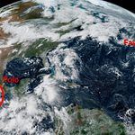
Atlantic historically quiet as the Pacific reaches historic heights

A remarkable split-screen continues on either side of North America as a near-record El Niño flexes its muscles across the region.
Tropical activity throughout the Atlantic basin is tough to come by as we’re firmly beyond the climatological peak of hurricane season. Meanwhile, the Pacific keeps churning out one powerful system after another.
Atlantic remains eerily quiet
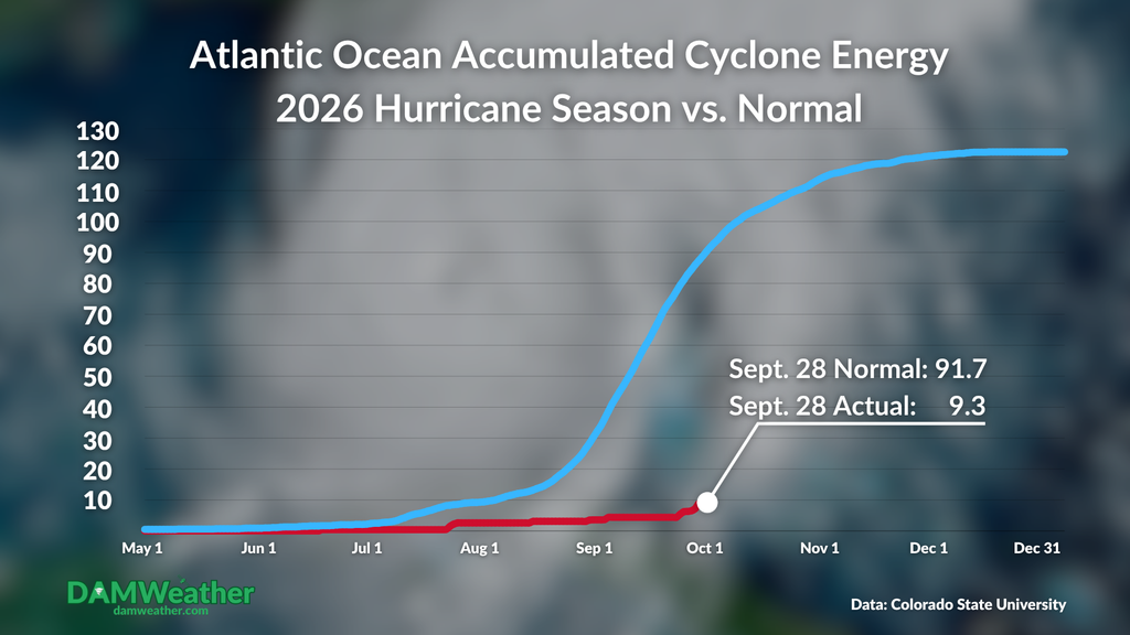
It’s the end of September and we still haven’t seen any hurricanes in the Atlantic Ocean so far this year. Previously, the longest wait for the season’s first hurricane in the satellite era was 8:00 a.m. on Sept. 11. Since then, we’ve seen three tropical storms that made an effort despite generally unfavorable conditions.
Tropical Storm Fay came close to hurricane status during the early morning hours on Sept. 22; even if forecasters find in their post-season analysis that Fay did in fact make it to hurricane strength, the old record is still broken by a week and a half. The system decayed and then regenerated a few days ago, and it continues to putter along as a resilient tropical depression smack dab in the middle of the ocean.
Tropical Storm Gonzalo was a short-lived system that brought foul weather to the Cabo Verde Islands last week. Tropical Storm Hanna formed in the north-central Atlantic on Monday morning, taking advantage of a brief window of favorable conditions before it, too, succumbs to strong wind shear.
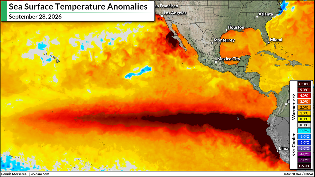
El Niño is largely responsible for the dearth of activity we’ve seen (or…not seen) across the Atlantic so far this year. The near-historic warmth over the region increased the wind shear blowing east over the Atlantic. Strong upper-level winds disrupt the thunderstorm activity that seeds the development of a tropical system.
Pacific hurricane season roaring along
As quiet as conditions are in the Atlantic, that’s how busy they are in the Pacific.
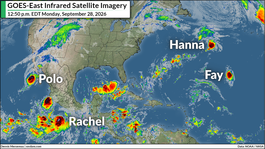
Hurricane Polo, which grew into one of the region’s most intense hurricanes on record last week, is on final approach to landfall on Mexico’s Baja Peninsula. The system’s remnant moisture will track over the U.S. Southwest and Plains states, leading to a widespread risk for flash flooding over the next few days.
Tropical Storm Rachel is steadily strengthening toward hurricane status as it moves parallel to Mexico’s west coast, where a tropical storm warning is in effect in and around Manzanillo.
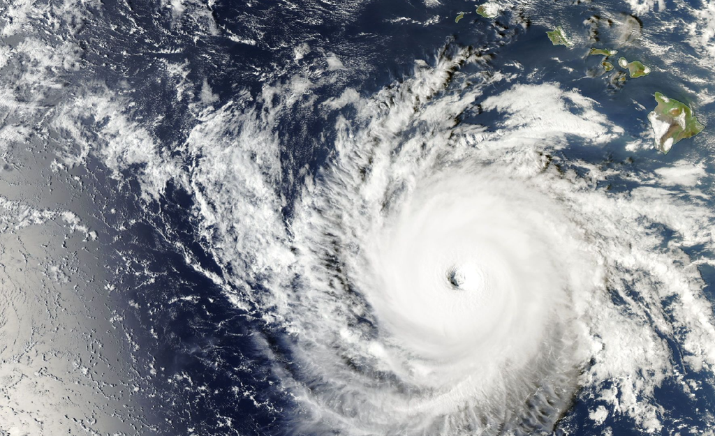
Hurricane Nolo rapidly intensified to a high-end Category 4 storm overnight Sunday into Monday as it passed south of Hawaii. The storm, which brought heavy rain to the Big Island through the weekend, will follow a track that takes it away from the main Hawaiian Islands through the week.
Super Typhoon Surigae’s highest winds narrowly missed Okinawa on Monday local time, and the storm will remain offshore as it continues tracking parallel to Japan through the week.
But wait, there’s more! Another disturbance about halfway between Hawaii and Mexico looks likely to develop into the region’s next storm at some point over the next couple of days. This system should meander out at sea for the foreseeable future.
The northeastern Pacific basin’s Accumulated Cyclone Energy stood at 256.3 by midday Monday, making this the region’s fourth-most active season on record behind 2018 (318.1), 1992 (294.3), and 2015 (288.9). With several months of hurricane season left, it’s certainly possible that this season will continue climbing the ranks.
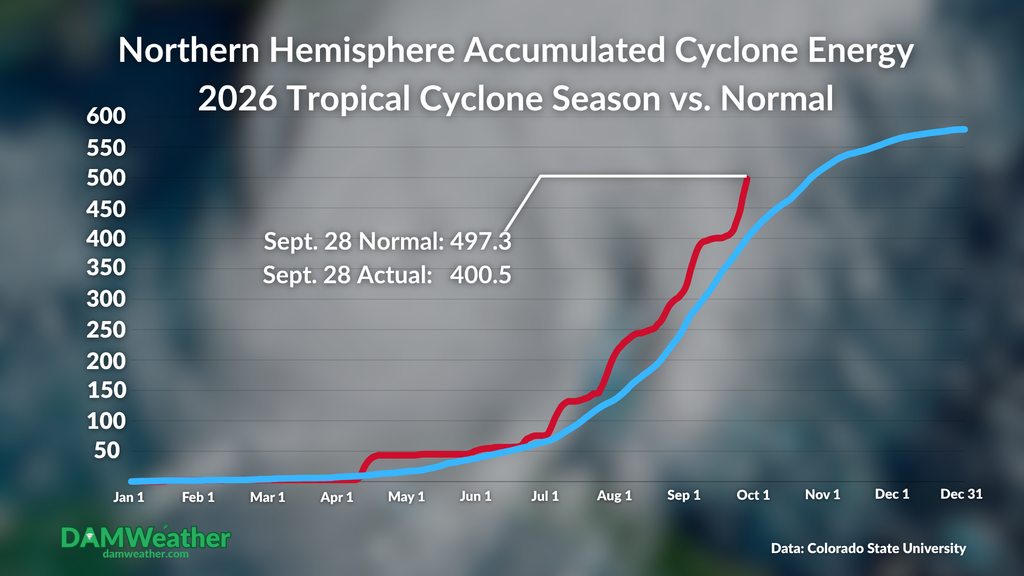
In fact, the bustling activity in both the northwestern and northeastern Pacific has actually overcome the immense ACE deficit racking up in the Atlantic to make this an above-average cyclone season throughout the northern hemisphere.
[Header image of Hurricane Nolo courtesy of NOAA/NASA]
Follow me on: Facebook | Bluesky | Instagram
Please consider subscribing to my Patreon. Your support helps me write engaging, hype-free weather coverage–no fretting over ad revenue, no chasing viral clicks. Just the weather.