Benevolent Low-Pressure System Set to Bring Sweet, Merciful Taste of Fall

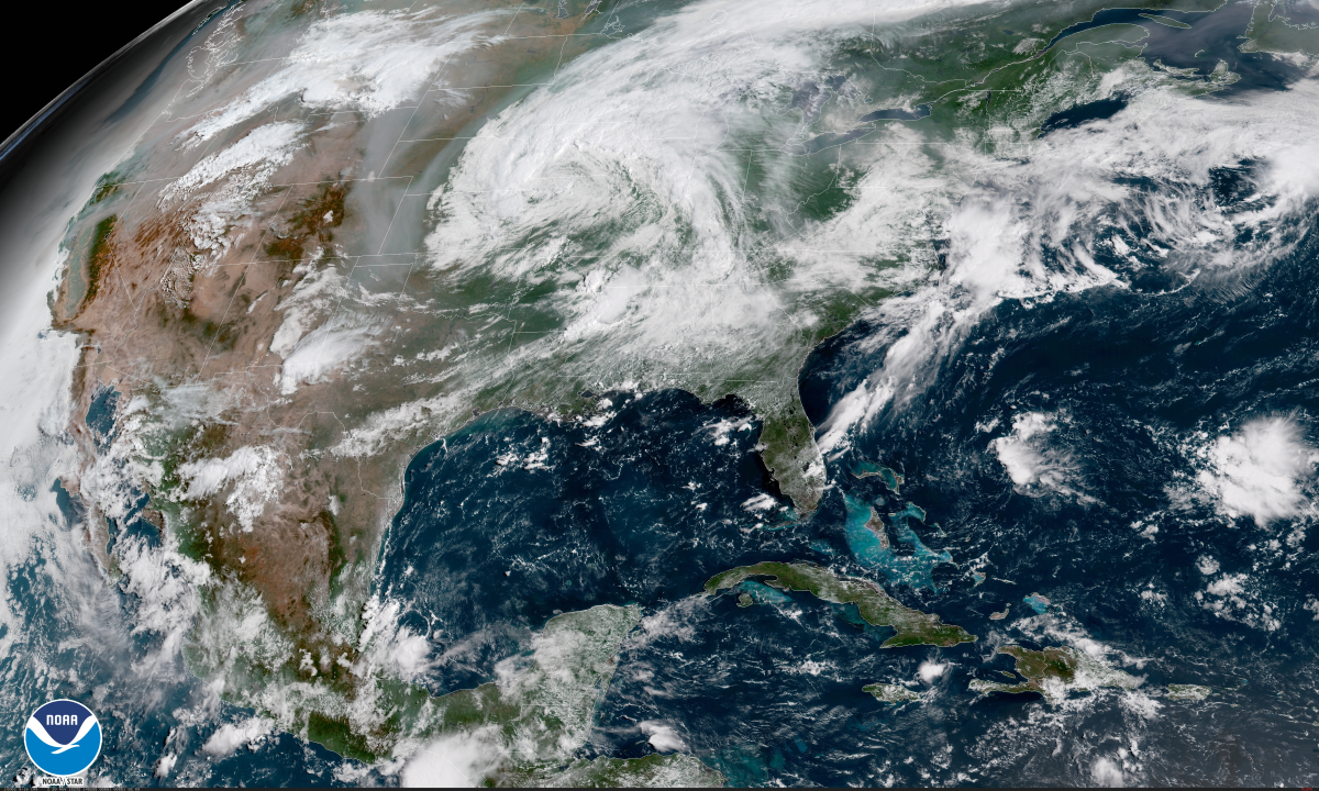
A brief hint of fall will wash over parts of the central and eastern United States over the next couple of days as a low-pressure system forces Canada to share some of that sweet autumn air with its less-deserving neighbors. Dry air will allow temperatures to bottom out in the 50s in some spots through the end of the week. It won’t last very long, but it’s a nice break from the humidity and a reminder that the end of summer is near.
Thunderstorms

The first preview of fall is the appearance of strong thunderstorms that are likely today in parts of the south and Midwest along and ahead of the cold front along the Mississippi River and the warm front farther north. A secondary peak in severe weather season typically starts during the fall as strong low-pressure systems sweep across the country.
An enhanced risk for severe thunderstorms—a three on a scale from one to five—exists across the Mississippi Valley from southern Illinois south through Memphis. The greatest threat with today’s thunderstorms is damaging winds, though some tornadoes and instances of large hail can’t be ruled out, especially in the areas under an enhanced or slight risk.
The marginal risk for severe weather over North Carolina today is due to potential for damaging winds from some of the thunderstorms that develop.
Dry Air
 |
| Source: Tropical Tidbits |
The low-pressure system responsible for today’s thunderstorms will slowly move northeast over the next couple of days, allowing drier, cooler air from Canada to fill in behind it. It’s going to feel fantastic in areas that benefit from the lower humidity, and that’s really all you can ask for when it’s still August. Low humidity even makes highs in the mid- to upper-80s feel comfortable.
The dew point is the best way to measure the comfort of the moisture in the air. Relative humidity is, well, relative, so it constantly changes as the temperature changes. The dew point means the same thing no matter what, so it’s a good way to index our comfort or misery. Generally, dew point values below 60°F are comfortable, and it’s oppressively muggy when the dew point climbs above 70°F.
You can follow the progression of dry air with the above loop of dew point values from last night’s run of the GFS model, shown above. The loop runs through next Monday, August 27th.
The reprieve won’t last very long—two or three days at most in the luckiest areas near the Great Lakes—but just a break from the monotonous slop of summer air is all it takes to refresh you long enough to wait for sustained autumn air to start taking hold.
Fall
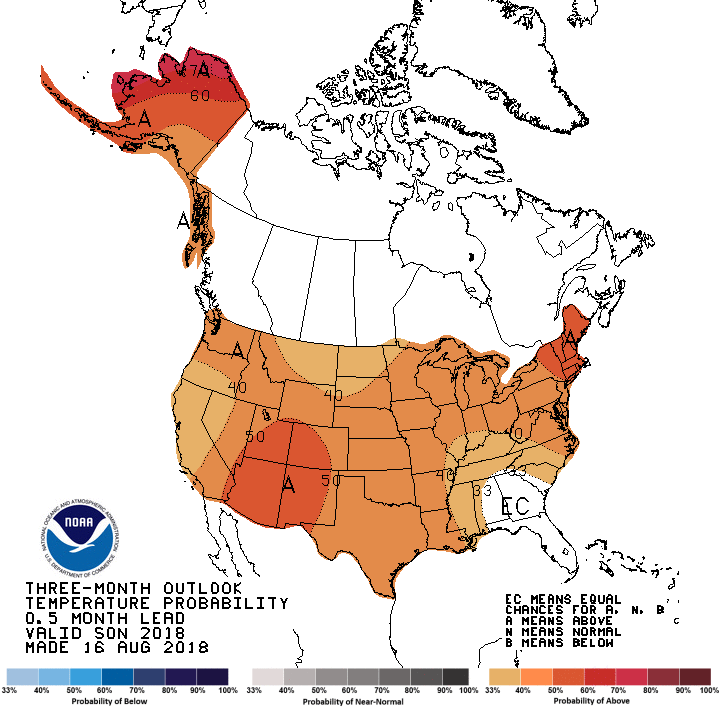 |
| Source: Climate Prediction Center |
Things will start to cool down in the coming weeks, but probably not as quickly as we’d like. The Climate Prediction Center’s latest outlook for the autumn months calls for decent odds of above-average temperatures for just about the entire Untied States. That doesn’t mean we’ll be sweating like crazy through Halloween—though, the way things are going these days, I wouldn’t count it out, either—but it probably won’t get crispy-cool right away.
While above-average temperatures is mostly a matter of personal comfort east of the Rockies, it’s a serious issue out west. The western United States has been dealing with above-average temperatures for quite a while now, and each day that passes with warmer-than-usual temperatures and no rainfall adds to the fire danger. The Mendocino Complex, the largest wildfire in California’s recorded history, is still burning nearly a month after it started, joining fires raging in western Canada to blanket North America and the Atlantic Ocean in thick smoke.
[Satellite Image: NOAA]
Please consider subscribing to my Patreon. Reader-funded news is more important than ever and your support helps fund engaging, hype-free weather coverage.