Hurricane Sally Could Produce ‘Historic Rain’ As It Creeps Toward The Alabama Coast


A historic flash flood threat will follow Hurricane Sally inland as it makes landfall around Mobile Bay on Wednesday morning. Widespread rainfall totals of a foot or more could lead to significant flooding across southern Alabama and the Florida Panhandle as the hurricane (and its remnants) crawls across the region over the next couple of days.
The storm looked pretty scary there for a while on Monday. Sally strengthened from a 60 MPH tropical storm early Monday morning to a 90 MPH hurricane by noon, and the storm’s winds kept ticking up through the afternoon until they plateaued around 100 MPH.
 |
| Source: NOAA/Gibson Ridge |
Winds have since backed off a bit as the hurricane’s struggled with its internal structure. A radar image from Tuesday afternoon (above) shows a well-defined eye with an eyewall that’s lurking a few dozen miles south of Dauphin Island. It’s good fortune that the storm wasn’t able to continue intensifying through landfall like we saw with a few other hurricanes earlier this year.
The NHC expects the hurricane to remain around its current strength through landfall.

The forecast has shifted east since Sunday and Monday. The weather shouldn’t be too bad in southeastern Louisiana now, which is great news for folks in New Orleans bracing for a nasty storm based on earlier predictions.
Hurricane Sally is poking around at a snail’s pace today, lingering a few dozen miles offshore without any upper level winds to pick it up and move it along. The last advisory had it moving north at a whopping 2 MPH. An upper-level trough should allow Sally to begin to pick up some speed make landfall in southern Alabama on Wednesday morning. Winds will pick up on Tuesday evening as the eyewall creeps closer to land.
The storm will continue crawling inland over the next few days as it begins to lose its tropical characteristics, but the heavy rain will persist until the system moves out over the Atlantic this weekend.
Flooding Rain

The northern Gulf Coast is no stranger to heavy rain. I went to school in Mobile. It rains quite a bit down there. This is no ordinary rainstorm. The potential rainfall from this hurricane is a high-end ordeal even by this region’s standards. There are tons of flood-prone areas around here, ranging from roads with poor drainage (shout out to University & Old Shell!) to the abundance of tiny streams and creeks and swampy areas that can fill up and overflow in a flash.
The slow forward motion of the storm will allow rainfall totals to push or exceed 20″ near and east of the point of landfall, which right now looks like it’ll be Mobile Bay eastward through Pensacola. NWS Mobile is characterizing this as a “historic” rainfall event for the region, a testament to how much rain is expected as the storm moves inland.
Flooding rains won’t stop at the coast. The hurricane and its remnants will slowly push into the southeastern states through the end of the week. Flash flooding is a threat all the way through parts of North Carolina. A swath of 5″+ of rain is possible along the storm’s track through Alabama, Georgia, and South Carolina. This could lead to significant flash flooding hundreds of miles inland from the point of landfall.
The standard warning applies: most deaths in landfalling tropical cyclones in this country occur when motorists try to drive across a flooded roadway. It only takes a few inches of water for a car to lose contact with the road and get washed downstream. Sometimes the road gets washed out by a flood and the water obscures the fact that there’s no road there anymore.
Wind
Don’t let the storm’s strength lull you into a false sense of security. (Oh please. I know how it goes. iT’s JuSt A cAtEgOrY oNe my foot.). Severe thunderstorms are warned for wind gusts of 58 MPH or stronger. This hurricane has sustained winds of 80 MPH. Sustained winds that strong—with higher gusts—will do a number on trees, power lines, roofing, siding, and loose items that can get tossed around.
It’s not just that these winds can do damage on their own. It’s the duration of the storm that’s going to stress otherwise-resilient trees and power lines. Strong winds are already causing damage near the coast in Alabama and Florida and the core of the storm won’t be fully over land for another 18 hours or so. The extended duration of the strong winds will lead to more damage and power outages than the region would’ve seen if the storm had moved along at a steady pace.
Storm Surge
 |
| Source: NHC |
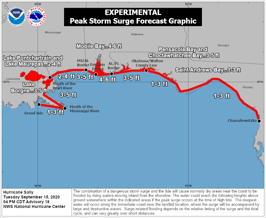
Any hurricane approaching the coast is bad enough for coastal residents, but a slow-moving hurricane will allow ample time for a damaging storm surge to build along portions of the coast expecting the strongest of Hurricane Sally’s winds.
Based on the storm’s current intensity and predicted path, the National Hurricane Center expects a maximum potential storm surge of 4 to 6 feet above ground level to occur on Dauphin Island and in Mobile Bay, with lower values possible in portions of Louisiana, Mississippi, and Florida.
It’s worth noting that the extensive rainfall could exacerbate the effects of a storm surge right along the coast in places like Mobile Bay, where the excess runoff from flooding rains in the Mobile, Tensaw, and Dog Rivers will jam up against the surge flowing into Mobile Bay.
Tornadoes
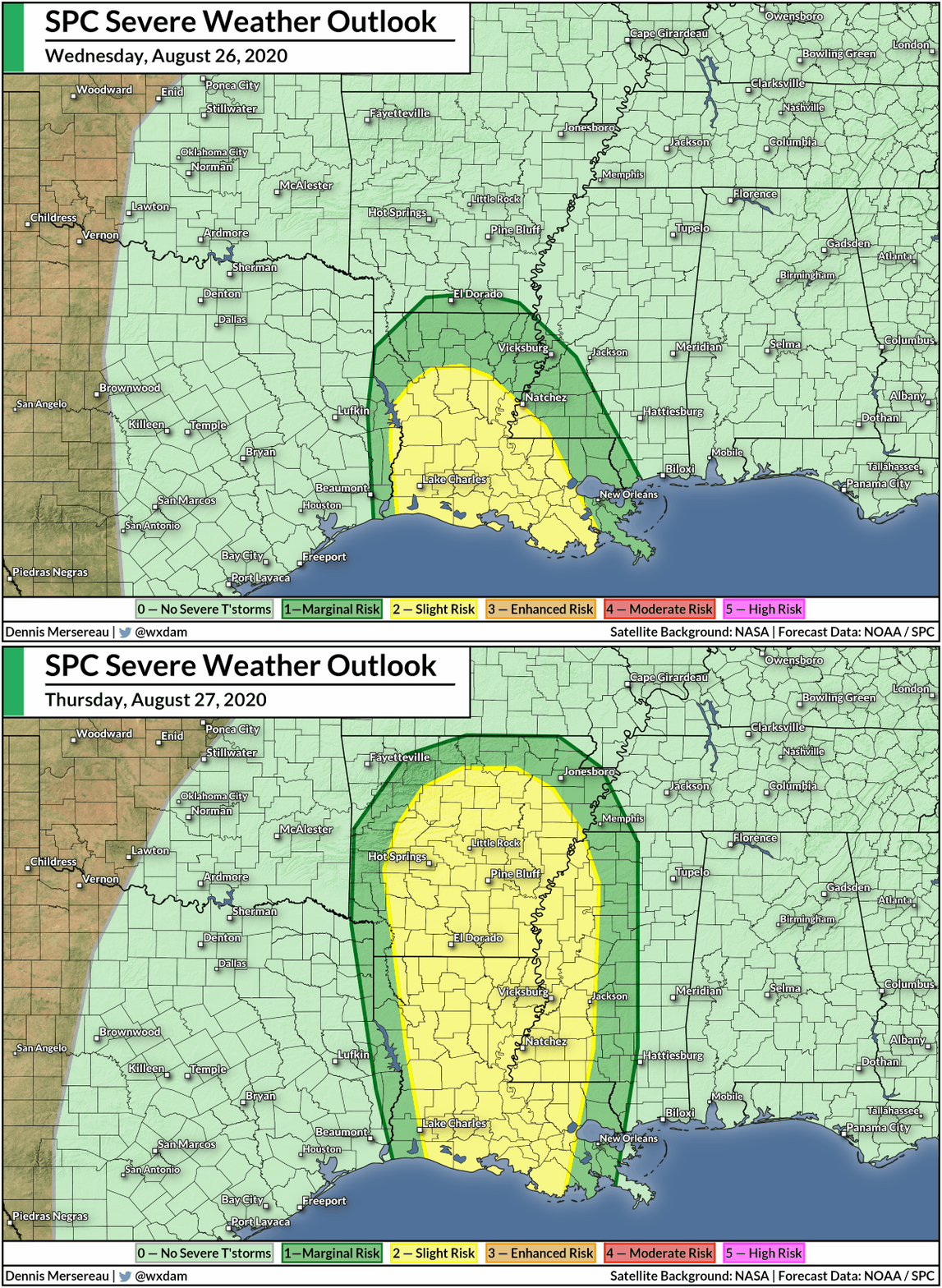
Tornadoes are possible around and to the east of the point of landfall. The threat for tornadoes will shift east on Wednesday as the hurricane moves farther inland. The SPC says there’s also a tornado risk in the southeast on Thursday, but uncertainties in the track and strength of the storm (or its remnants) means it’s too soon for details on exactly where.
Tropical tornadoes occur quickly and often come with reduced tornado warning lead time. Make sure you’ve got a way to quickly receive tornado warnings if you’re in the path of the storm over the next couple of days, especially at night when you’re asleep. The wireless emergency alert feature on your phone is great because the screeching tone can wake you up from even the soundest sleep.
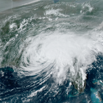
[Top Image: A “sandwich” satellite image that overlays infrared imagery on top of visible imagery, via NOAA]
You can follow me on Twitter or send me an email.
Please consider subscribing to my Patreon. Your support helps me write engaging, hype-free weather coverage—no fretting over ad revenue, no chasing viral clicks. Just the weather.