Another Significant East Coast Winter Storm Is On The Way


We’re staring down the potential for a significant winter storm across much of the East Coast this weekend. Hefty snowfall totals, significant ice from freezing rain, and gusty winds are all possible as the storm develops and races up the coast.
The Winter Storm Is In Its Infancy
 |
| Source: College of DuPage |
A system sliding out of the Canadian Prairies will bring heavy snow to much of the Midwest through Friday as it dives toward the southeast. You can see the first pangs of the system’s U.S. impacts with the snowfall spreading over the Dakotas tonight. Some folks in Iowa could end the day Friday with double-digit snowfall totals.
This system will swoop into the southeastern United States overnight into Saturday, developing into the winter storm we’ll deal with along the East Coast this weekend. The system will rapidly get its act together as it starts moving parallel to the Appalachians, and that’s where things get…interesting!
 |
| The storm around 8:00 a.m. on Sunday. (NOAA/WPC) |
We’ll see the greatest impacts in the southeast during the day on Sunday, moving into the Mid-Atlantic Sunday night into early Monday. The bulk of the wintry precipitation will move into the northeast on Monday before lifting away into eastern Canada overnight into Tuesday.
 |
| The storm around 8:00 a.m. on Monday. (NOAA/WPC) |
Like many eastern winter storms, the precise track of this system will determine if some communities see a lot of rain, a lot of ice, or a lot of snow. This isn’t going to be a straight snowstorm for many folks, especially not in the southeastern states. (Could you expect any more?)
It’s (Mostly) Too Early For The Fine Details
It’s still too early for the maps I love to make using the National Weather Service’s snowfall and ice accretion forecasts. Those forecasts only run out about 72 hours, which would take us to the early stages of the storm on Sunday evening.
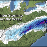
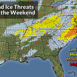
The graphic at the top of this post shows the Weather Prediction Center’s Winter Storm Severity Index (WSSI), a new-ish metric the agency uses to convey how impactful a winter storm will be for a certain area based on factors like snow totals, ice accumulations, blowing snow, and flash (sudden) freezes.
It looks like higher elevations in the Appalachians will see a solid snowstorm out of this event, with many areas picking up double-digit totals by the end of the storm. The Piedmont, on the other hand, is looking at a sloppy mess.
For many areas from northern Georgia into central Virginia, we’re likely looking at snow changing over to sleet and/or freezing rain, then possibly back over to snow as the system departs on Sunday night.
Throw out all those fantastical weather models that showed something like 18″ of snow in central North Carolina. Pfft. Chop that down to a tiny fraction once you account for sleet and freezing rain. This is going to be a mess, and any snow on the ground after the sleet and freezing rain is going to freeze hard into a solid mass of ice on Sunday night into Monday.
I can’t not post any snowfall or ice graphics, of course, so here’s what we have access to right now, courtesy of NWS Greenville, S.C.
This is their snowfall forecast as of Thursday evening:

And their ice accretion forecast from the same update:

The National Weather Service’s forecasts for everyone else in the storm’s path will go live through the day on Friday as the storm comes within range and forecasters get a better idea of who will see what.
This is the type of scenario where weather apps on your phone and the pre-installed weather doohickey on your computer fails to give you the information you need. Getting the temperature and probability of precipitation only gives you a small part of the story.
Some forecasts are more complicated than just a few numbers and icons. You need context to get the full story about this weekend’s winter storm, and you’ll only get that context from articles like this and posts from (legit!) local meteorologists. This is where your local TV weatherperson comes in handy. Events like this are where their experience and local knowledge really shine.
You can follow me on Twitter or send me an email.
Please consider subscribing to my Patreon. Your support helps me write engaging, hype-free weather coverage—no fretting over ad revenue, no chasing viral clicks. Just the weather.