Significant severe thunderstorm outbreaks expected Friday and Saturday


Two significant rounds of severe thunderstorms are likely over the next couple of days as a powerful low-pressure system develops across the center of the country.
I covered the basics of the setup yesterday. All the dynamics are present for a multi-day severe thunderstorm outbreak heading into the weekend.
A rapidly intensifying Colorado low will drag ample instability over the center of the U.S. Strong wind shear throughout the atmosphere will enable any thunderstorms that form to quickly turn severe, threatening damaging winds, large hail, and tornadoes.
Friday

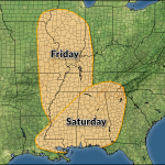
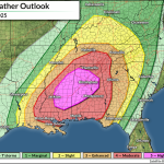
A moderate risk for severe weather—a level four out of five—is in effect Friday from southeastern Iowa through northwestern Tennessee. This includes St. Louis, Springfield, and Paducah. A broader threat for severe weather exists from southern Wisconsin all the way south to the Gulf of Mexico.
Forecasters expect a robust squall line to develop and race east across the region, posing a threat for widespread damaging wind gusts in excess of 60 mph.

Significant wind gusts of 75+ mph are possible in and around communities under the moderate risk. Embedded tornadoes could form within the squall line.
If you live in this area, please plan to avoid parts of your home where large trees or tree limbs loom overhead. If you’re in a vehicle when storms arrive, park away from trees and power lines. Most injuries and fatalities in severe thunderstorms are the result of trees falling into homes and vehicles during high winds.
Conditions will also be favorable for supercell thunderstorms to develop ahead of or within the squall line itself. These supercells could produce strong tornadoes, hail the size of golf balls or larger, and very strong wind gusts.
The threat will continue after dark across communities on the eastern side of the risk zones.
Saturday

Saturday could be a rough day for tornadoes across the Deep South.
If the lingering thunderstorm activity from Friday doesn’t stabilize the atmosphere, conditions on Saturday will be favorable for widespread intense supercells to develop across the Deep South from eastern Louisiana through eastern Tennessee.
A moderate risk for severe weather includes New Orleans, Mobile, Jackson, Montgomery, Tuscaloosa, and Birmingham, for the risk for intense, long-track tornadoes in any supercells that form across the region. This could be one of those days we get “particularly dangerous situation (PDS)” tornado watches.
While the bulk of Saturday’s risk will remain to the south, lines of severe thunderstorms are possible as far north as Cleveland and Erie. These storms could produce damaging wind gusts of 60 mph or stronger, which could lead to tree damage and power outages.
Severe Weather Safety
Make a plan in advance where to go in the event a tornado warning is issued for your location. Mentally map out the safest part of your home, as well as where you’d duck for cover in commonly visited places like school, work, grocery stores, and while you’re in your vehicle.
Ensure you have a way to receive severe weather warnings the moment they’re issued. Please remember that tornado sirens are not reliable and they’re not meant to be heard indoors.
Check your phone now and ensure that emergency alerts are enabled for tornado warnings. These free push alerts are a lifesaving defense against dangerous thunderstorms. The system triangulates your location based on your cell signal to determine if you’re in a tornado warning. It works, and it’s saved countless lives over the past decade.
Always have a backup when it comes to receiving severe weather alerts. NOAA Weather Radios are like smoke detectors for the weather. You can program these devices to sound a loud alarm the moment your county is included in a watch or warning—even when the power’s out and they’re running on batteries.
The NWS Is At Risk
The forecasts referenced in this article were issued by the National Weather Service, a critical federal agency that’s likely responsible for directly saving more lives than just about any other office in the government. The National Weather Service costs $3 per year per taxpayer.
Free and instant lifesaving warnings, Doppler radar data, satellite imagery, computer models, and realtime observations would likely vanish if this agency were gutted. Please contact your representatives to urge lawmakers to save NOAA and the National Weather Service from irreparable damage.
Follow me on Facebook | Bluesky | Instagram
Get in touch! Send me an email.
Please consider subscribing to my Patreon. Your support helps me write engaging, hype-free weather coverage—no fretting over ad revenue, no chasing viral clicks. Just the weather.